
User's Manual


MaxSea TimeZero Recreational v2
6. Bac
kup Collection: When you want to backup your data or when you want to "clone"
your data on another computer, it is recommend to use "Collection". Collection conveniently
groups all objects (route, marks, objects, tracks, ...), user 3D data (recorded with PBG)
and layers configuration in one file. To backup all your data, select "Backup Collection" from
the MaxSea menu. To restore all your data, select "Open Collection" from the MaxSea
menu.
Note that when MaxSea TZ USB key is connected, the backup dialog warns you to
automatically backup all your data in the dedicated folder on the USB key.
IMPORTANT: All your current data will be overwritten with the data contained in the
Collection. If you want to exchange data with another user (and merge the data) you have
to use the TZD or GPX format
7. Save UI as : this option allows you to save your own user interface. All setting up
parameters can be saved to easily recover them later next time running MaxSea. You can
save as many user interface as you want, user's interface file is saved by default in My
MaxSea from My documents folder. You can also save them directly on desktop to
quickly find it again. Double click on this file
to run MaxSea with
"MyConfig.MaxSea Settings" user interface. (next time running MaxSea the last one is re
opened by default )
8.
Import /Export Import/Export option is available under the MaxSea Button
will allow you to Import or Export navigation objects to a file.
Data Formats:
TimeZero Data this format allows TimeZero users to share their data between them.
GPX (GPS eXchange Format) is an XML format designed for describing GPS data between
software applications. This is the native format used by MaxSea TimeZero.
KML or Keyhole Markup Language is an XML-based language format for expressing
geographic annotation and visualization on existing or future Web application such as
Google Earth.
CSV or Comma separated values is a text format structured in a table of lists form. The
CSV format used by MaxSea TimeZero was designed to be directly compatible with
NavNet3D.
3D Data:
XYZ (MaxSea v12 PBG Layer export) is a previous MaxSea v12 User's data layers file
format.
PTZ (MaxSea v12 PBG Database export) the 3D Vector charts points contained in the PTZ
file will not be imported. The same data can be found in the mm3d vector chart data (dbt)
OLex Database export these files contain the user 3D data generated from Olex Software
BTH -Nobeltec is a previous Nobeltec 3D Bathyl files export.
Pictures
JPEG : JPEG photos can be imported and geo-referenced automatically on the chart by
MaxSea if your digital camera has an embedded GPS that can apply a geo tag to the
photos. If Your Digital camera is correctly setup with Date/Time and a matching Track or
logbook information in TimeZero.
Note that Photos which don't meet one of these condition will be rejected.
9.
Synchronize NN3D (available only if MaxSea belongs to Explorer range product)
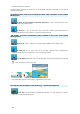
10. Chart Catalogue : consult and manage your Chart Catalogue : Getting information as
Chart area name or status when it's OK or Corrupted, Chart type (Raster / Vector /
S57vector / 3D data /Sat.Photo), or version. Click on the delete button to erase a chart
from database.
164