
User's Manual


MaxSea T
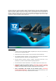
imeZero is a nautical navigation software application based on the most sophisticated display
technology available. MaxSea TimeZero features a full 3D operating environment with unparalleled
speed of zooming, powerful tools and an intuitive easy to use interface. The 3D environment of
MaxSea TimeZero combines nautical charts, 3D data, and satellite photographs that provides the best
maritime navigation information and situational awareness for the navigator that has ever been
achieved by a nautical navigation software application.
Standard Features:
Connect your GPS and autopilot (NMEA compatible upon serial ports or Ethernet by
Furuno) to your navigation software.
Download/overlay weather updates for free and perform advanced planning.
The navigation software operates in a fully rendered 3D environment and delivers
unparalleled speed and a seamless chart plotting experience
Exclusive MaxSea TimeZero interface combines functionality with ease of use,
providing for a practical and personalized navigating experience.
Exclusive MaxSea TimeZero PhotoFusion: fuse satellite images to the marine chart
Integration with FLIR M-Series Camera (Exclusively included in MaxSea
Explorer): MaxSea TimeZero can now control any FLIR M-Series camera and
instantly add a versatile Target and Object tracking feature to your system.
Direct compatibility with NavNet 3D and FAR2XX7 Radar (Exclusively
included in MaxSea Explorer): MaxSea TimeZero can be connected directly to one
(or two) FAR2XX7 radars using a simple Ethernet connection.
1