
Operation Manual
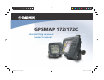


Table Of Contents
- GPSMAP 172/172C
- Introduction
- Getting Started
- Keypad Usage
- Selecting Options
- Entering Data
- Initializing the Receiver
- Power On/Screen Backlighting
- Simulator Mode
- Main Pages/Map Page
- Map Cursor
- Marking Waypoints
- Using the NAV Key
- Simulated Tour
- Reviewing/CreatingMap Waypoints
- Compass Navigation Page
- Highway Page
- Active Route Page/Main Menu Page
- Deleting Waypoints/Powering Off Unit
- Reference
- Map Page
- Map Page: Cursor
- Map Page: Options
- Compass Page
- Highway Page
- Highway Page Options
- Creating Waypoints
- Reviewing/Editing Waypoints
- Waypoint Lists
- Going to a Destination
- TracBack Navigation
- MOB: Man OverBoard
- Creating Routes
- Creating a Route/Following a Route
- Route List Page
- Route Review Page
- Editing Routes
- Active Route Page
- Find Key
- Find Options
- Main Menu Tabs
- Main Menu:GPS Tab
- Main Menu:Tide Tab
- Main Menu: Trip/
- Main Menu: Track Tab
- Main Menu: DSC Tab
- Main Menu: DSC/Card Tabs
- Main Menu: Temp Tab/Setup Tab
- Main Menu: Comm Tab
- Main Menu: Alarm Tab
- Appendix
- Index

The list to the right is provided to help you quickly find
some of the more important procedures you may use on
your new GPSMAP 172/172C.
TO DO THIS: SEE PAGE(S):
Turn the unit on or off
. . . . . . . . . . . . . . . . . . . . . . . . . . . . . . . . . . . . . . . . . . 6
Adjust screen backlighting
. . . . . . . . . . . . . . . . . . . . . . . . . . . . . . . . . . . . . . . 6
Enter data and select options . . . . . . . . . . . . . . . . . . . . . . . . . . . . . . . . . . . . . 3
Learn how to operate the unit’s function keys . . . . . . . . . . . . . . . . . . . . . . . . .
1
Mark your present location as a waypoint
. . . . . . . . . . . . . . . . . . . . . . . . . . 10
Go to a destination . . . . . . . . . . . . . . . . . . . . . . . . . . . . . . . . . . . . . . . . . . . . 11
Create and use a route
. . . . . . . . . . . . . . . . . . . . . . . . . . . . . . . . . . . . . . . . . 30
Pan using the map arrow
. . . . . . . . . . . . . . . . . . . . . . . . . . . . . . . . . . . . . . . 19
Zoom in or out on the Map page . . . . . . . . . . . . . . . . . . . . . . . . . . . . . . . . . 18
Reconfigure the Map page display
. . . . . . . . . . . . . . . . . . . . . . . . . . . . . . . . 21
Access the Main Menu . . . . . . . . . . . . . . . . . . . . . . . . . . . . . . . . . . . . . . . . . 53
Change units of measure (statute, nautical, metric)
. . . . . . . . . . . . . . . . . . . 71
Change the displayed time (zone) . . . . . . . . . . . . . . . . . . . . . . . . . . . . . . . . 72
View tide information . . . . . . . . . . . . . . . . . . . . . . . . . . . . . . . . . . . . . . . . . .
58
View celestial information
. . . . . . . . . . . . . . . . . . . . . . . . . . . . . . . . . . . . . . 60
Set Alarms . . . . . . . . . . . . . . . . . . . . . . . . . . . . . . . . . . . . . . . . . . . . . . . . . . 76
Use the Find function . . . . . . . . . . . . . . . . . . . . . . . . . . . . . . . . . . . . . . . . . . 51
View a unit message . . . . . . . . . . . . . . . . . . . . . . . . . . . . . . . . . . . . . . . . . . .
81
viii
Introduction
“How To” Index