
Item Brochure


Total Quality Management –
our commitment to total
customer satisfaction.
Ask your local Leica Geosystems
dealer for more information
about our TQM program.
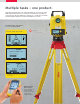
Laser plummet:
Laser class 2 in accordance
with IEC 60825-1
resp. EN 60825-1
Distance meter:
(PinPoint 200/300/400/500)
Laser class 3R in accordance
with IEC 60825-1
resp. EN 60825-1
The Bluetooth
®
word mark and
logos are owned by Bluetooth
SIG, Inc. and any use of such
marks by Leica Geosystems AG is
under license.
Leica Geosystems AG
Heerbrugg, Switzerland
www.leica-geosystems.com
Illustrations, descriptions and technical data are not binding. All rights reserved.
Printed in Switzerland – Copyright Leica Geosystems AG, Heerbrugg, Switzerland, 2009.
773692enUS – II.10 – RDV
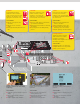
Whether you have to precisely layout a construction site, perform control
measurements, collect height and angle data, align concrete forms,
install ceilings and partitions, lay gravity flow pipe, locate underground
services or complete site preparation and earthworks – Leica Geosystems
offers the right instrument, construction laser or machine control
installation specifically designed for your construction application.
Easy-to-use, jobsite tough, accurate and reliable – Leica Geosystems
instruments and lasers ensure the efficient use of your materials and
resources. High quality products, such as optical and electronic levels,
construction lasers, total stations and machine automation systems,
provide fast results, keep you working and increase your profitability.
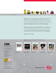
When it has to be right.
Leica Rugby 260SG,
270SG, 280DG
Easy to use grade
lasers
Leica RedLine
Tailor-made
Site Solutions
Leica Sprinter Family
One Button
Digital Levels
Leica Piper 100 / 200
The world´s most
versatile pipe laser
Leica DIGISYSTEM
TM
Safe and fast location
of underground
services