
Technical data

Chapter 10 291
Distance to Fault
Measuring Distance to Fault
Distance to Fault
Displaying Location Information Using GPS
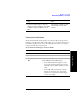
If you are making a Distance to Fault measurement, you may use GPS Location data
to verify your location. For additional information on the GPS Data function, refer
to “Displaying GPS Location Data” on page 462.
To Display GPS Location Information:
2 [Clear Calibration] If you previously selected Manual Frequency
Range, [Clear Calibration] only clears the
calibration for the Manual mode. Auto mode
calibration data is not cleared. Note also that if you
clear a Manual calibration, you will also clear the
calibration data for the
Return Loss and the One
Port Insertion Loss
measurements as these
measurements all share the same calibration data.
If you previously selected Auto Frequency Range,
[Clear Calibration] only clears the calibration for
the Auto mode. Manual mode calibration data is
not cleared.
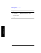
Step Notes
1 [Level/Location]
2 On [Show GPS
Location] select
On.
Displays GPS satellite location information. Uses the
internal GPS to capture the location of a
measurement. The GPS information can be used to
return to the same location. The Time Ref
(Freq/Chan/Time Ref mode) button must be set to
Internal GPS for this function to be active.
Information logged includes longitude, latitude,
altitude (feet/meters), and the number of satellites
tracked.
Each time you press this softkey, the selected option
changes.
Step Notes