
User`s manual


CompeGPS Team S.L.
http://www.compegps.com
http://support.compegps.com
General: Name of file (you may also change the track name from the contextual menu of
the tracks list or by „save as‟), User name, Outing name, Notes on track.
Date and time: Day, Departure time (first track point), Arrival time (last track point),
Duration, Difference between local time and UTC (more or less hours in regards to GMT),
Time stopped, Time moving.
Track points: Number of points, Recording intervals (this value can be set from „Main
Menu > Settings > Off-road > Tracklog‟), Extra data fields (additional data that the tracks
have besides the coordinates, altitude and time).
See: Thickness, real width of track and colour of the track line.
GPS: GPS model, series number and if the track features a digital signature.
Distances: Projected distance (it is the distance that has been covered on the horizontal,
disregards the distance covered in altitude), Distance with altitudes (the real distance
covered by outlining the orography of the ground), linear distance (distance on a straight
line between the first and the last point of the track), Area (surface enclosed by the track).
This last datum is achieved by closing the track with a straight line in case there are no
closed tracks).
Altitudes: Track with altitudes (if the track features the altitude datum), Maximum
altitude, Minimum altitude, Departure altitude (at the track origin), Arrival altitude (at the
last point), Gain from the departure (difference between the departure altitude and the
maximum reached), Departure-arrival slope, Maximum slope (difference of altitude
between the highest and lowest point of the track), Accumulated climb * (total of the
different gains in altitude made during the track, i.e. what we have had to climb in reality),
accumulated descent*, ( Max. vertical speed (climbing speed), Min. Vertical speed
(descent speed), Max. Slope, Min. Slope.
Speed: Medium speed and Maximum speed reached in the track.
Energy: Mass (weight of the person tracking together with the vehicle, bicycle,
motorbike, rucksack, etc.), Energy measured in Joules, Average power measured in vats
(consumed along the whole track), Average power on climbs measured in vats
(consumed during the track climbs).
*Only altitudes changes over 5 metres will be computed in properties, such as accumulated
climb/descent. This is in order to prevent the resulting fluctuations of the GPS error margin from
adding non real differences of level.
As a result, a track that begins and ends in the same place may have an „accumulated climb‟ that
does not match the „accumulated descent‟.
CompeGPS Land lets you modify the “minimum difference to accumulate difference of level” in
order to adjust it to your preferences in the track analysis.
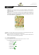
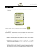
8.3.8.2 Properties of a track point
You may enter the properties of a single point in the track from the navigation screen by opening
the contextual menu on the point in the map and selecting „edit track point‟.