
Product Manual


Display Menus
Measure Menu
3
3-35
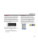
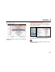
GPS Submenu
The GPS receiver integrated into the thermal imager is
activated in the "GPS" menu item. After having switched
on the GPS receiver, the function of the GPS receiver is
displayed on the right-hand side below the Fluke logo as
a symbol. When the GPS receiver is activated, the
display of the GPS data (latitude, longitude, satellites) can
also be activated in the first information line in the "Image
elements" menu (see Elements Submenu on page 3-12).
When switching off the GPS receiver, the first information
line is hidden automatically.
hvh219.jpg
Along with latitude, longitude, and the number of
satellites, further GPS information is saved together with
the thermal image: height, speed, and bearing.
Note
GPS functions work most effectively when
outdoors. Allow up to 20 minutes for the imager
to find satellites.
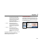
Laser Submenu
The laser distance meter integrated into the thermal
imager allows for precise distance measurement
depending on the target size, the angle, and the surface
properties up to a distance of approx. 70 m. Along with
the activation in the "Laser" menu item, the laser distance
meter can also be activated and deactivated directly by
pushing the multi-function button (factory setting).
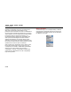
When this function is activated, the yellow laser symbol
will be displayed in the tool bar below the Fluke logo
simultaneously with an acoustic signal (2x beep). The
laser pointer, integrated depending on the equipment, is
activated analogously.
hvh220.jpg
hvh221.jpg