
Manual


Operating Manual Flytec 6020
Pressing the ▲key will increase the displayed altitude, the ▼ key will decrease altitude.
Due to this adjustment the air pressure display will also change. This air pressure value
(QNH) is always related to the height at sea level.
If the user does not know the altitude of his present location, he may obtain the data
by fading in the „User Field QNH“ and, using the arrow keys, by changing the altitude
value until the QNH matches the actual QNH as per weather forecast.
If the GPS system receives satellites, the GPS-altitude is applied as Alt1 by pressing the
F2
(Alti GPS) key. If there is no GPS reception, it is possible to set the altitude Alt1
by use of the function key
F1
(Alti 1013) to a value which complies to QNH pressure
of 1013 hPa.
If the altitude A1 of any given landing place is set to 0m, then after take-off there will
of course always be displayed the altitude above this location. The related air pressure
(QFE) is the real present air pressure at this place in hPa, which differs of course from
QNH, which is the pressure at sea level, according to the difference of altitude.
Within the user selectable fields it is also possible to choose altitude A1 in ft. This
information is important when being in contact with the air traffic manager in
Restricted Areas.
Furthermore it is possible to choose FL (ft) in the user selectable fields. This value is an
altitude display in feet for the Flight level (FL). This feature is not adjustable and is always
related to a QNH value of 1013 hPa (air pressure at sea level). This display is particularly
important for pilots of microlight aircraft to whom is assigned a Flight Level by air traffic-
controllers during flights in Restricted Areas.
2.1.2 Altimeter A2, relative altitude
A2 (within the user selectable fields) is a reference altitude, it can be modified by use of the
arrow keys ▲▼.
Correction of altitude A2:
Long pressure on
F2
⇒ will generate the message „Mod A2 ↑↓“ in the lower information line.
By use of the arrow ▲▼ keys it is possible to set the height difference, or to set with brief
pressure on
F2
(SET 0) the height difference to 0.
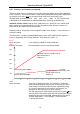
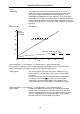
2.1.3 Altimeter A3, cumulated altitude
A3 (within the user selectable fields) sums up the total height meters gained during one
flight. For thermal flights this height is dependant on flight time. If several pilots complete
the same flight task, then the one who had the least gain in height (A3) would have been
the best to accomplish the task.
A2, A3, FL or QNH can be selected within the user selectable fields.
(see page 10).
- 13 -