VIDEO PLOTTER RP-25
Your Local Agent/Dealer 9-52 Ashihara-cho, Nishinomiya, Japan Telephone : 0798-65-2111 Telefax : 0798-65-4200 All rights reserved. Printed in Japan FIRST EDITION : FEB. 1996 F PUB.No. OME-30400 ( HIMA ) RP-25 : JAN.
SAFETY INSTRUCTIONS CAUTION No one navigational aid should be relied exclusively for the safety of vessel and crew. The navigator has the responsibility to check all aids available to confirm position. Electronic aids are not a substitute for basic navigational principles and common sense. Digital charts cannot replace official nautical charts. Digital charts are intended as an aid to navigation. Position should always be checked against nautical charts, as well as other aids to navigation.
FORWORD A Word to RP-25 Owners Congratulations on your choice of the FURUNO RP-25 Video Plotter. We are confident you will see why the FURUNO name has become synonymous with quality and reliability. For over 50 years FURUNO Electric Company has enjoyed an enviable reputation for innovative and dependable marine electronics equipment. This dedication to excellence is furthered by our extensive global network of agents and dealers.
The RP-25 function may be changed depending on your FR/FAR-2805 series radar specification. Refer to the following table to recognize your RP-25 working. Your 2805 spec.
TABLE OF CONTENTS 1. RADAR MAP ..................................................................................................1-1 1.1 Preparation .................................................................................................................. 1-2 1.2 Making a radar map ..................................................................................................... 1-3 1.2.1 Selecting the entering way ....................................................................... 1-3 1.
2.8.3 Deleting navigation lines .........................................................................2-23 2.8.4 Setting up the navigation lines ................................................................2-24 2.8.5 Displaying navigation lines......................................................................2-26 2.9 Recording and Replaying Data...................................................................................2-26 2.9.1 Formatting memory (RAM) card.................................
1. RADAR MAP A radar map is a combination map lines and symbols whereby the user can define and input the navigation data, route planning and monitoring data. The radar map has the capacity of 1,500 points of mark and line. The map data can be memorized to facilitate the repeated use on the routine navigation area. The user can create a radar map on-real time while using the radar for navigation or at leisure time at anchor or while the radar is not being used.
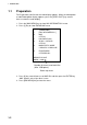
1. RADAR MAP 1.1 Preparation For R-type radar, confirm that the radar display appears. When the video plotter or radar/video plotter display appears, press the [VIDEO PLOT] key several times to select the radar display. 1. Press the [NAV MENU] key to show NAV INFORMATION 1 menu. 2. Press [1] key to show RADAR MAP menu.
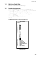
1. RADAR MAP 1.2 Making a Radar Map Marks/lines can be entered in three different ways. 1.2.1 Selecting the entering way 1. Press the [NAV MENU], [1] in that order to show RADAR MAP menu. 2. Press the [5] key several times to select CURSOR, L/L or OWN SHIP POSN. CURSOR: Enters mark/line at the position selected by cursor L/L: Enter mark/line at the position selected by L/L values OWN SHIP POSN: Enter mark/line at the current own ship’s position 3. Press the [ENTER] key. 4.
1. RADAR MAP 2. Press the numeric key to select the number for desired mark. For example, press the [1] [2] key in order when you want to select “●”. 3. Operate the trackball to move the cursor to the desired position. 4. Press the [ENTER] key. The selected mark is entered at the selected position. 5. Repeat step 2 through 4. When using the same mark, repeat step3 and 4. 6. Press the [MARK] key to close the menu. When entering the line, follow the steps in below. 1.
1. RADAR MAP 2. Press the numeric keys to enter the value for the desired latitude. When you enter “45º67.888”, for example, press [4] [5] [6] [7] [8] [8] [8] in that order. 3. Press the [ENTER] key. 4. Press the [5] or [6] key to select North or South. [5] key: North, [6] key: South 5. Press the [ENTER] key. 6. Press the numeric key to enter the value for the desired longitude. When you enter “123º45.666”, for example, press [1] [2] [3] [4] [5] [6] [6] [6] in that order. 7. Press the [ENTER] key. 8.
1. RADAR MAP 1.3 Erasing Contents of the Radar Map 1.3.1 Erasing the mark/line independently 1. 2. 3. 4. 5. Select CURSOR at MARK ENTRY MODE field on RADAR MAP menu. Press the [MARK] key to show the ENTER MARK menu. Press the [2] key twice to select MARK CANCEL. Operate the trackball to move the cursor to the mark you want to erase. Press the [ENTER] key. When erasing the line, move the cursor to the starting/ending point. Selecting the connecting point erases both lines connected to it.
1. RADAR MAP 1.4 Position and bearing correction 1.4.1 Radar map correction When there is an error between the radar screen and marks/lines, do the following procedures. 1. Press the [CHART ALIGN] key. “MAN ALIGN” appears at the right side of screen. 2. Operate the trackball to align the radar screen and radar map. 3. Press the [CHART ALIGN] key again. The screen is fixed, and “ MAN ALINED” appears instead of “MAN ALIGN”. 1.4.
2. VIDEO PLOTTER 2.1 Overview If your 2805 radar is for R (Regular) type, the video plotter function is available in addition to he radar map’s. Keys for video plotter ORIGIN MARK VECTOR TRUE/ REL VECTOR TIME TARGET DATA TARGET BASED SPEED AUTO PLOT LOST TARGET HISTORY CHART ALIGN VIDEO PLOT TRAIL MARK RADAR MENU E,AUTO PLOT MENU NAV MENU 1 2 3 4 5 6 7 8 9 CANCEL - ENTER 0 Control panel (right) 2.1.
2. VIDEO PLOTTER Sample video plotter display Range Range/bearing to cursor Motion mode 12/2 3.458 NM + 179.9 R Waypoint TM W12 W11 W10 Own ship's position OWN SHIP 35 20.370 N 141 18.370 E +CURSOR PSN 35 20.360 N 141 18.770 E Origin mark Own ship mark Cursor position Cursor Note: Grid line is not appeared on G-type. 2.1.2 Display modes The RP-25 has five presentation modes. • NORTH UP • COURSE UP • HEAD UP • HEAD UP TB • NORTH UP • NORTH UP TM Press the [MODE] key to select the mode.
2. VIDEO PLOTTER 2.2 Chart Cards CAUTION WARNING Chart cards are intended as an aid to navigation. The navigation has the responsivility to check all aids available to confirm position. 2.2.1 Handle chart cards and memory cards with care. Keep cards away from direct sunlight, heat sources, and active gases. Keep cards away from water and chemicals. Keep the connector free foreign material. Do not drop the cards. Displaying chart cards To display a chart; 1.
2. VIDEO PLOTTER 2.2.2 Chart position correction There may be instances when the radar image is not overland on the chart correctly. This is mainly due to position error inherent in the navigation aid connected to the radar. You can align chart with the radar image as follows. Note: There is no alteration between own sip’s data value and it displayed on the navigator though the chart position is corrected. 1. Press the [CHART ALIGN] key. “MAN ALIGN” appears at right side of the screen. 2.
2. VIDEO PLOTTER 2.3 Setting up the Video Plotter 2.3.1 Hiding/showing graphics 1. Press the [NAV MENU], [8] key in order to show DISPLAY SELECT menu. [DISPLAY SELECT] 1 2 3 4 5 6 7 8 9 0 [VIDEO PLOTTER 1] SYMBOL OFF/ON COAST LINE OFF/ON LAND DENSITY OFF/ON PLACE NAME OFF/ON MARK OFF/ON OWN SHIP PLOT OFF/ON TARGET PLOT OFF/ON CONTOUR LINE OFF/ON GRID OFF/ON Display select menu 2. 3. 4. 5. The current settings are in reverse video (default setting: all item is ON.
2. VIDEO PLOTTER [NAV INFORMATION 1] 1 2 3 4 5 6 7 8 9 0 [VIDEO PLOTTER 1] SELECT NAVAID GPS+LC/ DEAD RECKONING OWN SHIP POSN OFF/L/L POSN 00 00.000 N/S 000 00.000 E/W + CURSOR DATA OFF/L/L WPT DATA OFF/REL/TRUE [WAY POINT] [NAV LINE] WIND DATA OFF/ON [NAV INFORMATION 2] Nav information 1 menu 2. For item 2, 3, 5, 6 and 9, press the appropriate numeric key several times to select the setting, and then press the [ENTER] key. 3. For item 4 POSN, do the following procedures. a) Press the [4] key.
2. VIDEO PLOTTER [NAV INFORMATION 2] 1 2 3 4 5 6 7 8 9 0 [NAV INFORMATION 1] WIND GRAPH OFF/ON WIND UNIT M/S/KT CURRENT DATA OFF/ON CURRENT GRAPH OFF/ON DEPTH DATA OFF/ON DEPTH GRAPH OFF/ON DEPTH SCALE 10/20/50/100/200/500 DEPTH UNIT M/FT/FA [NAV INFORMATION 3] Nav information 2 menu 5. Do the setting for each items similar to the NAV INFORMATION 1 menu. 6. Press the [0] key to show NAV INFORMATION 3 menu.
2. VIDEO PLOTTER 2.4 Track 2.4.1 Recording the own ship’s track Own ship’s track can be stored in the memory (Max. 6,000 points). When a track memory becomes full the oldest track is deleted to make room for the latest. The relation between the own ship track and storage time is shown in the table below.
2. VIDEO PLOTTER 2.4.2 Recording other ship’s track When your radar has ARPA function, tracks of 10 targets (other ships) can be recorded. Memory capacity for other ship’s track is 6,000 points, but this value is divided equally among ten targets, so there are 600 points per target. When a track memory becomes full the oldest track is deleted to make room for the latest. The relation between the own ship track and other ship’s track plotting intervals and storage time is shown in the table below.
2. VIDEO PLOTTER 2.4.4 Erasing track The display may become full of track when, for example, own ship traces the same route several times. You can erase all or a percentage of the track to the clear the display. Further, you can erase the tracks of other ships. 1. Press the [NAV MENU], [9] key in order to show ERASE menu. [ERASE] 1 2 3 4 5 6 [VIDEO PLOTTER 1] OWN SHIP PLOT 30/50/80/ALL TARGET PLOT 30/50/80/ALL MARKS OFF/AREA/ALL WAYPOINT OFF/ALL NAV LINES OFF/ALL Erase menu 2.
2. VIDEO PLOTTER 2.5 Marks, Lines 2.5.1 Entering mark You can inscribe marks on the display to denote important points, for example, a buoy or a wreck. The mark memory capacity is 6,000 points.(20 types mark and lines). Selecting method of entry Marks can be entered by cursor position, L/L or own ship’s position. 1. Press the [NAV MENU], [0] key to show VIDEO PLOTTER 2 menu.
2. VIDEO PLOTTER Selecting mark 1. Press the [MARK] key to show ENTER MARK menu. [ENTER MARK] MARK 01. 02. 03. 04. 05. 06. 07. 08. 09. 10. 11. 12. 13. 14. 15. 16. 17. 18. 19. 20. 21. 22. 01 NAV LINE COAST LINE CONTOUR LINE PROHIBITED AREAS CABLE LINE CHANGE MARK CANCEL Enter mark menu 2. Press the numeric key to select the mark shape desired. When selecting “·”, for example, press the [0], [7] in order. 3.
2. VIDEO PLOTTER 2.5.2 Entering line You can enter the line similar to mark. 1. Pres the [MARK] key to show ENTER MARK menu. 2. Press the numeric key to select line shape desired. No.14 through 20 are for line. Shapes of line No.16 through 20 are as below. No./name 16 NAV LINE Shape 17 COAST LINE 18 CONTOUR LINE 19 PROHIBITED AREAS 20 CABLE White line 3. The line is entered at the position selected on the previous page anytime the [ENTER] key is pressed.
2. VIDEO PLOTTER 2.6 Erasing Marks, Lines 2.6.1 Erasing individual marks/lines 1. 2. 3. 4. Select CURSOR at MARK ENTRY MODE on VIDEO PLOTTER 2 menu. Press the [MARK] key to show ENTER MARK menu. Press the [2] key twice to select mark cancel (item 22). Operate the trackball to move the cursor on the mark (starting/ending point of line) which you want to erase. 5. Press the [ENTER] key. When erasing a line, move the cursor on the starting/erasing point of line.
2. VIDEO PLOTTER [ERASE] 1 2 3 4 5 6 [VIDEO PLOTTER 1] OWN SHIP PLOT 30/50/80/ALL TARGET PLOT 30/50/80/ALL MARKS OFF/AREA/ALL WAYPOINT OFF/ALL NAV LINES OFF/ALL Erase menu 2. Press the [4] key several times to select AREA at MARKS (item 4) field, and then press the [ENTER] key. 2.6.3 Erasing all marks To erase all marks and lines in memory, follow the procedures in below. 1. Press the [NAV MENU], [9] key in order to show ERASE menu.
2. VIDEO PLOTTER 2.7 Waypoints 2.7.1 Entering waypoints In navigation terminology, a particular location is known as a “waypoint,” whether it be a starting point, a destination point or an intermediate on a voyage. This unit can store 97 waypoints, numbered 01 to 97. Waypoints may be entered by the cursor, by manual input of latitude and longitude, or own ship’s position. Entering waypoints by the cursor 1. Press the [NAV MENU], [4] key in order to show ENTER WPT, NAV LINE menu.
2. VIDEO PLOTTER b) Press the [ENTER] key. c) Press the numeric key to enter the value of longitude in eight digits, and then press the [ENTER] key. If necessary, press the [2] key to select East or West. d) Press the [ENTER] key. 6. To enter other waypoint, repeat step 4 and 5. Entering waypoints at own ship’s position 1. Press the [NAV MENU], [4], [2] key in that order to show ENTER WPT menu. 2. Press the [3] key to select OWN SHIP POSN at WPT ENTER MODE (item 3) field, and then press [ENTER] key. 3.
2. VIDEO PLOTTER [WPT LIST 1] 1 [ENTER WPT, NAV LINE] WPT 00 340 44.01 N 135 24.56 E 01 34 42.11 N 136 31.58 E 02 33 97.69 N 134 64.35 E 03 ** **.** N *** **.** E 04 ** **.** N *** **.** E 05 ** **.** N *** **.** E 06 ** **.** N *** **.** E 07 ** **.** N *** **.** E 9 0 ERASE WPT 00 [WPT LIST 2] Wpt list menu The list shows waypoints 01 through 07, the data of not registered number are displayed as asterisks. To show the next page, press the [0] key (Press the [1] key to return to the previous page).
2. VIDEO PLOTTER 2.7.3 Displaying a waypoint Internal storage waypoint 1. Press the [NAV MENU], [2] key in order to show WAY POINT menu. 2. Press the [7] key several times to select VIDEO PLOTTER at WPT DATA (item 7) field. 3. Press the [ENTER] key. [WAY POINT] 1 2 3 4 5 6 7 8 [VIDEO PLOTTER 1] WPT OFF/ON WPT NO. 00 00 00.000 N 000 00.000 E WPT DATA VIEO PLOTTER/NAVIGATION ARRIVAL ALARM OFF/ON 0.00 NM Way point menu (on selecting video plotter) 4. 5. 6. 7.
2. VIDEO PLOTTER External waypoint The waypoint from the external navigator can be displayed. 1. Press the [NAV MENU], [2] key to show WAY POINT menu. 2. Press the [7] key several times to select NAVIGATION at WPT DATA (item 7) field. 3. Press the [ENTER] key. [WAY POINT] 1 2 3 4 5 6 7 8 [VIDEO PLOTTER 1] WPT OFF/ON WPT LINE OFF/ON WPT NO. OFF/ON WPT DATA VIEO PLOTTER/NAVIGATION ARRIVAL ALARM OFF/ON 0.00 NM Way point menu (on selecting navigation) 4.
2. VIDEO PLOTTER 2.8 Navigation Lines 25 navigation lines may be entered, and each line may have up to 30 waypoints. (The total number of waypoints is 97.) 2.8.1 Entering navigation line Entering new navigation line 1. Press the [NAV MENU], [4] in order to show ENTER WPT, NAV LINE menu. [ENTER WPT, NAV LINE] 1 2 3 4 5 6 [VIDEO PLOTTER 1] [ENTER WPT] [WPT LIST] [ENTER NAV LINE] [NAV LINE LIST] Enter wpt, nav line menu 2. Press the [5] key to show ENTER NAV LINE menu.
2. VIDEO PLOTTER Adding waypoit to navigation lines To add waypoints to a navigation line; 1. Press the [NAV MENU], [4], [5] key in that order to show ENTER NAV LINE menu. 2. Press the [2] key. 3. Press the numeric key to enter the number (in two digits) for the navigation line which you want to add the waypoint, and then press the [ENTER] key. The cursor moves to the end of the navigation line contents. 4. Press the numeric key to enter the number (in two digit) for the waypoint which you want to add. 5.
2. VIDEO PLOTTER 2.8.3 Deleting navigation lines Deleting individual navigation lines 1. Press the [NAV MENU], [4], [6], [9] key in that order to select ERASE NAV LINE (item 9) on NAV LINE LIST menu. 2. Press the numeric key to enter the number (in two digits) for the navigation line which you want to delete. Note: The navigation line in use cannot be deleted. 3. Press the [ENTER] key. 4. Press the [NAV MENU] key to close the menu. Deleting all navigation lines 1.
2. VIDEO PLOTTER 2.8.4 Setting up the navigation lines Navigation lines can be set up as follows: 1. Press the [NAV MENU], [3] key to show NAV LINE menu. 2. Press the [7] key several times to select VIDEO PLOTTER at NAV LINE DATA (item 7) field. 3. Press the [ENTER] key. [NAV LINE] 1 2 3 4 5 6 7 8 9 [VIDEO PLOTTER 1] NAV LINE NAV WIDTH OFF/ON 0.00NM WPT NO. OFF/ON WPT (**)->@->(**) (**)->(**) NAV LINE DATA VIEO PLOTTER/NAVIGATION ARRIVAL ALARM OFF/ON 0.
2. VIDEO PLOTTER 11. Press the [ENTER] key. For example, when you select the navigation line which has waypoints 11→12→13→14, and you are going to waypoint 12, the display shows “(11) →@→12→(13) →(14)”. “@” means the own ship’s position. 12. If you want to be alerted when own ship nears a waypoint, press the [8] key several times to select ON at ARRIVAL ALARM (item 8) field. 13. Press the [ENTER] key. 14. Press the numeric key t enter the arrival alarm range, and then press the [ENTER] key. 15.
2. VIDEO PLOTTER 2.8.5 Displaying navigation lines Internal navigation lines Navigation lines made at the previous section can be displayed as follow. 1. Press the [NAV MENU], [3] key to show NAV LINE menu. 2. Press the [7] key several times to select VIDEO PLOTTER at NAVLINE DATA (item 7) field. 3. Press the [2] key twice to select ON at NAV LINE (item 2) field. 4. Press the [ENTER] key. 5. Press the [3] key to select NAV LINE NO. (item 3). 6.
2. VIDEO PLOTTER 2. Pres the [NAV MENU] , [6] key in order to select CARD. 3. Press the [6] key to select RECORD 4. Press the [ENTER] key to show RECORD CARD menu. [RECOARD CARD] 1 2 3 4 0 [VIDEO PLOTTER 1] OWN SHIP PLOT FILE TARGET PLOT FILE MARK FILE FORMAT NO/YES Record card menu 5. Press the [0] key twice to select YES at FORMAT (item 0) field. 6. Press the [ENTER] key. When the formatting finishes, “COMPLETED” appears at the bottom of the menu. 2.9.
2. VIDEO PLOTTER 2.9.3 Replaying data 1. 2. 3. 4. Insert the memory card which has data in the right hand card slot. Press the [NAV MENU] key. Press the [6] key several times to select REPLAY. Press the [ENTER] key. [REPLAY CARD 1] 1 2 3 4 5 6 7 8 9 [VIDEO PLOTTER 1] FILE FILE FILE FILE FILE FILE FILE FILE Replay card menu 5. Press the numeric key to enter the number for the file which you wish to replay. When the data replaying finishes, “COMPLETE” appears at the bottom of the menu.
3. MAINTENANCE (FOR TECHNICIANS) 3.1 Initial Settings An item on the DISPLAY SELECT menu can be deleted thru the INITIAL SETTING menu. If it is necessary to change the settings, follow the procedure below. 1. Turn the radar off. 2. Dismount the SPU Board from the display unit, and then on #4 of DIP switch S on the board. 3. Remount the SPU board to the display unit. 4. Turn the radar on. 5. Press the [NAV MENU], [0], [0] key in order to show VIDEO PLOTTER INITIAL SETTING menu.
3. MAINTENANCE (FOR TECHNICIANS) 3.2 Replacement of Battery on RP Board The RP Board is mounted in the display unit of the FR-2805 series radars. For general maintenance and trouble shooting, therefore, refer to radar’s operator’s manual. The only maintenance required for the RP-25 is the replacement of the battery on the RP-Board. A lithium battery on the RP Board preserves RP-25 data when power is off. The life of the battery is about three years.
MENU TREE [RADAR MAP display] NAV MENU key NAV INFORMATION 1 menu 1 [RADAR MAP] 1 [NAV INFORMATION 1] 2 MAP 3 NAV DATA POSN 4 ALIGN + CURSOR 5 MARK ENTRY MODE 6 ERASE MARK 2 SELECT NAVAID GPS+LC/DEAD RECKONING 3 OWN SHIP POSN OFF/L/L 4 POSN 00 00.000 N/S OFF/ON OFF/ON CURSOR/L/L/OWN SHIP OFF/AREA/ALL 000 00.000 E/W 5 + CURSOR DATA OFF/L/L 6 WPT DATA OFF/REL/TRU 7 [WAYPOINT] 1 [NAV INFORMATION 1] 2 WPT OFF/ON 4 WPT NO. 7 WPT DATA VIDEO PLOTTER/NAVIGATION 8 ARRIVAL ALARM OFF/ON 0.
[VIDEO PLOTTER screen] NAV MENU key VIDEO PLOTTER 1 menu 1 [NAV INFORMATION ] 1 [VIDEO PLOTTER 1] 2 SELECT NAVAID 3 OWN SHIP POSN 4 OWN SHIP GPS+LC/DEAD RECKONING OFF/L/L 00 00.000 N/S 000 00.
LATITUDE ERROR TABLE (ON 96 NM RANGE) (nm) EBL LAT 70° 65° 60 55° 50° 45° 40° 35° 30° 25° 20° 15° 10° 5° 0° 5° 10° 15° 20° 0.21980213 0.21229339 0.43290201 0.41810678 0.632803 0.61115946 0.8134132 0.78556318 0.20316898 0.40012949 0.58486463 0.19249832 0.37910698 0.18036264 0.35519924 0.16685429 25° 30° 35° 40° 45° 0.96923215 0.93600295 1.09551918 1.05790007 1.1884382 1.14755221 1.24517456 1.26402037 1.20224625 1.22034042 0.75173456 0.89565021 1.0122297 1.09793265 1.15016811 1.
SPECIFICATIONS Radar Plotter Radar Map Display Radar Display, Video Plotter display, Radar/Video Plotter display Radar display only Display Mode HU*, TM, CU, NU, CG (No chart available in HU and CG mode) HU, TM, CU, NU, CG *Not available in G-type. Display Range 0.125/0.25/0.5/0.75/1/1.