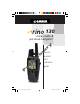
30 2-way radio & personal navigator in owner’s manual and reference guide P r e li m a r y ® 190-00284-00_Prelim_FCC.
© Copyright 2003 Garmin Ltd. or its subsidiaries Garmin International, Inc. 1200 E 151st Street, Olathe, Kansas 66062 U.S.A. Tel. 913/397.8200 Fax. 913/397.8282 r a Garmin Corporation No. 68, Jangshu 2nd Road, Shijr, Taipei County, Taiwan Tel. 886/2.2642.9199 Fax. 886/2.2642.9099 y Garmin (Europe) Ltd. Unit 5, The Quadrangle, Abbey Park Industrial Estate, Romsey, SO51 9AQ U.K. Tel. 44/1794.519944 Fax.44/1794.519222 in P r e li m All rights reserved.
Introduction r y About This Manual / Packing List in P r e li m a Thank you for choosing the Garmin Rino (Radio Integrated with Navigation for the Outdoors). To get the most from your new Rino, take time to read through the Quick Start Guide first, then this owner’s manual to understand all of the operating features. This Reference Manual describes the Main Pages of the Rino and their options in detail.
Introduction P r e in li m a r y FCC Compliance & GMRS Licensing FCC Compliance The Rino 130 complies with Part 15 of the FCC regulations and with Canadian ICES-003 for Class B digital devices. Operation of this device is subject to the following conditions: (1) This device may not cause harmful interference, and (2) this device must accept any interference received, including interference that may cause undesired operation.
Introduction Warnings & Precautions in P r e y li m Warnings and Precautions The GPS system is operated by the United States government, which is solely responsible for its accuracy and maintenance. The system is subject to changes which could affect the accuracy and performance of all GPS equipment. Although the Garmin Rino 130 is a precision electronic NAVigation AID (NAVAID), any NAVAID can be misused or misinterpreted and, therefore, become unsafe.
Introduction P r e in li m a r y Warnings & Precautions Important: Read this information before using your Rino. Exposure to Radio Frequency Signals - Your wireless handheld radio is a low power radio transmitter and receiver. When it is ON, it receives and also sends out radio frequency (RF) signals.In August 1996, The Federal Communications Commissions (FCC) adopted RF exposure guidelines with safety levels for handheld wireless radios.
Introduction r y Warnings & Precautions in P r e li m a not carry the radio in a breast pocket should use the ear opposite the pacemaker to minimize the potential for interference should turn the radio OFF immediately if you have any reason to suspect that interference is taking place Hearing Aids - Some digital wireless radios may interfere with some hearing aids. In the event of such interference, you may want to consult your hearing aid manufacturer to discuss alternatives.
Introduction in P r e li m a r y LIMITED WARRANTY This Garmin product is warranted to be free from defects in materials or workmanship for one year from the date of purchase. Within this period, Garmin will at its sole option, repair or replace any components that fail in normal use. Such repairs or replacement will be made at no charge to the customer for parts or labor, provided that the customer shall be responsible for any transportation cost.
Introduction r y Software License Agreement & Registration in li m a Software License Agreement BY USING THE Rino 130, YOU AGREE TO BE BOUND BY THE TERMS AND CONDITIONS OF THE FOLLOWING SOFTWARE LICENSE AGREEMENT. PLEASE READ THIS AGREEMENT CAREFULLY. Garmin grants you a limited license to use the software embedded in this device (the “Software”) in binary executable form in the normal operation of the product.
Table of Contents m The Main Page..................................................2 Status Bar....................................................3 My ID......................................................3-4 Channels and Codes................................4-5 Scan and Montior....................................5-6 Setup Radio.............................................7-8 Informational Picture.............................9-10 Peer-to-Peer..........................................
Main Pages r y Features in P r e li m a Rino 130 - Overview The Rino 130 (Radios Integrated with Navigation for the Outdoors) is a 7.6 ounce, 12 channel GPS-enabled handheld device with integrate radio functionality to provide two-way communications for up to two miles using 14 FRS (Family Radio Service) and 8 high-performance GMRS (General Mobile Radio Service) channels for up to five miles. You can keep track of up to 50 other contacts from other Rino users.
Radio Page P r e li m Radio Page in a r y The Main Page Radio Page - Overview The Radio Page is the first of the default Main Pages. This page provides the user interface for FRS (Family Radio Service) and GMRS (General Mobile Radio Service) radio operations. Use this page to control and setup the radio, view current settings and see informational graphics of the radio’s operation.
Radio Page Status Bar - Overview The Status Bar at the top of the screen will display on all the available Main Pages. As you move around any Main Page or change pages, the current page’s title will briefly display for 3 seconds then be replaced by the Status Bar. You will see current settings and operational icons on the Status Bar as you operate the unit.
Radio Page 2. Move the CLICK STICK Up, Down, Left or Right to highlight the ‘Clear’ field, then press IN on the CLICK STICK to clear the default ‘Name’ ID. My ID / Channels & Codes 3. To enter a new ID, press the CLICK STICK Up, Down, Left or Right to move the cursor to the desired letter, number or a space, then press IN on the CLICK STICK to select that highlighted character. You may enter up to 10 characters for your ID.
Radio Page r y Channels & Codes / Scan & Monitor in m a using the same channel. Simply select the same squelch code (number) as selected by the other person(s) you desire to communicate with. NOTE: Squelch codes do not cause your conversation to be private. They only allow you to filter out other users on the same channel, so you only hear the radios you want to.
Radio Page scan through the all the channels, selecting only specific channels/codes will decrease the scan time. Decreasing scan time will help prevent the chances of missing a transmission. The Scanlist also has Option Menu choices to ‘Scan Current Codes’ or ‘Scan All Codes’. Choosing ‘Scan Current Codes’ will scan only the Channel and Code combination in memory The ‘Monitor’ option lets you listen to a single channel for any activity, including static and weak voice signals.
Radio Page The Radio Page Options Menu provides the following: Setup Radio, Setup Scanlist, Turn Radio Off/On and Turn GPS Off/On. Setup Radio To access the page Options Menu: 1. Highlight the Option Menu on-screen button at the top of the display screen and then press IN on the CLICK STICK to open the menu. 2. Highlight the desired option on the menu and then press IN on the CLICK STICK to activate the option. in r a Setup Radio - Overview The ‘Setup Radio’ option displays the Radio Setup Page.
Radio Page P r e li m Selecting a Ring Tone. Tone will sound when you press IN to accept it. in a r y Setup Radio to set the unit to ‘Ask When Detected’ before changing accessories. VOX Level - Controls the sensitivity level of any Voice Operated Transmission (VOX) accessory. VOX accessories allow you to use the unit hands-free. A lower VOX setting is recommended for quiet environments while a higher VOX setting should be used in noisy environments.
Radio Page r y Informational Picture in Informational Picture Mark Waypoint P r e li m a Informational Picture - Overview The Informational Picture on the bottom half of screen features Garmin’s Mr. Mark Waypoint to show current GPS & radio status and radio actions. As you operate the unit, the graphics will change depending on what actions you are taking or the unit settings. Four satellites are shown on at the top of the picture along with descriptive text to indicate GPS reception status.
Radio Page GPS and Radio On; Position not ready; Transmitting on GMRS Informational Picture r a GPS and Radio On; Ready to transmit Position; Receiving transmission y GPS and Radio On; Position transmitted in m GPS and Radio On; Ready to transmit Position; Activity on channel that does not match code.
Radio Page Peer-to-Peer - Overview The Rino’s most unique feature is being able to send it’s location to another Rino, this is called Peer-to-Peer positioning. With peer-to-peer enabled (see pg. 8) and you have a GPS position (see pg. 48), whenever you press and release either the CALL key or the TALK key, the Rino will automatically send out its location. This information will be available to all other Rino users that are monitoring the same channel and code.
Radio Page To accept a new contact: 1. When a new contact is received, the New Contact page will appear. Highlight ‘OK’ and press IN on the CLICK STICK. If you do not OK the contact, it will not be saved. Contacts To review a contact and contact details: 1. From the Map Page, highlight the desired contact of the Contact Bar and press IN on the CLICK STICK.
Radio Page Send Location - Overview Another feature is the ability to send a specific location to other Rino users. This can come in handy if you are trying to round-up the group, or just want to meet at a specific location. You may send any point found from the Find ‘N Go menu. If the unit needs to wait until 10 seconds have elapsed since the last position transmission, a “Waiting to send location...” message will appear until the unit is able to transmit.
Map Page Main Page Option Menu & Main Page Menu Buttons Status Bar y Position Icon a r Map Scale P r e li in The Map Page displays your present position and direction of movement using a triangular ‘Position Icon’ that is centered on the map. As you travel the map display leaves a “trail” (track log) of your movements. The map also displays geographic details such as rivers, lakes, highways, and towns.
Map Page To allow you to view the map from different perspectives, the scale can be changed from 20 feet to 500 miles. The CLICK STICK and Z (Zoom) button on the front right of the unit allow you to zoom in or out on the map. Pressing the Z (Zoom) button from any page (other than the Map Page) will automatically take you to the Map Page. A lower zoom scale displays less area but more map detail, while a higher zoom scale shows you a larger area with less map detail.
Map Page Map Page options allow a variety of operating and custom features for your Rino 130. The Map Page options are: Pan Map - Allows you to move the Panning Arrow (Map Pointer) about on the map. Stop Navigation - Stops navigating to a destination. Show... - Allows you to choose to show either the Contact Bar (see also pg. 12), four programmable Data Fields or show the Map Only.
Map Page r y Options Map Page with Panning Arrow in Highlighted Map Item P r e li m a Using the Pan Map Option The Map Page pan function allows you to display an arrow used to point at and identify items on the map, and to move the map in order to view areas beyond the current viewing area on the display. The map panning function is activated from the Options Menu on the Map Page.
Map Page Stop Navigation The ‘Stop Navigation’ option allows you to quit navigation of a Goto, Route or Track in progress. When there is no active navigation, the ‘Stop Navigation’ option is “grayed out” and is non-functional. Options To stop navigation: 1. Select ‘Stop Navigation’ and press IN on the CLICK STICK. r y Show... The ‘Show...’ option allows you to view either navigation data in a four field window on the right side the page or the Contact Bar.
Map Page The ‘Setup Map’ option displays the five Map Setup Pages, each accessed by an on-screen button. A list of options displays for the features listed. Scale options indicate the zoom level at which Tracks, Tracks Logs, Map Features, or Text Boxes display, allowing you to remove map clutter and define map features. Setup Options Page - Orientation: ‘Track Up’ or ‘North Up’; fixes the top of the map display to the current track heading or to a north heading.
Map Page To use Setup Map options: 1. Select ‘Setup Map’ from the Options Menu and then press IN on the CLICK STICK to display the Map Setup Page. Setup Options 2. Press UP or DOWN on the CLICK STICK to highlight the desired sub-page button, which will display the options list for that sub-page to the left. 3.
Navigation Page The Main Page Straight Line Distance to the Destination Destination (Waypoint) Name Times to Destination y Bearing Pointer r Selectable Data Fields in a Compass Ring P r e li m The Navigation Page provides active guidance with a rotating compass ring that shows your course over ground (track) while you’re moving and a bearing pointer to indicate the current direction to your destination (bearing) relative to the course over ground.
Navigation Page The Main Pages P r e li m Navigation Page with Course Pointer and Course Deviation Indicator (CDI) Scale active. in a r y CDI Scale Navigation Page Options The options include: Stop Navigation - Cancels navigation (“Grayed out” or disabled unless you are navigating on a Goto, Track, or Route.
Navigation Page To Setup the Navigation Page: 1. With the Navigation Page displayed, use the CLICK STICK to highlight the Options Menu button at the top of the page. Then press it IN to display the menu. The Main Pages 2. Use the CLICK STICK to highlight your selection and then press IN to select it. To stop navigating: y 1. Highlight the on-screen Options Menu button at the top of the Navigation or Map Page and press the CLICK STICK. r 2. Select ‘Stop Navigation’, then press the CLICK STICK.
Trip Computer Page Main Page in a r y Selectable Data Fields Trip Computer Page P r e li m The Trip Computer Page default displays up to seven different types of navigation data. Choosing ‘Big Numbers’ will display 2 large data fields. Each data field is selectable and can contain one of many data information options. By selecting the information options that you prefer and arranging them in a desired order on the page, you can customize the Trip Computer Page to meet your navigation needs.
Trip Computer Page Trip Computer Page The Trip Computer provides a variety of data fields with read-outs of current information as you travel. Seven small or two large fields display navigation information and are user programmable. The default settings for these fields are shown in the illustration. The list of data field choices may be found on page 18 and definitions may be found in Appendix F. The Option Menu for this page provides the following options: Reset, Big Numbers, and Restore Defaults.
Main Menu Page The Main Menu Page with Feature Icons & Time/Date. Main Page To exit these pages, highlight the on-screen ‘X’ button and press IN on the CLICK STICK. in r e li m a r y The Main Menu provides you with a directory of the Rino’s advanced features. From the Main Menu page you can mark and create new waypoints; find map items such as cities, interstate exits, addresses, points of interest, etc.
Main Menu Page r y Options in Inserting a page in the Main Page Sequence. P r e li m a Using the Main Menu The Main Menu provides access to additional Rino feature pages. The pages listed below provide enhancements to Rino operation. Press the PAGE button repeatedly to cycle to the Main Menu or select it from the Main Page Menu at the top of each main page. Mark Waypoint Page - Allows you to mark and store a waypoint for your current location or a map pointer location.
Main Menu Page The Mark (Waypoint) Page The Mark Waypoint Page allows you to mark and record your current location as a waypoint and appears with a graphic name block (man with a flag) that displays the assigned number for that waypoint and a waypoint symbol. Marking Waypoints To mark your current location as a waypoint: a r y 1. Press IN and hold the CLICK STICK to access the Shortcut Menu, then highlight ‘Mark Waypoint’ and press IN.
Main Menu Page To create a waypoint using the panning arrow when a map item is not highlighted: Waypoints 1. With the Pan Map feature active, move the panning arrow (map pointer) on the map to the location you want to mark and then, press the CLICK STICK. 2. The Mark Waypoint Page displays, automatically assigning a number to the waypoint. Be certain to press and release the CLICK STICK for this operation. Pressing IN and holding the CLICK STICK displayed the Shortcut Menu. r a 1.
Main Menu Page Projecting a Waypoint Projecting a waypoint from any map item (another waypoint, etc.) allows you to establish a new waypoint on a bearing and distance projected from that map item. Waypoints To project a waypoint: 1. Select a map item from the Find ‘N Go Menu. 2. Highlight the Option Menu on-screen button at the top of the Information Page and press the CLICK STICK IN to display the options. Highlight ‘Project Waypoint’ and press IN. a r y 3.
Main Menu Page To save Map or Find ‘N Go Menu items as waypoints: Find ‘N Go 1. Access the Information Page for the desired item (highlighted from the map or selected from the Find ‘N Go Menu). 2. Open the Options Menu at the top of the page, select ‘Save As Waypoint’ and press IN on the CLICK STICK to save the item to the Waypoints List. To access the Find ‘N Go Menu: r e li 1. Hold IN on the CLICK STICK button to access the Shortcut Menu. Highlight ‘Find ‘N Go’ press IN.
Main Menu Page Finding Items y Finding a Waypoint Waypoints that you have created and stored in the Rino can be found by selecting the “Waypoint’ option from the Find ‘N Go Menu. You can find a waypoint from the list of waypoints using the ‘By Name’ or ‘Nearest’ options as explained on the previous page. When selected from the list, the waypoint displays on the Waypoint Information Page.
Main Menu Page y Find List for Nearest Cities in a 1. Use the CLICK STICK to select the ‘Cities’ option, then press it IN to display the find ‘By Name’ or find by ‘Nearest’ prompt. Selecting ‘By Name’ displays the keyboard as an alternative scrolling through the list of nearest cities. Finding Items r Finding a City Cities can be found by selecting the ‘Cities’ option of the Find ‘N Go Menu, selecting the city from the list of ‘Nearest’ or ‘By Name’, and then displaying the City Information Page.
Main Menu Page To find an exit: 1. Use the CLICK STICK to highlight ‘Exits’ and then press it IN to display the Exit List. Finding Items 2. Highlight and select an exit type by pressing IN on the CLICK STICK. 3. A list of exits nearest to you displays. The title box indicates the interstate highway which is served by the exits. Two fields at the bottom of the page indicate distance and bearing to the exit. List of Exit Types 4. Scroll through the list to highlight the desired exit. r y 5.
Main Menu Page In many instances, these categories are subdivided into types, such as in the instance of Food & Drink. When you select Food and Drink from the list of categories, you are then presented with a list of types which includes ‘All Types’ and cuisine options such as American, Asian, Barbecue, Chinese and many more. Once you have selected an item, you can display the Information Page for that item.
Main Menu Page To locate an address: 1. Use the CLICK STICK to highlight ‘Address’ and press it IN to display the ‘Find Address’ page. Finding Items 2. Highlight the’ Number’ field and use the keyboard for entering numbers. 3. Move to the ‘Street’ field using the CLICK STICK. 4. Press IN on the CLICK STICK to display the ‘Select Street Name’ list. Find the street by using the keyboard to enter characters until a list appears. a r y 5.
Main Menu Page Finding a Last Found Place You can use the Recently Found Places option to locate Points of Interest, Cities, Waypoints or Contacts and Intersections and other locations you have recently retrieved. The process for finding recent points from the Find ‘N Go list is the same as finding a regular waypoint. Finding Items To find a ‘Last Found Place’: r a 2.
Main Menu Page Using a Goto to Navigate to a Destination The Goto function allows you to create a direct route to a destination, (waypoint, city, or point of interest). Once you have accessed the Information Page for an item, use the Goto button at the bottom of the page to initiate travel to a map item using the Map and Navigation Pages for guidance. Using a Goto To activate a Goto: y 1.
Main Menu Page Creating and Using a Route Route navigation allows you to create a sequence of intermediate waypoints which lead you to your final destination. The Rino stores 20 routes, each with up to 50 waypoints. A route can be created and modified from the Route Page, and waypoints can be added to a route from the Find ‘N Go Menu. More complex routes can be created using a PC and MapSource mapping programs and then transferred to the unit memory. Routes in 3.
Main Menu Page Editing a Route Routes To remove all waypoints: 1. Select the on-screen page options button from the Route Page and press the CLICK STICK IN to access the Options Menu. 2. Highlight the ‘Remove All’ option and then press IN on the CLICK STICK to remove all waypoints from the list. When you see the prompt “Do you really want to remove all waypoints from the route?”, select “Yes”. y To reverse the route: a r 1.
Main Menu Page To review a route point: 1. Select the point from the Route Points List and press the CLICK STICK IN to access the Options Menu for the waypoint. Routes 2. Highlight ‘Review’ and then press IN on the CLICK STICK to display the Information Page. 3. Highlight the on-screen ‘OK’ button and then press IN on the CLICK STICK to return to the Route List. To insert a new point on the route list: r a 2.
Main Menu Page To move a route point: 1. Select the point from the Route Points List and press the CLICK STICK IN to access the Options Menu for the waypoint. Routes 2. Highlight the ‘Move’ option and press IN on the CLICK STICK to select the waypoint. 3. Use the CLICK STICK to move the point up or down in the list. Press IN on the CLICK STICK to leave the waypoint in the new list order.
Main Menu Page 3. Drag the line to a map item or other location where you want to establish a new waypoint and then press IN on the CLICK STICK to place the new waypoint. A waypoint information page displays. Press the on-screen ‘OK’ button to save the new waypoint, then press it again after returning to the Route Map. Routes To review or remove a route point: 1. Select the Route from the Routes List and press the CLICK STICK IN to display the Route Page. in r a 3.
Main Menu Page To stop navigation: 1. Highlight the ‘Stop Navigation’ option on either the Navigation or Map page’s Options Menu or select the ‘Stop’ button on the Route Page. Routes Data Fields for the Route Page When navigating a Route, the data displayed in the data fields on the Route Page may be customized to provide useful navigation information that is specifically related to route navigation.
Main Menu Page r y Tracks Page in Tracks Page P r e li m a Using Track Logs The Rino draws an electronic bread crumb trail on the Map Page as you travel along. This bread crumb trail is the ‘Track Log’. The Track Log contains information about points along its path, including time, and position. The Rino uses this information to allow you to navigate using the saved track. You may also save tracks from other Rino users as they communicate with you.
Main Menu Page To save and use a Track Log: 1. Access the ‘Tracks’ page from the Main Menu. The page has On/Off buttons, a list of tracks, and the number of unused tracks. Tracks Page 2. You can press IN on the on-screen ‘Off’ button to pause track logging. When track logging is active the ‘On’ button appears to be recessed. 3. Highlight the ‘Save’ on-screen button and then press the CLICK STICK to display the track log ‘Save Back Through’ list. y 4.
Main Menu Page r y Proximity Page a Proximity Points The Proximity list lets you define an alarm circle around a stored waypoint/contact position, and can be used to help you avoid dangerous areas or to alert you when you have strayed away too far from other Rino users. Up to ten waypoints may be listed, with a maximum alarm radius of 99.99 nautical or statute miles or kilometers. If entering a proximity alarm circle, a ‘Near Proximity Point ’ message will appear.
Main Menu Page Satellite Page The Satellite Page provides a picture of satellite signal tracking, tells you when the unit is ready for navigation, and shows your location coordinates. The Skyview graphic represents a view looking up at the sky from your current location showing satellites and their assigned numbers. The outer ring represents the horizon around you, the inner ring represents a view above you at a 45° angle from vertical, and the center represents directly overhead.
Main Menu Page r y Satellite Page in Satellite Page Options Menu Highlight the on-screen button at the top of the page & press in on the CLICK STICK. P r e li m a travel through rocks, buildings, people, metal, or heavy tree cover so for best results, keep the unit in clear view of the sky.
Main Menu Page To select the ‘Use With GPS Off’ option: 1. Use the CLICK STICK to highlight the Option Menu button at the top of the page and then press it IN to display the Options Menu. Satellite Page 2. Use the CLICK STICK to highlight the ‘Use With GPS Off’ option and then press it IN to activate. The Rino stops tracking satellites and should not be used for navigation. However, the next time you turn the unit on, it returns to Normal GPS operation. To select ‘Track Up’ or ‘North Up’: r y 1.
Main Menu Page The Setup Menu The Setup Pages allow you to customize your Rino to your personal preferences. You can choose time settings, units of measure, display backlighting and contrast settings, heading measurement, interface options and system operating mode. By highlighting the icons on the Setup Menu and then pressing in on the CLICK STICK, you can display the Setup Page for each of the menu items.
Main Menu Page Units Page The Units features are best used by individuals with a working knowledge of map grids and datums. To learn more about these subjects, visit the National Imagery and Mapping Agency at http://www.nima.mil or inquire at your local library. Setup Page To select Units Page options: 1. For all fields on this page, highlight the field and then press the CLICK STICK to display the Options Menu for the field. y 2.
Main Menu Page To setup Loran TD from the Main Menu: 1. When ‘Loran TD’ is chosen, the Loran TD setup window will automatically appear. Setup Page 2. To change the settings of any of the five fields, highlight the field, press the CLICK STICK IN. 3. When done, highlight ‘Save’ and press IN.
Main Menu Page Display Page You can adjust the amount of time that the backlighting feature stays on and adjust the screen contrast. Backlighting Timeout - Choose from Stays On, to delays of 15 seconds, 30 seconds, one, or two minutes before timing out. Contrast Adjustment - Can be adjusted from light to dark using the slider adjacent to the contrast bar. Setup Page To set the backlighting timeout: y 1. Highlight the Backlight Timeout field and then press IN on the CLICK STICK to display options.
Main Menu Page r y Setup Page in Serial Data Options P r e li m a Interface Page The Interface Settings Page allows you to choose from different input/output serial data formats. This feature is used when connecting to external NMEA devices, a DGPS beacon receiver, a personal computer, etc. See page 68 for using the Rino with MapSource. The formats are: formats: Garmin - The proprietary format used to exchange waypoint, track, and map data with a PC.
Main Menu Page System Page The System Setup Page allows you to change GPS operation modes, use the WAAS capabilities, and turn the Message Beep on or off and choose the battery type. The Option Menu allows you restore defaults or display the current version of unit operating software and the Unit I.D. Number. Software updates and instructions for downloading are available from the Garmin web site (www.Garmin.com). Choose one of the four GPS options other than ‘Normal’ to significantly save battery power.
Main Menu Page Calendar This feature provides you with a monthly calendar with programmable reference notes dates. You can display one monthly calendar of days at a time and mark days on each with reference notes using the data entry keypad. Days that are shaded have notes added. You can create reference notes for multiple months and for months in years yet to come. You can record 100 notes with up to 18 characters each. Calendar r Calendar Page in To use the current month and year: a 1.
Main Menu Page Alarm Clock This feature provides an alarm for the system clock. Enter a time in the time field and turn the alarm on and off from the control field menu. Remember to enter alarm times in the same time format (UTC or local) you’re using for your system. The unit must be on for the clock alarm to work. To set an alarm clock time: Alarm Clock / Calculator y 1. Use the CLICK STICK to highlight the time field and then press IN to display the keyboard.
Main Menu Page Stopwatch This feature allows you to use the unit as a stopwatch, including a lap timer. You may also have the unit record the lap time based on distance. For example, if you set the lap distance to one mile, the unit will record the time it takes you to travel one mile. To start the stopwatch: Stopwatch 1. Use the CLICK STICK to highlight the ‘Start’ field and then press IN. You may also press the V (Volume) key to Start the stopwatch. r a 1.
Main Menu Page Sun and Moon This feature provides you with a graphic display of both sun and moon positioning for a certain date, time and location with times for sunrise, sunset, moonrise, and moonset. Sun and Moon / Hunt and Fish To set the date and time: 1. For the Date and Current Time, highlight each field, then press IN on the CLICK STICK to begin data entry of individual characters. a r y 2.
Main Menu Page To set the location: 1. Highlight the Location field and then press IN on the CLICK STICK to display the ‘New Location’ options list. Hunt and Fish / Area Calculator 2. Highlight the option desired and then press IN on the CLICK STICK to activate. If you choose ‘Current Location’ the field values displayed on the page reflect the times at your current location.
Main Menu Page Games Menu The Games Page includes: Memory Race, Waypoint Bomber, Clothesline, Assimilation and Beast Hunt. Highlight the appropriate icon and then press IN on the CLICK STICK to play the desired game. Brief instructions will be displayed when you start each game. Games a r y Memory Race Be the first to clear the board by matching all of the two symbols sets together. Each symbol is in a square (you can adjust the size) which you will need to walk or travel to.
Main Menu Page Clothesline Team members select the same user symbol and then attempt to “hit” or ‘clothesline” other players by pressing the TALK key when an opposing team member is between them. You may also mark a point and assign it a symbol to be used as a stationary team member. You must wait 10 seconds between attempts. Press CALL to show the score and PAGE to quit the game. y r Clothesline in Assimilation P r e li m a Assimilation Think of this as a high-tech game of tag.
Appendix A P r e in li m a r y FRS Explained What is FRS? FRS, or Family Radio Service, is a UHF radio frequency band licensed by the FCC for general public use. The operating frequency ranges from 462.5625 to 467.7125 MHz, with a transmitting power of one half watt. FRS radios are small and lightweight, making them ideally suited for outdoor activities. The use of FRS radios does not require a license.
Appendix A r y FRS Explained in m a simply set your FRS radios to an unused channel and enjoy less interference. You may also find this useful just to listen in on others currently using FRS. After all, these are public-use frequencies and everyone has a right to talk or listen in. For greater communication, some FRS radios have a voice scramble feature. This features will cause your message to sound garbled to other FRS users that are not part of your group.
Appendix B Specifications Physical Case: Fully-gasketed, high-impact plastic alloy, waterproof to IPX7 standards (waterproof to one meter for 30 minutes) Size: 4.5”H x 2.3”W x 1.6”D; 7”H with antenna (11.4 x 5.8 x 4.1; 17.8 cm) Weight: Approx. 7.6 ounces (236 g) w/batteries Temperature Range: 5° to 158°F (-15° to 70°C) (operating) Display: 1.4”H x 1.4”W (3.6 cm x 3.
Appendix C r y Accessories in P r e li m a To obtain accessories, see your local dealer or visit the Garmin web site at www.Garmin.com and click on Shop link. 12-volt Adapter Cable: Provides unit power from an automobile cigarette lighter. 2.5 to 3.5 mm Jack Adapter: Allows you to use 3rd party headsets with your Rino unit.. Bash Guard Kit: Helps protect the Rino’s edges against hard shocks. Includes 2 bash guards, quick-release neck lanyard and belt clip.
Appendix D Transferring MapSource Map Data If you have purchased a Garmin MapSource CD-ROM mapping program you may want to transfer detailed map data before beginning use, to provide your unit with maximum Find features and mapping capability. The Rino accepts up to 8 MB of map data from most MapSource Garmin MapSource products. It is not possible to transfer 3rd party maps into CD-ROM’s offer a variety of Garmin products.
Appendix E To resolve problems that cannot be remedied using this guide, contact Garmin Customer Service at: 913-397-8200 or 800-800-1020 GPS Troubleshooting Guide Probable Cause Remedy Unit does not turn on. Batteries are exhausted. Replace batteries. Unit does not turn ON, even with new batteries. Batteries may be installed backwards. Reinstall batteries. You are pressing and releasing the POWER button. You must press and hold the POWER button for two seconds.
Appendix E To resolve problems that cannot be remedied using this Radio Troubleshooting guide, contact Garmin Customer Service at: Guide 913-397-8200 or 800-800-1020 Probable Cause Remedy Radio not transmitting. TALK key may not be fully depressed. Radio feature not set to On. Press and hold TALK key in until done talking. Turn radio On. Messages not being received by others Incorrect channel/code setting. Out of radio range or obstructions. Make sure other radios have the same channel and code set.
Appendix F The following data field options are available on the Map, Navigation and Trip Computer Main Pages. Data Field Definitions Bearing - The direction from your current location to a destination. Course - The direction from your starting location to a destination. Current Destination - The next waypoint on your route. Current Distance - The remaining distance to your next waypoint. r a Current ETE - The estimated time needed to arrive at the next waypoint on your route.
Appendix F Pointer - Indicates the direction to the next destination. Data Field Definitions Speed - Your rate of travel can be displayed in miles per hour, kilometers per hour, or nautical miles per hour. Sunrise - The time at which the sun rises on this day. Sunset - The time at which the sun sets on this day. Time of Day - The time for the selected time zone. y To Course - The compass direction you must go in order to get back to the original course.
Appendix G Wiring Diagram y Cable View in m a r Interface formats are selected from the Setup ‘Interface Page’ on page 55 of this manual. See also page 68 for using the Rino with MapSource. The input/output lines on your Rino unit are RS-232 compatible, allowing easy interface to a wide range of external devices, including PC’s, differential beacon receivers, marine autopilots and /or a second GPS receiver. The NMEA 0183 version 3.
FRS Channel Frequency 1 462.5625 462.5875 16 462.575 3 462.6125 17 462.600 4 462.6375 18 462.625 5 462.6625 19 462.650 6 462.6875 20 462.675 7 462.7125 21 462.700 8 467.5625 22 462.725 9 467.5875 10 467.6125 11 467.6375 12 467.6625 13 467.6875 14 467.7125 r y 2 Frequency Code m Frequency Code Frequency 1 67 14 107.2 27 167.9 2 71.9 r e 15 110.9 28 173.8 74.4 16 114.8 29 179.9 77 17 118.8 30 186.2 5 79.7 18 123 31 192.8 6 82.
Index A C P r e li m Calculator Page ................................26-27, 58 Calendar Page ..................................26-27, 57 Call Button.......................................11, 62-63 Call Tone....................................................... 7 Cancel Goto .......................................... 16, 23 Cautions.................................................... iii-v Change Course Pointer Scale....................... 22 Channels ....................................
Index li m Navigation Page......................................21-23 Nearest (Waypoints, Cities, Exits, etc.) ...31-36 New Contact Page ..................................11-12 NMEA ................................................... 55, 66 Normal Mode.............................................. 56 North Reference .......................................... 54 North Up .............................................. 19, 50 O P P r e Odometer...............................................
Index Turning the GPS Receiver “Off” ..................... 7 Turning the Radio “Off” ................................. 7 U Unit Features........................................... 1, 66 Units of Measure ....................................52-53 Units Page ..............................................52-53 User Symbol............................ 3, 4, 11, 13, 63 UTC Offset .................................................. 51 V y Vibrate ..........................................................
in P r e li m a r y For the latest free software updates throughout the life of your Garmin products, visit the Garmin web site at www.Garmin.com © 2003 Garmin Ltd. or its subsidiaries Garmin International, Inc. 1200 East 151st Street, Olathe, Kansas 66062, U.S.A. Garmin (Europe) Ltd. Unit 5, The Quadrangle, Abbey Park Industrial Estate, Romsey, SO51 9DL, U.K. Garmin Corporation No. 68, Jangshu 2nd Road, Shijr, Taipei County, Taiwan www.garmin.com Part Number 190-00284-00 Rev.