Camper 660 Owner’s Manual May 2015 Printed in Taiwan 190-01915-00_0A
All rights reserved. Under the copyright laws, this manual may not be copied, in whole or in part, without the written consent of Garmin. Garmin reserves the right to change or improve its products and to make changes in the content of this manual without obligation to notify any person or organization of such changes or improvements. Go to www.garmin.com for current updates and supplemental information concerning the use of this product. Garmin and the Garmin logo are trademarks of Garmin Ltd.
Table of Contents Getting Started............................................................... 1 Connecting the Device to Vehicle Power ................................... 1 Acquiring GPS Signals ............................................................... 1 Status Bar Icons ......................................................................... 1 Using the On-Screen Buttons ..................................................... 1 Entering and Exiting Sleep Mode .......................................
Using In-Call Options ................................................................ 11 Saving a Home Phone Number ................................................ 12 Calling Home ....................................................................... 12 Using the Apps............................................................. 12 Using Help ................................................................................ 12 Searching Help Topics .........................................................
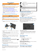
Getting Started GPS signal status WARNING See the Important Safety and Product Information guide in the product box for product warnings and other important information. Bluetooth technology status (appears when Bluetooth is enabled) • Update the maps and software on your device. • Mount the device in your vehicle and connect it to power (Connecting the Device to Vehicle Power). • Acquire GPS signals (Acquiring GPS Signals).
Vehicle Profiles WARNING Entering your vehicle profile characteristics does not guarantee that your vehicle's characteristics will be accounted for in all route suggestions or that you will receive the warning icons in all cases. Limitations may exist in the map data such that your device cannot account for these restrictions or road conditions in all cases. Always defer to all posted road signs and road conditions when making driving decisions.
A data field displaying the speed limit may appear as you travel on major roadways. This feature is not available in all areas. Active Lane Guidance As you approach a turn while navigating a route, a detailed simulation of the road appears beside the map, if available. A colored line À indicates the proper lane for the turn. The device recalculates the route to travel through the selected location.
route, a vacation, or a road trip. You can edit a saved trip to further customize it, including reordering locations, optimizing the order of stops, adding scheduling information, and adding shaping points. You can also use the trip planner to edit and save your active route. Planning a Trip A trip can include many locations, and it must include at least a starting point and a destination. The starting location is the location from which you plan to start your trip.
2 Select an option: 6 Select Done. NOTE: The menu changes based on your area and the map data on your device. • Select Toll Roads. • Select Tolls and Fees > Toll Roads. 3 Select an option: • To be asked each time before routing through a toll area, select Always Ask. • To always avoid tolls, select Avoid. • To always allow tolls, select Allow. 4 Select Save Disabling a Custom Avoidance You can disable a custom avoidance without deleting it. 1 Select Settings > Navigation > Custom Avoidances.
• To search for coordinates, enter latitude and longitude coordinates. 5 Select an option: • To search using a suggested search term, select the term. • To search using the text you entered, select . 6 If necessary, select a location. Exploring a Venue You can view a list of all points of interest located within each venue. 1 Select a venue. 2 Select > Explore this Venue. Changing the Search Area NOTE: This feature is not available in all areas.
1 Go to www.garmin.com/poiloader. 2 Follow the on-screen instructions. Viewing Current Location Information Finding Custom POIs Before you can find custom POIs, you must load custom POIs on your device using the POI Loader software (Installing POI Loader). 1 Select Where To? > Categories. 2 Scroll to the Other Categories section, and select a category. Search Tools Search tools allow you to search for specific types of locations by responding to on-screen prompts.
Going Home Select Where To? > Go Home. Editing Your Home Location Information 1 Select Where To? > Saved > Home. 2 Select . 3 Select > Edit. 4 Enter your changes. 5 Select Done. Editing a Saved Location 1 Select Where To? > Saved. 2 If necessary, select a category. 3 Select a location. 4 Select . 5 Select > Edit. 6 Select an option: • Select Name. • Select Phone Number. • Select Categories to assign categories to the saved location.
Viewing the Trip Information Page The trip information page displays your speed and provides statistics about your trip. NOTE: If you make frequent stops, leave the device turned on, so it can accurately measure elapsed time during the trip. From the map, select Speed. Viewing the Trip Log Your device keeps a trip log, which is a record of the path you have traveled. 1 Select Settings > Map & Vehicle > Map Layers. 2 Select the Trip Log check box. Resetting Trip Information 1 From the map, select Speed.
• Traffic alerts appear on the map when there are traffic incidents along your route or in your area. • You can receive traffic information through a traffic receiver or as a subscription service through Smartphone Link (Garmin Live Services). • The device must be connected to Smartphone Link with an active traffic subscription to receive traffic information through Smartphone Link. • The device must be connected to vehicle power to receive traffic information through a traffic receiver.
1 Say your wakeup phrase (Setting the Wakeup Phrase). 2 Say Find Place. 3 Listen for the voice prompt, and speak the name of the location. 4 Say the line number. 5 Say Navigate. Muting Instructions You can disable the voice prompts for voice command without muting the device. 1 Select Apps > Voice Command > . 2 Select Mute Instructions > Enabled. Voice Control For regions where the Voice Command feature is unavailable, the Voice Control feature is activated.
TIP: You can use this feature if you want to turn off your device and remain on the call, or if you need privacy. • To use the dial pad, select . TIP: You can use this feature to use automated systems, such as voice mail. • To mute the microphone, select . • To hang up, select . Saving a Home Phone Number TIP: After you save a home number, you can edit the home number by editing “Home” in your list of saved locations (Editing a Saved Location). 1 Select Apps > Phone > > Set Home Number.
Viewing a Traffic Camera Before you can view a traffic camera, you must save a traffic camera (Saving a Traffic Camera). 1 Select Apps > photoLive. 2 Select a camera. About ecoRoute In some areas, before you can use ecoRoute™ features, you must purchase an unlock code. Go to www.garmin.com /ecoroute for more information. NOTE: This feature is available only when you are using the car vehicle profile (Vehicle Profiles).
1 Select Apps > Weather. 2 Select a day. The detailed forecast for that day appears. Viewing Weather Near a Different City 1 Select Apps > Weather > Current Location. 2 Select an option: • To view weather for a favorite city, select a city in the list. • To add a favorite city, select Add City, and enter a city name. Viewing the Weather Radar Before you can use this feature, you must purchase Advanced Weather service using Smartphone Link.
Traffic Settings From the main menu, select Settings > Traffic. Traffic: Enables traffic. Current Provider: Sets the traffic provider to use for traffic data. The Auto option selects the best available traffic data automatically. Subscriptions: Lists the current traffic subscriptions. Optimize Route: Enables the device to use optimized alternate routes automatically or upon request (Avoiding Traffic Delays on Your Route).
Appendix Support and Updates Garmin Express provides easy access to these services for Garmin devices. • Product registration • Product manuals • Software updates • Data uploads to Garmin Connect™ • Map, chart, or course updates • Vehicles, voices, and other extras 2 Select an option: • To install on a Windows computer, select Download for Windows. • To install on a Mac computer, select Mac Version. 3 Open the downloaded file, and follow the on-screen instructions to complete the installation.
• GPI custom POI files from Garmin POI Loader (Installing POI Loader). About Memory Cards You can purchase memory cards from an electronics supplier, or purchase pre-loaded Garmin mapping software (www.garmin.com). In addition to map and data storage, the memory card can be used to store files such as maps, images, geocaches, routes, waypoints, and custom POIs. Installing a Memory Card The device supports microSD™ and microSDHC memory cards. 1 Insert a memory card into the slot on the device.
Removing the Suction Cup from the Windshield 1 Flip the lever on the suction cup toward you. 2 Pull the tab on the suction cup toward you. Purchasing Additional Maps 1 Go to your device product page at (www.garmin.com). 2 Click the Maps tab. 3 Follow the on-screen instructions. Purchasing Accessories Go to http://buy.garmin.com. Troubleshooting The suction cup will not stay on my windshield 1 Clean the suction cup and windshield with rubbing alcohol. 2 Dry with a clean, dry cloth.
Index Symbols 2-D map view 9 3-D map view 9 A accessories 18 active lane guidance 3 addresses, finding 7 answering calls 11 audio, proximity points 15 automatic volume, enabling 1 avoidances 5 area 5 deleting 5 disabling 5 road 5 road features 5 tolls 4 B battery charging 1, 17, 18 maximizing 18 problems 18 Bluetooth technology 11, 18 disabling 14 disconnecting a device 11 enabling 11 settings 14 brightness 1 C editing, saved trips 4 elevation profile 9 emergency services 7 EULAs 15 extras, custom point
calculation mode 4 myTrends 4 previewing 3 shaping 3 starting 2, 3 stopping 3 suggested 4 viewing on the map 2, 3 S safety cameras, subscriptions 9 satellite signals acquiring 1 viewing 17 saved locations 4 categories 8 deleting 8 editing 8 saving, current location 7 screen, brightness 1 screenshots 14 search bar 5 settings 14, 15 shaping a route 3 shortcuts adding 7 deleting 7 simulated locations 14 sleep mode 1 Smartphone Link 12 connecting 12 disabling calls 12 Garmin Live Services 12 software updating
www.garmin.
Part Information GPN: Description: Part Type: Lifecycle Phase: Rev: 190-01915-00 Camper 660 Owner's Manual (EN-US) Manuals / Printed Literature Production A IR#068931 Item Attribution Document Review Required: Item Notes: Preferred Rating: ESD Sensitive: Moisture Sensitive: Limited Shelf Life: Magnetic Sensitive: Item Attribution 1 of 1 Item: 190-01915-00 Rev:A IR#068931 Creation Date: 03-Jun-2015 07:39 AM CST