
User Manual


69Forerunner
®
735XT
EN
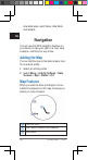
map.
• Select Elevation Prole to view an
elevation plot of the course.
• Select Name to view and edit the name
of the course.
Deleting a Course
1 Select Menu > Navigation > Courses.
2 Select a course.
3 Select Delete > Yes .
Stopping Navigation
1 During the activity, select to view the
compass or map.
2 Hold
.
3 Select Stop Navigation > Yes.
ANT+ Sensors
Your device can be used with wireless ANT+
sensors. For more information about compat-
ibility and purchasing optional sensors, go to
http://buy.garmin.com.
Pairing ANT+ Sensors
Pairing is the connecting of ANT+ wireless
sensors, for example, connecting a heart rate
monitor with your Garmin device. The rst time
you connect an ANT+ sensor to your device,
you must pair the device and sensor. After the
initial pairing, the device automatically connects
to the sensor when you start your activity and