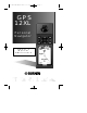
GPS 12XL NEW Manual Rev A 2/6/98 3:17 PM Page 1 GPS 12XL Personal Navigator Owner’s Manual & Reference ®
GPS 12XL NEW Manual Rev A 2/6/98 3:17 PM Page 2 Software Version 4.0 or above © 1998 GARMINCorporation, 1200 E. 151st Street, Olathe, Kansas 66062 USA Tel: 913-397-8200 or 800-800-1020 Fax: 913-397-8282 GARMIN (Europe) Ltd., Unit 5, The Quadrangle, Abbey Park, Romsey, Hampshire SO51 9AQ UK Tel: 011-44-1794-519944 Fax: 011-44-1794-519222 GARMIN (Asia) Corp., 4th Fl., No. 1, Lane 45, Pao-Hsing Road, Hsin Tien, Taiwan R.O.C. Tel: 011-886-02-917-3773 Fax: 011-886-02-917-1758 Web Site Address: www.garmin.
GPS 12XL NEW Manual Rev A 2/6/98 3:17 PM Page 3 INTRODUCTION GPS 12XL Packing List Operator’s Manual Thank you for choosing the GARMIN GPS 12XL —the smallest, easiest-to-use GPS navigator for outdoor use! The GPS 12XL represents GARMIN’s continuing commitment to provide quality navigation information in a versatile and user-friendly flexible design you’ll enjoy for years.
GPS 12XL NEW Manual Rev A 2/6/98 3:17 PM Page 4 INTRODUCTION Caution The GPS system is operated by the government of the United States, which is solely responsible for its accuracy and maintenance. The system is subject to changes which could affect the accuracy and performance of all GPS equipment. Although the GPS 12XL is a precision electronic NAVigation AID (NAVAID), any NAVAID can be misused or misinterpreted and, therefore, become unsafe. Use the GPS 12XL at your own risk.
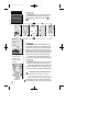
GPS 12XL NEW Manual Rev A 2/6/98 3:17 PM Page 1 INTRODUCTION Table of Contents SECTION ONE Introduction Glossary . . . . . . . . . . . . . . . . . . . . . . . . . . . . . . . . . . . . . . . . . . .2-3 Battery & Remote Antenna Installation . . . . . . . . . . . . . . . . . . . . . . .4 Keypad Usage & Data Entry . . . . . . . . . . . . . . . . . . . . . . . . . . . . . .5 Primary Page Overview . . . . . . . . . . . . . . . . . . . . . . . . . . . . . . . .
GPS 12XL NEW Manual Rev A 2/6/98 3:17 PM Page 2 INTRODUCTION Glossary The GPS 12XL is a powerful navigation tool that can guide you anywhere in the world. To better understand its operation and capabilities, it may be helpful to review the basic terms and concepts briefly explained below. Other navigation and GPS definitions used in the manual are defined in the appropriate reference sections of the manual.
GPS 12XL NEW Manual Rev A 2/6/98 3:17 PM Page 3 INTRODUCTION Glossary Grid Coordinate system that projects the earth on a flat surface, using square zones for position measurements. UTM/UPS and Maidenhead formats are grid systems. Ground Speed (SPD) The velocity you are traveling relative to a ground position. Latitude The north/south measurement of position perpendicular to the earth’s polar axis.
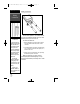
GPS 12XL NEW Manual Rev A INTRODUCTION 2/6/98 3:17 PM Page 4 Battery Installation Battery Installation Remote Antenna Installation An optional remote antenna may be used with the GPS 12XL. The remote antenna will improve the receiving capabilities of the unit by magnifying weaker signals which the built-in antenna may not be able to use. The remote antenna is attached by plugging it into the connector on the back of the unit (see above). Contact your GARMIN dealer for remote antennas and accessories.
GPS 12XL NEW Manual Rev A 2/6/98 3:17 PM Page 5 INTRODUCTION Keypad Usage & Data Entry Turns the unit on and off and activates screen backlighting. Scrolls through the main data pages in sequence and returns display from a submenu page to a primary page. Captures a position and displays the mark position page. Displays GOTO page with the waypoint highlighted for GOTO operation. Pressing GOTO twice activates MOB. Confirms data entry and activates highlighted fields to allow data entry.
GPS 12XL NEW Manual Rev A INTRODUCTION Primary Pages Satellite 2/6/98 3:17 PM Page 6 Primary Pages Before we start the tour, let’s briefly look at the five primary information pages used for the GPS 12XL. Switch between pages by pressing either the or keys. Position Map Compass Main Menu Satellite Page Satellite Page The Satellite Page will allow you to monitor satellite signal reception and strength. The Satellite Page shows satellite positions and signal strength.
GPS 12XL NEW Manual Rev A 2/6/98 3:17 PM Page 7 Map Page The Map Page acts as a window. It allows you to view your position, the “path” you have traveled over, and nearby waypoints. INTRODUCTION Primary Pages A diamond icon in the center of the screen represents your current position. As you move, you will see a thin line—called a track log—appear along the path you have just covered. Names of stored waypoints and nearby cities can also be shown on the map.
GPS 12XL NEW Manual Rev A GETTING STARTED Power On & Marking a Position 2/6/98 3:17 PM Page 8 Getting Started Tour Now that you’ve seen the primary pages, let’s get started by taking a simple tour to show you the basics about using your GPS 12XL. The tour assumes that your unit has been turned on and that none of the factory settings ( units of measure, selectable fields, etc.) have been changed.
GPS 12XL NEW Manual Rev A 2/6/98 3:17 PM Page 9 GETTING STARTED Using the Position Page Walk for 3-4 minutes and watch the Position Page. The direction you are moving (track), your speed, trip distance, and altitude are shown on the upper half of the screen. The latitude and longitude of your position are displayed in the middle of the page, with the time of day shown below. Position/Map Pages & Going To a Waypoint Let’s continue by moving to the next page: 1. Press .
GPS 12XL NEW Manual Rev A GETTING STARTED Compass Page and Cancelling a GOTO 2/6/98 3:17 PM Page 10 Compass Page Destination Waypoint Bearing to Waypoint Distance to Waypoint Graphic Compass Speed Over Ground Pointer to Waypoint Track Over Ground Selectable Field The GPS 12XL will also provide steering guidance with a Highway Page. To change the display from the Compass Page, press ENTER twice. Once a GOTO is activated, the GPS 12XL provides steering guidance until the GOTO is canceled.
GPS 12XL NEW Manual Rev A 2/6/98 3:18 PM Page 11 GETTING STARTED Clearing a Cluttered Map Display After you’ve used the GPS12XL for a few trips, you may find that your map display has become a bit messy from keeping track of your every move. For practice, let’s clean up the screen by clearing the track log (the plot points left on the Map Page) we’ve just created during the Getting Started tour. 1. Press or until the Map Page appears. 2. Highlight the ‘OPT’ field and press 3.
GPS 12XL NEW Manual Rev A REFERENCE Satellite Page 2/6/98 3:18 PM Page 12 Satellite Page Status Field Battery Indicator Horizontal Accuracy Skyview Display Signal Strength Indicators The GPS 12XL’s Satellite Page displays the status of various receiver functions. The status information will help you understand what the GPS 12XL is doing at any given time, and will tell you whether or not the receiver has calculated a position fix.
GPS 12XL NEW Manual Rev A 2/6/98 3:18 PM Page 13 Receiver Status Receiver status is indicated at the top left of the page, with the current horizontal accuracy (estimated position error, in feet or meters) at the top right. The status will be shown as one of the following conditions: Searching— the GPS 12XL is looking for any available satellites in view. AutoLocate— the GPS 12XLis initializing and collecting new almanac data.
GPS 12XL NEW Manual Rev A REFERENCE Battery Level, Backlighting & Emergency Erase 2/6/98 3:18 PM Page 14 Battery Level Indicator The Satellite Page also features a battery level indicator, located to the left of the sky view, which displays the strength of the unit’s batteries. The battery indicator will not appear if the receiver is using external power. ! The battery level indicator is calibrated for alka line batteries. Voltage differences will display Ni-Cad and lithium batteries differently .
GPS 12XL NEW Manual Rev A 2/6/98 3:18 PM Page 15 Position Page The second page in the GPS 12XL’s primary page sequence is the Position Page. This page shows you where you are, what direction you’re heading, and how fast you’re going, and it’s most useful when you are traveling without an active destination waypoint. The graphic heading display at the top of the page indicates the direction you’re heading (track) while you’re moving.
GPS 12XL NEW Manual Rev A REFERENCE Maximum Speed & Altitude Fields 2/6/98 3:18 PM Page 16 To reset timer, speed measurement, or odometer: 1. Highlight the user-selectable field, and press . ‘Reset’ will appear as a selectable option (see left). 2. Press to confirm or to exit. The trip odometer, trip timer, and average speed fields are linked. Resetting one of these options in a user-selectable field will automatically reset the corresponding data in the other.
GPS 12XL NEW Manual Rev A 2/6/98 3:18 PM Page 17 REFERENCE Marking a Position The GPS 12XL allows you to mark and store up to 500 positions as waypoints. A waypoint can be entered by taking an instant electronic fix, by manually entering coordinates (pg. 20), or by using the bearing and distance to a known position (pg. 20). Position Averaging To mark your present position: 1. Press . The mark position page will appear, showing the captured position and a default threedigit name. 2.
GPS 12XL NEW Manual Rev A REFERENCE Nearest Waypoints & Waypoint List 2/6/98 3:18 PM Page 18 Waypoint Pages The GPS 12XL has three waypoint pages that let you quickly manage up to 500 waypoints. These pages— nearest waypoints, waypoint list, and waypoint definition—can be accessed through the Main Menu Page. To select a waypoint page: 1. Access the Main Menu, and highlight a waypoint page option: ‘Waypoint’, ‘Waypoint List’ or ‘Nearest Wpts’. 2. Press .
GPS 12XL NEW Manual Rev A 2/6/98 3:18 PM Page 19 REFERENCE Waypoint List Page (continued) To delete waypoints by symbol: 1. Follow step one from the previous page, under ‘delete all user-defined waypoints’. 2. Select ‘DELETE BY SYMBOL’ and press . Waypoint List & Proximity Waypoints 3. Select the symbol corresponding to the waypoints you wish to delete. Press . 4. Press to confirm the ‘DONE’ prompt, highlight the ‘YES?’ prompt, and press .
GPS 12XL NEW Manual Rev A 2/6/98 3:18 PM Page 20 REFERENCE Waypoint Definition Page Waypoint Definition & Reference Waypoints Waypoint Name Position Coordinates Reference Waypoint Waypoint Comment (leave blank for present position) Distance from Reference Waypoint Bearing from Reference Waypoint Function Prompts The GPS 12XL’s advanced waypoint planning features allow you to create new waypoints and practice navigation without ever setting foot outside.
GPS 12XL NEW Manual Rev A 2/6/98 3:18 PM Page 21 REFERENCE Reference Waypoints (cont.) 3. Highlight the ‘REF’ field, and press . 4. Enter a reference waypoint name (or leave the field blank to use your present position), and press . 5. Repeat the preceding two steps to enter the bearing (‘BRG’ field) and distance (‘DST’ field) of your new waypoint fromthe reference waypoint. 6. Press Waypoint Symbols & Comments to confirm the ‘DONE?’ prompt.
GPS 12XL NEW Manual Rev A REFERENCE Rename, Delete & Scan Waypoints 2/6/98 3:18 PM Page 22 Renaming and Deleting Waypoints The rename and delete function fields are located along the bottom left side of the waypoint definition page. To rename a stored waypoint: 1. Highlight ‘RENAME?’, and press . 2. Enter the new waypoint name, and press 3. Press . to confirm the ‘Yes?’ prompt. To delete a stored waypoint: 1. Highlight ‘DELETE?’, and press . 2.
GPS 12XL NEW Manual Rev A 2/6/98 3:18 PM Page 23 REFERENCE Selecting a GOTO Destination The GPS 12XL provides four ways to navigate to a destination: GOTO, MOB, TracBack, and route navigation. The most basic method of selecting a destination is the GOTO function, which lets you choose any stored waypoint as the destination and quickly sets a direct course from your present position. GOTO & MOB Functions To activate the GOTO function: 1. Press . 2.
GPS 12XL NEW Manual Rev A REFERENCE TracBack 2/6/98 3:18 PM Page 24 TracBack Navigation GARMIN’s patented TracBack feature allows you to quickly retrace your path using the track log automatically stored in the receiver. This feature eliminates the need to mark waypoints along the way and manually create and activate a route back to where you began your trip. Three track recording options are available: Off—no plot will be recorded. Fill—a track log will be recorded until track memory is full.
GPS 12XL NEW Manual Rev A 2/6/98 3:18 PM Page 25 Tips On the TracBack Feature • Always clear your track log at the exact point that you want to go back to (trail head, truck, etc.). • The ‘RECORD’ option on the track log setup page must be set to ‘WRAP’ or ‘FILL’. • There must be at least two track log points stored in memory to create a TracBack route.
GPS 12XL NEW Manual Rev A REFERENCE Routes 2/6/98 3:18 PM Page 26 Route Navigation The last form of navigating to a destination with the GPS 12XL is by creating a user-defined route. The route navigation feature lets you plan and navigate a course from one place to another using a set of pre-defined waypoints. Routes are often used when it’s not practical, safe, or possible to navigate a direct course to a particular destination (e.g., through a body of water or impassable terrain).
GPS 12XL NEW Manual Rev A 2/6/98 3:18 PM Page 27 REFERENCE Route Definition Page Route Number Comment Field Leg Distance Desired Track of Leg Route Definition Page Total Route Distance Copy Field Function Prompts The last form of navigating to a destination with the GPS 12XL is by creating a user-defined route. The GPS 12XL lets you create and store up to 20 routes of 30 waypoints each. Routes can be copied, cleared, inverted, and activated through the route definition page.
GPS 12XL NEW Manual Rev A REFERENCE 2/6/98 3:18 PM Page 28 Creating and Navigating Routes To create a route from the route definition page: Using Routes 1. Highlight the route number field, and press . 2. Enter a route number, and press . (Select an empty route—without any waypoints listed—when creating a new route.) 3. Enter the first waypoint of your route, and press . As you continue entering the rest of your waypoints, the list will automatically scroll down. 4.
GPS 12XL NEW Manual Rev A 2/6/98 3:18 PM Page 29 REFERENCE Active Route Page Once a route has been activated, the active route page will display the waypoint sequence of your route with the estimated time enroute (ETE) at your present speed and the distance to each waypoint. As long as you are navigating an active route, the active route page will become part of the main page sequence of the unit.
GPS 12XL NEW Manual Rev A 2/6/98 3:18 PM Page 30 REFERENCE Editing Routes Editing Routes & On-Route GOTO’s To edit a route from the active route page or the route definition page: Use the on-screen menu to select the desired editing function. The on-screen menu is displayed by highlighting a route waypoint and pressing ENTER.. You can ‘skip ahead’ and bypass one or more legs of the route by highlighting a waypoint further along the route, pressing GOTO and ENTER.
GPS 12XL NEW Manual Rev A 2/6/98 3:18 PM Page 31 REFERENCE Selecting a Navigation Page Once you’ve selected a GOTO destination or activated a TracBack, MOB, or route; the GPS 12XL will provide graphic steering guidance to the destination with one of two navigation pages: Compass Page Navigation Pages Highway Page •The Compass Page (default) provides a directional pointer indicating the bearing to your destination and a rotating compass ring which shows your direction of travel (track) at the top of
GPS 12XL NEW Manual Rev A REFERENCE Navigation Pages 2/6/98 3:18 PM Page 32 Selecting a Navigation Page (cont.) Distance to Waypoint Graphic Compass Ring Track Over Ground User-Selectable Field The ‘ETE’ field, located at bottom center on both pages, is a user-selectable field that allows you to display a variety of navigation values for your trip. To access the user-selectable field: 1.
GPS 12XL NEW Manual Rev A 2/6/98 3:18 PM Page 33 REFERENCE Using the Compass Page Bearing to Waypoint Pointer to Waypoint Destination Waypoint Compass Page Speed Over Ground The Compass Page provides better steering guidance than the Highway Page for travel at slower speeds (e.g., walking), travel with many directional changes and when it’s not necessary to follow an exact course.
GPS 12XL NEW Manual Rev A REFERENCE Highway Page 2/6/98 3:18 PM Page 34 Using the Highway Page Bearing to Waypoint Distance to Waypoint Track Destination Waypoint Speed Over Ground CDI Scale Graphic Highway Display In this example, the Highway Page indicates that you are off course to the left. Steer right to get back on course. Notice the highway always shows the direction to turn. If the highway leads straight up the page, you should continue in your current direction.
GPS 12XL NEW Manual Rev A 2/6/98 3:18 PM Page 35 REFERENCE Map Page Zoom Scale Bearing to Waypoint Pan & Option Fields Map Page Distance to Waypoint Present Position Track Speed The Map Page shows your position and surroundings, and provides you with a target cursor that lets you pan ahead to nearby waypoints, determine the distance and bearing to a map position, and mark new waypoints while you navigate. The Map Page is broken down into two sections: control fields and map section.
GPS 12XL NEW Manual Rev A REFERENCE Zooming, Panning, & Map Options 2/6/98 3:18 PM Page 36 Zooming, Panning, and Map Options There are three main functions you can perform from the Map Page— zooming, pointing & panning, and options (changing the map/track setup and finding cities). Each of these functions has its own “field”, which may be selected and activated for use. Whenever the Map Page first appears, the zoom field (at the top left) is always highlighted.
GPS 12XL NEW Manual Rev A 2/6/98 3:18 PM Page 37 REFERENCE Zooming, Panning, and Map Options (cont.) From the waypoint definition page, you can also define how each individual waypoint is displayed on the map. The GPS 12XL displays waypoints as a name with a corresponding symbol (e.g., “fuel” and a gas pump symbol), a symbol only (e.g., a fish symbol), or a 16-character comment and corresponding symbol (e.g., “great view” and the camp site symbol).
GPS 12XL NEW Manual Rev A REFERENCE Using the Cursor & Map Options 2/6/98 3:18 PM Page 38 Using the Cursor to Mark and Go to (cont.) You can also use the target crosshair as an instant GOTO destination. This feature is similar to the MOB mode, and will allow you to mark and instantly set a course for a new waypoint called ‘MAP’. To go to the target crosshair: 1. Place the target crosshair on the desired location. 2. Press , and press .
GPS 12XL NEW Manual Rev A 2/6/98 3:18 PM Page 39 REFERENCE Map Setup Page and Orientation (cont.) • ’Nearest’— shows up to nine nearest waypoints (from your present position) on the map. • ’Names’— displays the waypoint name for up to nine nearest waypoints. Map & Track Setup • ’Track Log’— displays and plots track log points on the map. To turn a map item on or off: 1. Highlight the data field next to the desired option and press . 2. Select ‘YES’ or ‘NO’ and press .
GPS 12XL NEW Manual Rev A REFERENCE Track Setup & Find City 2/6/98 3:18 PM Page 40 Managing and Clearing the Track Log The rest of the track setup window displays the percentage of available memory currently used to store track log data, as well as a function field to clear the track log memory. To clear the track log: 1. Highlight ‘CLEAR LOG?’, and press 2. Highlight ‘Yes?’, and press . . Note: It’s a good idea to clear the track log at the beginning of the trail, etc.
GPS 12XL NEW Manual Rev A 2/6/98 3:18 PM Page 41 To GOTO the city location from the find city page: 1. Highlight ‘GOTO’ at the bottom of the page and press twice. City Setup Page The city setup page lets you select the zoom range where city locations become visible on the map. The cities are divided into three categories: large, medium and small. (Large cities are those with approximate populations greater than 100,000. Medium cities are those with approximate populations over 5,000.
GPS 12XL NEW Manual Rev A REFERENCE Messages & Setup Menu 2/6/98 3:18 PM Page 42 Messages The messages page displays any current message alerts. There are two types of messages: temporary alerts (e.g., approaching a waypoint) and condition alerts (e.g., battery power low). All messages are initially indicated by a flashing on-screen indicator. Temporary alerts are then cleared, while condition alerts can be viewed again from the messages page.
GPS 12XL NEW Manual Rev A 2/6/98 3:18 PM Page 43 REFERENCE To enter the time offset: 1. Highlight the ‘OFFSET’ field, and press . 2. Enter the time offset, and press . Note: Move the cursor to the left to change the plus or minus sign. System Setup System Setup: Hours (Time Format) The time display shown on the system setup and Position Pages may be set to display the time in a 12or 24-hour format. To select the time format: 1. Highlight the ‘HOURS’ field, and press . 2.
GPS 12XL NEW Manual Rev A REFERENCE Navigation Setup 2/6/98 3:18 PM Page 44 Navigation Setup Page The navigation setup page is used to select the desired position format, map datum, CDI scale, units of measure for speed and distance, and a heading reference. Navigation Setup: Position Formats The default position format for the GPS 12XL is latitude and longitude in degrees and minutes (hdddº mm.mmm’). You may also select degrees, minutes and seconds (hdddºmm’ss.s’’); degrees only (hddd.
GPS 12XL NEW Manual Rev A 2/6/98 3:18 PM Page 45 REFERENCE Navigation Setup: Map Datums (continued) To define a user datum: 1. Highlight the ‘MAP DATUM’ field, and press . Navigation Setup 2. Scroll through the map datum options until ‘User’ appears, and press . 3. Enter the five parameters of the map datum—‘DX’, ‘DY’, ‘DZ’, ‘DA’, and ‘DF’—using the rocker keypad, and press . The signs of each value should follow the convention: WGS 84 +/- local geodetic system. 4. Highlight ‘SAVE?’, and press .
GPS 12XL NEW Manual Rev A REFERENCE Alarms 2/6/98 3:18 PM Page 46 Alarms The alarms page is used to set two alarms on the GPS 12XL: arrival and CDI. The arrival alarm will alert you when you are approaching a waypoint. The arrival alarm has three available settings: • ’Off’— No alarm will occur. • ’On’— The alarm will occur at the user-specified distance from the destination waypoint.
GPS 12XL NEW Manual Rev A 2/6/98 3:18 PM Page 47 REFERENCE Interface Setup The GPS 12XL’s interface page lets you specify the formats for connecting external devices. There are six options: GRMN/GRMN, None/None, RTCM/None, RTCM/NMEA, NMEA/NMEA, and None/NMEA. Each option lists the input format first, followed by the output format. Interface Setup & DGPS To select an I/O format: 1. Highlight the I/O field and press . 2. Select the desired setting and press .
GPS 12XL NEW Manual Rev A 2/6/98 3:18 PM Page 48 REFERENCE Interface Setup: DGPS (continued) To enter a DGPS beacon frequency: DGPS 1. Highlight the ‘FREQ’ field, and press . 2. Enter the desired frequency, and press 3. Highlight the ‘RATE’ field, and press . . 4. Select the desired bit rate (bps), and press The baud rate is selectable for all RTCM and NMEA interface options. Alert messages will signal any problems with DGPS operation. 48 .
GPS 12XL NEW Manual Rev A 2/6/98 3:18 PM Page 49 REFERENCE Navigation Simulator The GPS 12XL’s simulator mode lets you practice all aspects of its operation without active satellite acquisition. You can plan and practice trips, enter new waypoints and routes, and save them for use during normal operation. Navigation Simulator To activate the simulator: 1. From the Main Menu Page, highlight ‘SYSTEM SETUP’, and press . 2. Highlight the ‘MODE’ field, and press 3. Select ‘Simulator?’, and press . .
GPS 12XL NEW Manual Rev A APPENDIX A Initialization 2/6/98 3:18 PM Page 50 Initializing Your GPS 12XL for First-Time Use The GPS 12XL typically acquires a position fast enough that initialization is not required. However, initialization may be necessary for the following: • After memory loss • When the receiver has been moved more than 500 miles with the power off.
GPS 12XL NEW Manual Rev A 2/6/98 3:18 PM Page 51 To initialize the receiver: 1. If the ‘COUNTRY’ option is not highlighted, press the key repeatedly to move the field highlight to the ‘COUNTRY’ option. 2. Press the APPENDIX A Initialization key. 3. Use the key to scroll through the list options until the country of your present position appears. 4. Use the key to highlight the country/state/region you’re in.
GPS 12XL NEW Manual Rev A 2/6/98 3:18 PM Page 52 APPENDIX B Specifications & Wiring Never attempt any repairs yourself. To protect your GPS 12XL, keep it in its carrying case when not in use, and never allow gasoline or other solvents to come into contact with the case. Clean the case and lens with a soft cloth and a household window cleaner. PHYSICAL Case: waterproof* Size: 14.6 x 5.1 x 3.4 cm Weight: Approx 9.
GPS 12XL NEW Manual Rev A 2/6/98 3:18 PM Page 53 APPENDIX B unit view Specifications & Wiring Three optional cables are available to connect the GPS 12XL to an external power source or interface with another unit or PC: • Cigarette Lighter Adapter— Allows connection to a 12-volt DC cigarette lighter plug. Part No. 010-10085-00. • Data Transfer Cable— Allows data transfer between GARMIN GPS units.
GPS 12XL NEW Manual Rev A APPENDIX C Messages & Time Offsets 2/6/98 3:18 PM Page 54 The GPS 12XL uses a flashing on-screen message indicator to alert you to important information. Whenever the message indicator appears, press PAGE to view the message page. There are two types of messages: temporary alerts and condition alerts. Temporary alerts are cleared from the message page after viewing, while condition alerts remain until the condition has been resolved.
GPS 12XL NEW Manual Rev A 2/6/98 3:18 PM Page 55 APPENDIX C Messages & Time Offsets Route Waypoint was Deleted—A route waypoint entered does not exist in the database and has been deleted from the route. RTCMInput has Failed—DGPS data being received has been lost. You are no longer receiving the beacon signal. Searching the Sky—The GPS 12XL is in searching the sky for almanac data or the unit is in AutoLocateTM mode.
GPS 12XL NEW Manual Rev A 2/6/98 3:18 PM Page 56 APPENDIX D Map Datums Adindan Afgooye AINELABD ‘70 Anna 1 Ast ‘65 ARC 1950 ARC 1960 Ascnsn Isld ‘58 Astro B4 Sorol Astro Bcn “E” Astro Dos 71/4 Astr Stn ‘52 Astrln Geod ‘66 Astrln Geod ‘84 Austria Bellevue (IGN) Bermuda 1957 Bogata Observ Campo Inchspe Canton Ast ‘66 Cape Cape Canavrl Carthage CH-1903 Chatham 1971 Chua Astro Corrego Alegr Djakarta Dos 1968 56 The following list shows the map datums available for the GPS 12XL.
GPS 12XL NEW Manual Rev A 2/6/98 3:18 PM Mahe 1971- Mahe Island Marco Astro- Salvage Island Massawa- Eritrea (Ethiopia) Merchich- Morocco Midway Astro ‘61- Midway Minna- Nigeria North American 1927- Alaska North American 1927Bahamas (excluding San Salvador Island) NAD27 Canada North American 1927Canada and Newfoundland NAD27 Canal Zone North Am. 1927- Canal Zone NAD27 Caribbn North American 1927Caribbean (Barbados, Caicos Islands, Cuba, Dom. Rep.
GPS 12XL NEW Manual Rev A 2/6/98 3:18 PM Page 58 APPENDIX E Index A D Activating a Route . . . . . .28 Active Route Page . . . . . .29 Acquiring a position . . . . . .8 Alarms . . . . . . . . . . . . . . .46 Altitude (ALT) . . . . . . . . .15 Arrival Alarm . . . . . . . . . .46 AutoLocate™ . . . . . . . . . .50 Average Speed (AVSPD) . .15 Averaging positions . . . . .17 Date and Time . . . . . . . . .43 Deleting Waypoints . . . . .22 DGPS Interface . . . . . .
GPS 12XL NEW Manual Rev A 2/6/98 3:18 PM Page 59 APPENDIX E Index M R Mag. Heading Reference . .45 Man Overboard . . . . . . . .23 Map Cursor . . . . . . . . . . .37 Map Datums . . . . . . .44, 56 Map Options . . . . . . .37-38 Map Orientation . . . . . . .38 Map Page . . . . . . . . .7, 9, 35 Map Setup . . . . . . . . . . . .38 Marking a Position . . . .8, 17 Max. Speed (MXSPD) .15-16 Maximum Speed (MXSPD)15 Main Menu Page . . . . .7, 41 Messages . . . . . . . . . .42, 54 Receiver Status . . . . .
GPS 12XL NEW Manual Rev A 2/6/98 3:18 PM Page 60 APPENDIX E Index Scanning . . . . . . . . . . .22 Waypoint List . . . . . . . 18 Waypoint Pages . . . . . .18 Waypoint Symbols .21, 37 T Time Format . . . . . . . . . .43 Time Offset . . . . . . . . . . .42 TracBack Navigation . . . . .24 TracBack Tips . . . . . . . . .25 Track Log Display . . .24, 39 Track Method . . . . . . . . .39 Track Setup . . . . . . . . . . .39 Trip odometer . . . . . . . . .15 Trip Timer (TTIME) . . . . .15 Troubleshooting . .
GPS 12XL NEW Manual Rev A 2/6/98 3:18 PM Page 61 GARMIN Corporation warrants this product to be free from defects in materials and workmanship for one year from the date of purchase. GARMIN will at its sole option, repair or replace any components which fail in normal use. Such repairs or replacement will be made at no charge to the customer for parts or labor. The customer is, however, responsible for any transportation costs.
GPS 12XL NEW Manual Rev A 2/6/98 3:18 PM Page 62 ® © 1998 GARMIN Corporation 1200 E. 151st Street, Olathe, KS 66062 USA Web Site Address: www.garmin.com GARMIN (Europe) Ltd. - Unit 5, The Quadrangle, Abbey Park, Romsey, Hampshire, SO51 9AQ, UK GARMIN (Asia) Corp., 4th Fl., No. 1, Lane 45, Pao-Hsing Road, Hsin Tien, Taiwan R.O.C. Part Number 190-00134-10 Rev.