
User's Guide
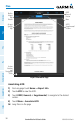
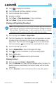
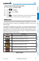
Table Of Contents
- Overview
- Plan
- File
- Fly
- Subscriptions
- Appendix A: License Agreement and Warranty
Garmin Pilot for iOS User’s Guide
190-01501-00 Rev. N
102
Plan
OverviewPlanFileFlySubscriptionsAppendicesIndex
3)
Touch Add Widget Select METAR or TAF from the list of available Widgets.
METAR or TAF information for the Departure Airports is displayed. To view
METAR or TAF information along the route of flight drag the NavTrack.
Colored push-pins show the location for the corresponding METAR or TAF
report.
Or:
1)
From any page touch Home > Trip Planning.
2)
Touch the Brief Tab.
3)
Touch Refresh if necessary to update the weather information.
4)
Touch to expand METARs or Terminal Forecasts, to view the applicable
METAR and TAF information for the route of flight
AIRMETS
An AIRMET (AIRmen’s METeorological Information) can be especially helpful for
pilots of light aircraft that have limited flight capability or instrumentation. An AIRMET
must affect or be forecast to affect an area of at least 3,000 square miles at any one
time. AIRMETs are routinely issued for six-hour periods and are amended as necessary
due to changing weather conditions. AIRMETs are displayed as green (IFR/mountain
obscuration), orange (turbulence), or blue (icing) shaded areas on the map display.
SIGMETS
A SIGMET (SIGnificant METeorological Information) advises of weather that is
potentially hazardous to all aircraft. In the contiguous United States, the following
items are covered: severe icing, severe or extreme turbulence, volcanic ash (red), dust
storms, and sandstorms that lower visibility to less than three statute miles.
A Convective SIGMET is issued for thunderstorms, isolated severe thunderstorms,
embedded thunderstorms, hail at the surface, and tornadoes.
A SIGMET is widespread and must affect or be forecast to affect an area of at least
3,000 square miles.