
User's Guide
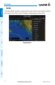
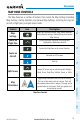
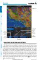
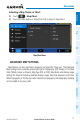
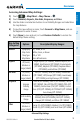
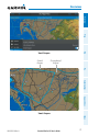
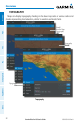
Table Of Contents
- Overview
- Plan
- File
- Fly
- Subscriptions
- Appendix A: License Agreement and Warranty
Garmin Pilot for iOS User’s Guide
190-01501-00 Rev. N
19
Overview
Overview Plan File Fly Subscriptions Appendices Index
Accessing Advanced Map Settings:
1)
Touch > Map/Chart > Map Theme > .
2)
Touch General, Airports, Nav Aids, Airspaces, or Cities.
3)
Use the sliders and selection buttons to set Visibility Ranges and Label Sizes
for map features.
4)
To give the new settings a name, Touch General > Map Name, and use
the keyboard to enter a name.
5)
Touch Done to save and exit, or touch Restore Defaults to restore the
default Map Theme setting.
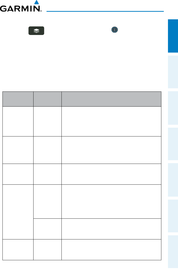
Map Setting
Categories
Options Description/Display Ranges:
General
Topography
Map Color
Map Type
Map Name
Off, Shade, or On
White, Green, or Brown
IFR, or VFR
User defined name.
Airports
Off, Small,
Medium or
Large (Labels)
Large Airports (Off-200NM), Medium Airports (Off-
50NM), Small Airports (Off-10NM), Private Airports
(Off-5NM), Heliports (Off-20NM), Seaplane Bases
(Off-50NM), and SafeTaxi (Off-20NM)
Nav Aids
Off, Small,
Medium or
Large (Labels)
VOR (Off-100NM), NDB (Off-50NM), Intersection
(Off-10NM), VRP (Europe) (Off-10NM), Low Airways
(Off-100NM), and High Airways (Off-100NM)
Airspaces
Airspace
Visibility
Range
Class B (Off-200NM), Class C (Off-200NM), Class D
(Off-100NM), Class E/TRSA (Off-100NM), TMA (Off-
200NM), Control Area (CTA) (Off-100NM), Control
Zone (CTR) (Off-100NM), ATZ/TIZ/MATZ (Off-100NM),
Euro Airway (Off-100NM)
SUA Visibility
Range
Restricted, Alert/Warning, Parachute Area (Off-
200NM), MOA (Off-200NM), ADIZ (Off-100NM),
Danger (Off-100NM), and Other (Off-100NM)
Cities
Off, Small,
Medium or
Large (Labels)
Large City (Off-2000NM), Medium City (Off-200NM),
Small City (Off-100NM), and Small Town (Off-50NM)
Advanced Map Settings