
User's Guide
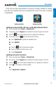
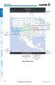
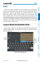
Table Of Contents
- Overview
- Plan
- File
- Fly
- Subscriptions
- Appendix A: License Agreement and Warranty
Garmin Pilot for iOS User’s Guide
190-01501-00 Rev. N
77
Plan
Overview Plan File Fly Subscriptions Appendices Index
PLAN
Garmin Pilot's powerful capabilities start with pre-flight planning, providing pilots
with the most comprehensive aviation weather information to make better-informed
flight decisions. Pilots can check weather radar, visible and infrared cloud imagery,
METARs, TAFs, AIRMETs, SIGMETs, PIREPs, NOTAMs, winds and temperatures aloft,
TFRs, and lightning data. With Garmin Pilot, weather data can be overlaid on VFR
Sectionals, IFR low altitude en route charts, IFR high altitude en route charts, WAC, or
on IFR, VFR, or Roads/Borders basemaps, to visualize the weather for your route. Add
text-based weather widgets and use the exclusive NavTrack feature to view weather
information along the planned route.
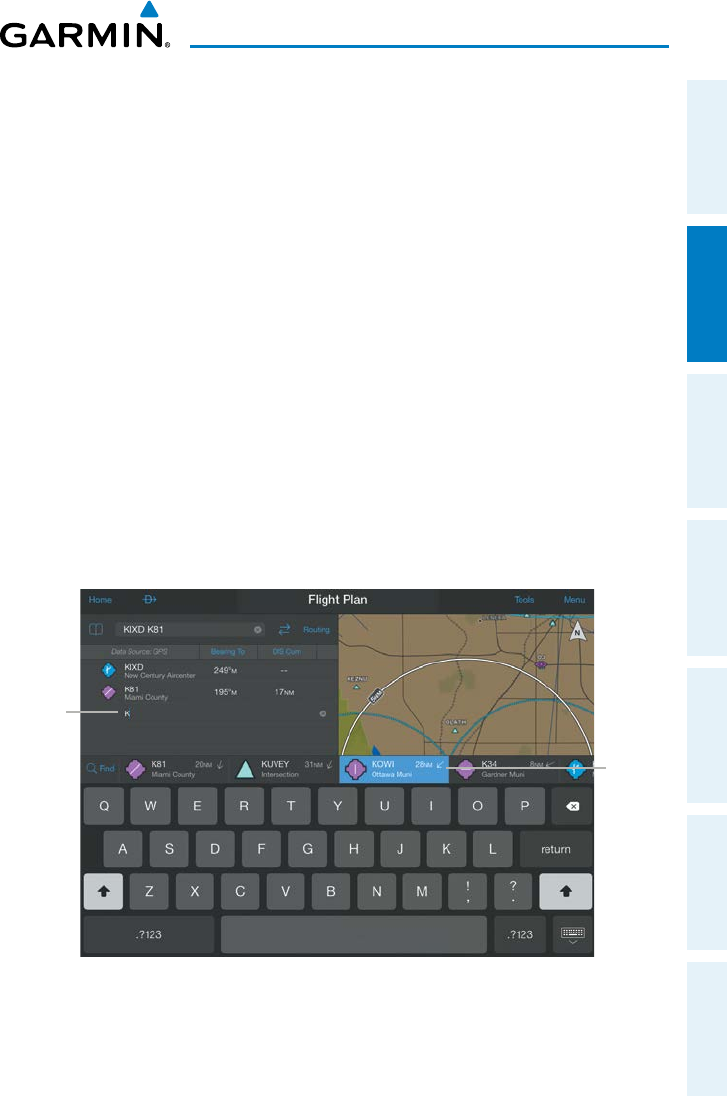
FastFind PREDICTIVE WAYPOINT ENTRY
When entering a waypoint into the flight plan, FastFind Predictive Waypoint Entry
populates airport identifiers and navigation aids nearest your location or previous
point in the flight plan.
FastFind Predictive Waypoint Entry
Begin
Typing the
Waypoint
Touch the
Desired
Waypoint
from the
FastFind
List