DNX8170DABS DNX7170DABS DNX5170DABS DNX5170BTS DNX317BTS DNX317DABS GPS NAVIGATION SYSTEM INSTRUCTION MANUAL © 2017 JVC KENWOOD Corporation IM392_Nav_E_En_00
© 2017 JVC KENWOOD Corporation All rights reserved. Under the copyright laws, this manual may not be copied, in whole or in part, without the written consent of Garmin. Garmin reserves the right to change or improve its products and to make changes in the content of this manual without obligation to notify any person or organization of such changes or improvements. Go to www.garmin.com for current updates and supplemental information concerning the use of this product.
conduct and acceptable content, including laws regulating the export of data to the United States or your country of residence. No Warranty. The Navigation Provider Products are provided to you "as is," and you agree to use them at your own risk.
Map Data. Use of the Map Data is subject to certain restrictions and/or requirements imposed by third party suppliers and/or governmental or regulatory authorities, and in the case of HERE Data, as further set forth at http://corporate.navteq.com/supplier _terms.html. Term.
Table of Contents Getting Started................................ 1 Navigation System ................................... 1 Status Bar Icons ...................................... 1 Using the On-Screen Buttons .................. 1 Removing a Shortcut ............................... 1 Adding a Shortcut .................................... 1 Using Multi-touch Controls ...................... 1 Updating the Software ............................. 1 Updating Map Data ..................................
Saving Trip Logs ............................... 10 Viewing Previous Routes and Destinations ........................................... 10 Viewing the Weather Forecast .............. 10 Viewing Weather Near a Different City .................................................... 10 Viewing the Weather Radar .............. 10 Viewing Weather Alerts .................... 10 Checking Road Conditions ............... 10 Viewing Road Weather .......................... 10 Finding Fuel Stations and Prices ...........
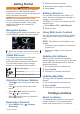
Getting Started WARNING See the Safety Precautions and Important Information in the KENWOOD system instruction manual for product warnings and other important information. NOTE: The screenshots shown in this manual may not exactly match the screens on your navigation system. The images used in this manual are intended for reference only. Navigation System For complete audio system information, see the KENWOOD system instruction manual. À Opens the navigation system when selected.
categories to browse for nearby businesses and attractions. Finding a Location by Category 1 Select Where To?. 2 Select a category, or select Categories. 3 If necessary, select a subcategory. 4 Select a location. Searching Within a Category To narrow your search results, you can search within some categories. 1 Select Where To?. 2 Select a category, or select Categories. 3 If necessary, select a subcategory. 4 If necessary, enter all or part of the name in the search bar.
3 Select the intersection. Finding a City 1 Select Where To? > Categories > Cities. Select an option: 2 • Select a city from the list of nearby cities. • To search near another location, select Searching near: (Changing the Search Area). • To search for a city by name, select Enter Search, enter a city name, and select . Finding a Location Using Coordinates You can find a location using latitude and longitude coordinates. 1 Select Where To? > Categories > Coordinates.
2 Select a parking location. Setting a Simulated Location If you are indoors or not receiving satellite signals, you can use the GPS to set a simulated location. 1 Select Settings > Navigation > GPS Simulator. 2 From the main menu, select View Map. 3 Tap the map twice to select an area. The address of the location appears at the bottom of the screen. 4 Select the location description. 5 Select Set Location. Saving Locations Saving a Location 1 Search for a location (Finding a Location by Category).
to use safe driving judgment at all times. Garmin and JVC KENWOOD will not be responsible for any traffic fines or citations you receive for failing to follow all applicable traffic laws and signs. The route is marked with a magenta line. A checkered flag marks your destination. As you travel, the device guides you to the destination with voice prompts, arrows on the map, and directions at the top of the map.
About Custom Avoidances Taking a Detour Custom avoidances allow you to avoid specific areas and sections of road. You can enable and disable custom avoidances as needed. Avoiding an Area 1 Select Settings > Navigation > Custom Avoidances. 2 If necessary, select Add Avoidance. 3 Select Add Avoid Area. 4 Select the upper-left corner of the area to avoid, and select Next. 5 Select the lower-right corner of the area to avoid, and select Next. The selected area is shaded on the map. 6 Select Done.
Map Pages Customizing the Map Customizing the Map Layers You can customize which data appear on the map, such as icons for points of interest and road conditions. 1 From the map, select . 2 Select Map Layers. 3 Select which layers you want to include on the map, and select Save. Viewing the Trip Log Your device keeps a trip log, which is a record of the path you have traveled. 1 Select Settings > Map & Vehicle > Map Layers. 2 Select the Trip Log check box. 3 Select Save.
Viewing the Trip Information Page The trip information page displays your speed and provides statistics about your trip. NOTE: If you make frequent stops, leave the device turned on, so it can accurately measure elapsed time during the trip. From the map, select Speed. Resetting Trip Information 1 From the map, select Speed. 2 Select > Reset All. 3 Select an option: • When not navigating a route, select Select All to reset every data field except the speedometer, on the first page.
About ecoChallenge ecoChallenge helps you maximize the vehicle fuel economy by scoring your driving habits. The higher your ecoChallenge scores, the more fuel you have saved. ecoChallenge collects data and calculates a score whenever your vehicle is moving. Viewing ecoChallenge Scores Select Apps > ecoRoute™ > ecoChallenge. About the ecoChallenge Score The leaf color on the ecoChallenge icon changes depending on your performance in the challenge.
5 If prompted, select a route. Editing a Saved Trip 1 Select Apps > Trip Planner. 2 Select a saved trip. 3 Select . 4 Select an option: • Select Edit Destinations to add and delete a location, or to change the order of locations. • Select Delete Trip. • Select Rename Trip. • Select Optimize Order to arrange the stops on your trip in the most-efficient order. • Select Route Preference to change the route calculation mode for your trip. Saving Trip Logs Trip logs are recorded while you navigate a route.
Finding Fuel Stations and Prices Traffic Data Using INRIX Traffic Service Before you can use this feature, your device must be connected using Bluetooth to access connected services. You can find nearby fuel stations and compare fuel prices. 1 Select Apps > Fuel Prices. 2 If necessary, select > Fuel Type, select a fuel type, and select Save. 3 Select a fuel station. You can purchase a traffic subscription to receive traffic data using INRIX traffic service.
3 Select an event. Manually Avoiding Traffic on Your Route 1 From the map, select . 2 Select Traffic On Route. 3 If necessary, use the arrows to view other traffic delays on your route. > Avoid. 4 Select Taking an Alternate Route 1 While navigating an automobile route, select . 2 Select Alternate Route. 3 Select a route. Viewing Traffic on the Map The traffic map shows color-coded traffic flow and delays on nearby roads. 1 From the map, select . 2 Select Traffic Conditions.
Safe Mode: Disables all functions that require significant operator attention and could become a distraction while driving. Voice Prompts: Enables voice prompts. GPS Simulator: Stops the device from receiving a GPS signal. Changing the Route Calculation Mode 1 Select Settings > Navigation > Calculation Mode. 2 Select an option: • Select Faster Time to calculate routes that are faster to drive but can be longer in distance.
Destinations), and Trip Log (Viewing the Trip Log) features. Clear Travel History: Clears your travel history from the navigation system. Update Maps: Exports data from the navigation unit for map and software updates and traffic subscriptions (Updating Map Data). Proximity Alerts Settings NOTE: You must have custom points of interest (POIs) loaded for proximity points alerts to display. NOTE: This feature is not available in all areas. Select Settings > Proximity Alerts.
To download free navigation software updates and purchase updated maps for your product, go to www.garmin.com/kenwood.