
Operation Manual


160
User Manual
Navigating on A-B-C-D .........................41
Navigation ...................... 21, 22, 97, 150
Navigation Data ............................. 34, 86
Navigation Speed ................................. 39
NMEA....................................................26
NMEA WPL & RTE............................... 72
NMEA-0183 .......................... 87, 94, 150
NOAA .................................................... 37
NT/NT+ ................................................. 42
O
Object Info ............................................43
Obstructions .................... 52, 59, 60, 61
Off-line redraw ......................................44
Official data source............................... 43
Operating Frequency .......................... 121
opto-isolated ........................................... 4
OSGB .......................................... 96, 150
Other Map Configurations .................... 49
Outdoor Recreational Area................... 60
P
Page Selection menu .........................123
Pair........................................................ 96
Palette................................................... 45
Perspective View .....................15, 22, 43
Photos & Diagrams ....................... 15, 43
Physical Characteristics ....................... 18
Pictures ............................................... 150
Placing EBL & VRM ............................. 80
Port 1/Port 2/Port 3 Input ..................... 37
Port Info ................................ 43, 56, 150
Port information .................................... 15
Port Services ........................................59
Ports & Services ................... 51, 56, 150
Ports By Distance ................................. 59
Ports By Name .....................................59
Position Request ................................ 108
Power Output ........................................ 18
Power supply ........................................ 17
Presentation Features ..........................43
Preset Mode .......................................128
PTX .....................................................113
PTX icon ............................................. 114
PTX information window ..................... 115
PTX List Page ..................................... 115
Q
Quick Info .................... 43, 54, 105, 111
Quick Info on Lakes.............................. 54
R
RAM Clear .......................................... 144
RAM Menu .......................................... 143
RAM Test ............................................ 144
Range ................................................. 129
Range Mode ....................................... 129
Receiver ....................................... 14, 119
Receiving AIS .....................................105
Removing ............................................ 138
Removing C-CARD .............................. 29
Restart GPS ......................................... 39
Reversing route ............................. 72, 73
Rivers & Lakes ..................................... 51
Roads ............................................ 43, 51
Rocks ....................................................52
Rolling Road Scale ...............................97
Route ............................. 63, 65, 71, 150
route check report ................................ 75
Route Data Report................................ 89
Route Name .................................. 72, 73
Route Report ................................. 73, 74
Routes .................................................. 71
RTCM.................................................. 150
S
Safe Route Checking ........................... 74
Safety Route Check ....................... 15, 44
Safety Status Bar .......................... 15, 47
Safety Toolbar ...................................... 44
Satellite image coverage ...................... 15
Satellite Imagery ............................ 15, 48
Save Settings ..................................... 133
Saving File ............................................84
Scrolling Speed .................................. 131
Seabed Type ........................................ 51
Search & Find ....................................... 43
Selecting active Track .......................... 82
Selecting distance ................................ 84
Selecting Route ....................................71
Selecting time ....................................... 84
Selecting track Color ............................83
Send/Receive Route............................. 72
Sensitivity............................................ 130
Sensitivity menu ........................ 124, 130
Serial Ports .....................................4, 145
Set Default Settings............................132
Setup menu ............... 93, 124, 127, 128
Shallow Alarm ..................................... 133
Shift ..................................................... 129
Show PTX .......................................... 116
Simulation ........................................... 101
Slave Chart Plotter ............................... 88
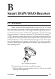
Smart DGPS WAAS Receiver ........... 155
Smooth Zoom .................................15, 43
SOG ............................................. 34, 151
Specifications ....................................... 14
Speed ................................... 37, 74, 151
Speed & Fuel ........................................ 74
Speed Over Ground ........................... 149
Spot Soundings ........................... 43, 151