
Operation Manual


47
User Manual
Data Off
Red when at least one of the following objects or layers is turned off (by the user): Depths/
soundings; Wrecks/obstructions; Tracks/routes; Attention areas; Nav-Aids.
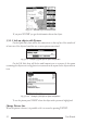
Clear View
Displays when Clear View function is On.
Dangers
Red when “Guardian Technology” detects one of the following objects: Land,
Intertidal, Depth Area, Rocks, Obstructions, Shoreline Constructions, Fishing Fa-
cility, Wrecks, Dragged area, Diffusion area, Mooring facilities, Pingos and Produc-
tion installations.
Caution
Red when “Guardian Technology” detects cautionary or restricted area.
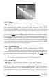
3.5.1.9 Satellite Imagery
'MENU' + "MAP SETTINGS" +'ENTER' + "SATELLITE IMAGERY" + 'ENTER'
It is possible to overlay the Satellite image for background map. When it is set On,
the Palette is set to Normal to display the proper colors.
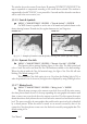
3.5.1.10 Currents Prediction
'MENU' + "MAP SETTINGS" +'ENTER' + "Currents Prediction" + 'ENTER'
It is possible to see the variation of the Tidal arrows on the selected area at any given
time. A window is shown on the low-left side of the chart, press 'ENTER' to set the date and
time manually, 'MENU' to decrease time and 'GOTO' to increase time. Press 'CLEAR' to exit.
3.5.1.11 Other Map Configurations
'MENU' + "MAP SETTINGS" +'ENTER' + "Other Map Configurations" + 'ENTER'
This function allows the user to customize the following selections and is divided
into the following settings: Marine Settings, Depth Settings, Land Settings and Chart Settings.
Display Mode: To simplify the customization of the chart display, the map settings are
now re-organized in modes allowing the user to choose the preferred setting. Pre-pro-
grammed settings are user selectable from Full, Medium, Low, Radar, Tides, Custom. The
default setting is Custom.
'MENU' + "MAP SETTINGS" +'ENTER' + "Other Map Configurations" + 'ENTER'
+ "Display Mode" + 'ENTER'
The table below shows the selections for each mode: