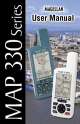
User Manual MAP 330/MAP 330M This User Manual provides the instructions for using the Magellan MAP 330 and the Magellan MAP 330M GPS receivers. Any reference to the MAP 330 in this User Manual applies to both receivers. Those areas that apply only to the MAP 330M will be noted.
WARNINGS FOR SAFETY REASONS, THE DRIVER SHOULD NOT USE THIS DEVICE IN A VEHICLE WHILE IN MOTION TO ASSIST THE DRIVER TO NAVIGATE. Please do not try and change any settings on the MAP 330 while driving. Come to a complete stop or have your passenger make any changes. Taking your eyes off the road is dangerous and can result in an accident in which you or others could be injured.
MAGELLAN CORPORATION LIMITED WARRANTY All Magellan GPS receivers are navigation aids, and are not intended to replace other methods of navigation. Purchaser is advised to perform careful position charting and use good judgment. READ THE USER GUIDE CAREFULLY BEFORE USING THE PRODUCT.
• SERVICING PERFORMED OR ATTEMPTED BY ANYONE OTHER THAN AN AUTHORIZED MAGELLAN SERVICE CENTER. • MODIFICATIONS TO THE RECEIVER WHICH MAY BE REQUIRED DUE TO ANY CHANGE IN THE GLOBAL POSITIONING SYSTEM (GPS). (Note: All Magellan GPS receivers use GPS to obtain position, velocity and time information. GPS is operated by the U.S. Government, which is solely responsible for its accuracy and maintenance. Certain conditions can cause inaccuracies which could require modifications to the receiver.
Introduction About This User Manual ......................................................................... 1 Setting Up the MAP 330 Installing the Batteries ............................................................................. 3 Connecting the Wrist Strap ..................................................................... 4 Initialization for First Time Use .............................................................. 5 Turn the MAP 330 On .....................................................
Reference Power/Backlight/Contrast ..................................................................... 23 Turn the MAP 330 On ................................................................................ 23 Turn the MAP 330 Off ................................................................................ 23 Using the Display Backlight ......................................................................... 23 Adjusting the Display Contrast ...........................................................
Satellite Status Screen ............................................................................ 38 Waypoints / Database ........................................................................... 39 Accessing Waypoints in the Database ........................................................... 39 Selecting Waypoints from the Nearest List ................................................... 39 Selecting Waypoints from the Alphabetical List ...........................................
Setup .................................................................................................... 51 Initializing the MAP 330 ............................................................................. 51 Turning the NAV Screens On/Off ............................................................... 52 Selecting the Coordinate System .................................................................. 52 Selecting a Map Datum ..........................................................................
Using the Simulator .............................................................................. 60 Turning on the Simulator - Auto Mode ....................................................... 60 Turning on the Simulator - User Mode ........................................................ 60 Turning the Simulator Off ........................................................................... 60 Help ......................................................................................................
vi Magellan MAP 330 GPS Receiver
Introduction Introduction Welcome and congratulations on your purchase of the Magellan MAP 330 GPS receiver. The MAP 330 has all the features that a sailor, fisherman, hiker, hunter, or any person involved with outdoor recreational activities has come to expect from a Magellan GPS receiver. In addition to these features, the MAP 330 offers the ability to display your location on detailed city maps providing you with a complete navigation tool that will last you for years to come.
Introduction Reference Guide: Here you will find step-by-step instructions for all of the features found in the MAP 330. This chapter is set up in a way that you can quickly and easily find the feature you are looking for. Frequently Asked Questions: This chapter is aimed at answering some of the more basic questions that you may have about your MAP 330, the global positioning system (GPS) and using the MAP 330 to its fullest.
Setting Setting Up Up the the MAP MAP 330 330 Setting up the MAP 330 is a simple three-step process: installing the batteries, attaching the wrist strap and initializing the MAP 330. The MAP 330 uses two AA batteries that are installed from the back through the battery cover. You can expect to get up to 10 hours of usage on two AA batteries with the backlight turned off. To remove the battery cover, turn the ring of the battery door screw counterclockwise until the battery cover can be removed.
Setting Up the MAP 330 The wrist strap attaches to the ring on the screw for the battery door cover. The picture below shows how the wrist strap should be attached.
Setting Setting Up Up the the MAP MAP 330 330 The final step in setting up the MAP 330 is to initialize the receiver for firsttime use. This will help your MAP 330 begin computing your position in the fastest manner possible. The reason for initialization is to speed up the process for computing the first position fix when the MAP 330 has no last position computed in memory (i.e., when the MAP 330 is brand new or memory has been cleared).
Setting Up the MAP 330 The MAP 330 displays a message box indicating that the receiver needs to be initialized. Press ENTER Use the Press to highlight your general region. ENTER Use the Press ENTER to highlight your area. . The cursor appears in the time field, waiting for you to input your local time. Set your local time using the arrow keys. Be sure that you set the AM/PM indicator.
Setting Setting Up Up the the MAP MAP 330 330 To use the arrow keys to edit a field, follow the simple diagram below. Editing moves the cursor block left or right. Pressing right arrow results in: increments the value up or down. Pressing up arrow results in: When the time is correct, press ENTER . The last piece of information needed is the date. Using the arrow keys, enter the present date. Press ENTER .
Setting Up the MAP 330 The Sat Status screen is displayed and the MAP 330 is now ready to be used. At this point you can begin using the MAP 330 beginning with the Basic Operation described in the next chapter or you can turn the MAP 330 off. To turn the MAP 330 off, press 8 .
Basic Basic Operation Operation For many of you this will be your first introduction into using a GPS receiver as a navigational tool. With all of the features and functions provided with the MAP 330, it may seem a bit intimidating at first. Don’t worry. There are only a few things you need to know to use the MAP 330. They will be discussed here in detail. Other features and functions can be found in the Reference Section of this manual. Quadrifilar Antenna IN - Zooms in the display of the Map screen.
Basic Operation External Connections Provides connection to external power and data handling devices. Pressure Relief Vent Battery Cover Power/Data Cable (purchased separately) - Allows access to the external connector for the MAP 330. See the section on Accessories for description of available cables. Battery Cover Screw and Wrist Strap Ring Tuning the MAP 330 On Press Press ENTER [You have 10 seconds to press ENTER accepting the displayed warning or the MAP 330 will shut off.
Basic Basic Operation Operation Turning the MAP 330 Off Pressing the ON/OFF button again will turn off the MAP 330 immediately. Press Pressing ESC key will cancel the power down sequence. Shutdown Screen displayed The display backlight can be set to one of three levels (low, high or off ).
Basic Operation Because the MAP 330 attains information it needs from satellites orbiting the earth, the antenna needs to have a relatively unobstructed view of the sky. This allows the MAP 330 to choose from all satellites currently available. If the view of the sky is poor, (large cliffs or buildings, heavy foliage or other obstructions) the satellite signals can be blocked and the receiver may take longer to compute a position fix.
Basic Basic Operation Operation In the Cursor Mode, you are provided with a cursor that can be moved on the map. At the bottom of the display is the information for the position of the cursor relative to your present position. Also any points of interest that the cursor is over will be shown. To access the Cursor Mode, press any arrow on the keypad. A crosshair appears that can be moved with the arrow keys. To return to the Position Mode, press ESC .
Basic Operation From any screen other than a navigation screen, pressing NAV returns you to the last navigation screen viewed. Note that if you are inputting data, pressing NAV will return you to the last navigation screen but your inputs will not be saved. While viewing any navigation screen, you can maneuver through the other screens following the sequence below. NAV Map Screen (Position Mode) ESC Map Screen (Cursor Mode) Compass Screen Lg.
Basic Basic Operation Operation A waypoint is a point on a map that you can name and save in the MAP 330. They are primarily used for creating routes. Whether the route is a simple GOTO or a more complex multileg route, it needs stored waypoints to use as its starting and destination point. Saving a Waypoint with a Receiver-Generated Name From any screen, press and hold MARK for 2 seconds and the Mark screen is displayed.
Basic Operation The Icon Select window is displayed. Use the arrow keypad to move from one icon to another with the name of the icon displayed at the top. As a reference tool, all of the icons and their names are listed in the Reference Chapter. When you have highlighted the icon you want to use, press ENTER . The cursor is now highlighting the Waypoint Name field. With the Name field highlighted, press ENTER . The input keyboard is displayed.
Basic Basic Operation Operation When you have the name the way you want it, highlight “OK” and press ENTER . You are returned to the Mark screen with the new name displayed. Entering a Message Any waypoint can have a message assigned to it. This comes in handy in further identifying the waypoint. If this was a waypoint for a friend’s house or business, you could add a phone number or any other information that you find useful. Use the UP/DOWN arrows to highlight the Message field and press ENTER .
Basic Operation A GOTO route is simply a route with a start point and a single destination point; I am here and I want to go to there. All that is required to create a GOTO route is having the destination waypoint saved in memory. This waypoint can be one that you have saved earlier (which is stored in your User Waypoint List) or any of the landmarks that come with the MAP 330 in its built-in database. For example, suppose you parked your car and planned on going hiking for about an hour.
Basic Basic Operation Operation The example shown here is a sample of a City Waypoint List. This is a sample of a Nearest City Waypoint list for Magellan. Your screen will look different. Use the UP/DOWN arrows to highlight your choice of waypoint to be your destination and press ENTER . The GOTO route is now active and you are returned to the last viewed navigation screen.
Basic Operation Since we are looking for Los Angeles, we need to repeat pressing the UP key until the letter “L” is displayed in the cursor. The City Waypoint list would look like this. This is pretty good as now the listing shows the cities beginning with the letter “L”, but we can get even closer. Press the RIGHT arrow once. The cursor has moved to the second character in the list. Press the UP arrow until the letter “O” is in the cursor.
Basic Basic Operation Operation You can now select Los Angeles from the list by pressing ENTER . The first city in the list is now highlighted. Use the DOWN arrow to highlight Los Angeles. With Los Angeles highlighted, it can be selected as the destination of the GOTO route by pressing ENTER . You are now sent to the last NAV screen that was viewed. The GOTO route has been activated and you are ready to begin navigating on the route.
Basic Operation GOTO routes are NOT saved in memory when the MAP 330 is turned off. If you are navigating on a GOTO route and you need to turn the MAP 330 off, you will need to restart the GOTO. Routes, however, are stored in memory. If you need to make a GOTO but expect to turn the MAP 330 off before arriving, you might consider making a 1-leg route using the route menu. More information on routes can be found in the Reference chapter of this manual.
Reference Turn the MAP 330 On — Applies power to the MAP 330 and displays last NAV screen viewed. During power-up the first screen shows the software and map database versions currently loaded in the MAP 330. The second screen gives a warning that must be read. After reading the warning press ENTER to proceed. (If you do not press ENTER, the MAP 330 will shut off after 10 seconds.) ENTER Turn the MAP 330 Off — Shuts down the MAP 330. Press ESC key to abort before 5 seconds has elapsed.
Reference Adjusting the Display Contrast — Sets the contrast of the display for easy viewing in most lighting conditions. From Any Screen MENU Highlight ENTER ENTER Contrast Adjust Contrast Level Selecting NAV Screens — The NAV button provides a means of accessing the navigation screens. (Note: the sequence displayed is when all five navigation screens are turned on. Screens turned off in Setup will not be displayed.
Reference Present Position Icon Track History Map Scale Indicator Data Fields Present Position Icon The Present Position Icon graphically displays your position on the map. While you are moving it will point in the direction you are heading. If the MAP 330 is not computing positions, this icon is replaced with an hourglass icon. Map Scale Indicator Provides the scale for the map. The number displayed represents approximately 1/4 of the screen’s width. Scale can be changed with the IN and OUT buttons.
Reference In the Cursor Mode, you are provided with a cursor that can be moved on the map. At the bottom of the display is the information for the position of the cursor relative to your present position. Also any points of interest that the cursor is over will be shown. To access the Cursor Mode, press any arrow on the keypad. A crosshair appears that can be moved with the arrow keys. To return to the Position Mode, press ESC .
Reference Setting the Map Detail — The detail of the map can be set to highest, high, medium, low or lowest. This changes the zoom level that different map objects (cities, highways, labels, etc.) are displayed. If you have set a zoom level and the display is too cluttered, set the map detail to a lower level; conversely set it to a higher level to view more detail. The default is Medium.
Reference Turning On/Off Display Waypoints — Turns on or off the waypoints on the Map screen. Default is On. MENU From the MAP Screen ENTER Highlight Map Setup ENTER Use arrows to select On or Off Use arrows to highlight the “Display Waypoints” field ENTER NAV City Definition — The MAP 330 refers to cities as major, large, medium or small. Each city definition has its own icon and is defined by the population of the city.
Reference When Nav Info is hidden and the map is in the cursor mode, the bearing (BRG) and distance (DIS) to the cursor is shown at the bottom of the map. If the cursor happens to be on a map object, the name of the object is displayed instead of BRG/DIS. Selecting Street Information or Data Fields for Nav Information — When the Nav Info box is being displayed at the bottom of the Map screen, you have the option of displaying street information or two customizable data fields.
Reference Data Description Bearing This is the direction to your destination from your present position, in degrees, from North. Distance This is distance (measured in the Nav Units selected in Setup) to your destination. Speed This is the rate that you are travelling. The unit of measure is selected in Setup - Nav Units. Heading This is the direction you are moving (in degrees). When the heading and bearing are the same, you are travelling on a direct line to your destination.
Reference Changing the Map Orientation — You can change how the map is orientated on the screen to either North Up, Course Up or Track Up. Default is North Up. From the MAP Screen MENU ENTER Highlight Map Setup Use arrows to select the desired Map Orientation ENTER Use arrows to highlight the “Orientation” field ENTER NAV Track History — As you travel, the MAP 330 automatically saves hidden waypoints into its memory. These waypoints can then be used to guide you back to where you started.
Reference Setting the Track Mode to “OFF” stops recording your track. The same temporary waypoints used to create the track are used to compute a backtrack route. Therefore, setting Track Mode to “Off ” will not allow you to create a backtrack route. It is highly recommended that you do not set the Track Mode to OFF in case you ever need to use backtrack. From the MAP Screen MENU Highlight ENTER Confirm ENTER Clear Track Clearing Track — This will delete all of the track points stored in memory.
Reference Destination Name Data Fields Heading Marker Destination Icon Sun/Moon Position Marker Compass Destination Name Compass/Heading Marker When you are navigating on a Using the compass and the GOTO or multileg route, the name heading marker, you can view of the destination is placed here. your heading information in a For multileg routes, the name familiar manner.
Reference Customizing the Data Fields — Allows you to change the data that is being displayed to 1 of 13 data options (bearing, distance, speed, heading, VMG, CTS, ETA, ETE, XTE, turn, elevation, time, or date) for any of the four fields. (See explanation of Data Types in the Map Screen section.
Reference Customizing the Data Fields — Allows you to change the data that is being display to 1 of 13 data options (bearing, distance, speed, heading, VMG, CTS, ETA, ETE, XTE, turn, elevation, time, or date) for any of the four fields. (See explanation of Data Types in the Map Screen section.
Reference Present Position Coordinates and Elevation Current Time and Date GPS Status Data Fields Trip Odometer Use the Left/Right Arrows to toggle between Position 1 and Position 2 Present Position Coordinates Data Fields and Elevation Customizable data fields. The Displays your present position in the data displayed can be selected coordinate system chosen in Setup. from 13 different options. Also displays the elevation of the Customizing is accessed through present position.
Reference Customizing the Data Fields — Allows you to change the data that is being displayed to 1 of 13 data options (bearing, distance, speed, heading, VMG, CTS, ETA, ETE, XTE, turn, elevation, time, or date) for any of the two fields. (See explanation of Data Types in the Map Screen section.
Reference The Satellite Status screen visually displays the satellites being used and the strength of the received signal. Additionally, this screen displays the power source you are connected to and, if internal batteries, how much battery life is remaining. This is a very handy screen when you wish to view how well your MAP 330 is tracking satellites.
Reference Accessing Waypoints in the Database — All stored waypoints, whether user-input or preloaded, can be found in the Waypoint Database. You will need to access waypoints in the database whenever you are editing waypoints, activating a GOTO route or creating a multileg route. From Any Screen MENU Highlight Database Use left/right arrows to select “Find By” ENTER Use up/down arrows to select category ENTER Selecting Waypoints from the Nearest List.
Reference 1 Scroll Quick-Find Box Changes character Moves cursor left/right 2 3 Access Waypoint List ENTER Moves cursor from “QuickFind” box to highlight waypoints in list ESC While waypoint list is highlighted, you can return to the “Quick-Find” box by pressing ESC. Select Waypoint Moves highlight up/down ENTER Selects highlighted waypoint Moves name left or right to display long names. Also displays population if applicable. Selecting Waypoints Nearest to the Cursor.
Reference Saving Present Position as a Waypoint — Creates and stores your present position into the memory of the MAP 330. Stored waypoints can be used in GOTO and route creation. While saving the waypoint, you can edit the icon, name and add a message or you can just save the waypoint using the default name supplied by the MAP 330.
Reference From Map Screen MARK Use arrow keys to move cursor to desired position ENTER Modify (see Note) Hold down for 2-3 seconds (Note: To modify the icon, name or message use the Up/Down arrows to highlight the field you wish to change and press ENTER. You are then placed into the Edit Mode.) Deleting a User Waypoint — Deletes a waypoint that you have created.
Reference Viewing a Map Object on the Map — Displays on the Map the Map Object you have selected. Note: This function is for viewing map objects (cities, airports, etc.) only. See Viewing User Waypoints on the Map for instructions on how to perform this feature using User waypoints. From Any Screen MENU Highlight ENTER Database Select Database Category ENTER ENTER Select Waypoint from the list Viewing a User Waypoint on the Map — Locates and displays on the Map the selected User Waypoint.
Reference Searching for a Street Address — This option allows you to search an uploaded map database for a specific street address. After finding the address, you can save it as a waypoint (MARK) or view it on the Map Screen. NOTE: The option is available ONLY if you have uploaded one or more detailed maps from the Magellan MapSend Streets CD-ROM.
Reference Creating a GOTO Route — Creates and sets as the active route a 1-leg route with your present position as the starting point and a destination waypoint that you choose from the waypoint database. From Any Screen GOTO If a GOTO route already exists, you will be asked to clear it. Select Waypoint from List Select Waypoint Category Use L/R arrows to select “Find By” ENTER ENTER GOTO routes are not saved in memory. When you turn your MAP 330 off and then back on, the GOTO route is gone.
Reference Creating a Multileg Route — Provides the means to create a multileg route that can be stored in memory. Multileg routes are easily the most complicated function in the MAP 330, but once you can visualize what a multileg route (route) is, it becomes very easy to understand and create. If you understand that a GOTO is a 1-leg route with a starting point and a destination point, then imagine a bunch of GOTO’s strung together where the destination of one GOTO is the starting point for the next GOTO.
Reference From Any Screen MENU Highlight ENTER Routes Step 1: Select starting waypoint ENTER Select Waypoint Category Select Waypoint from List Use L/R arrows to select “Find By” Select Waypoint from List ENTER ENTER Step 2: Use up/down arrows to move Select leg highlight to next available leg in destination the route. Indicated by dashes.
Reference Activating/Deactivating a Route — Enables the activating or deactivating of a stored route. When a route is being used to navigate, it is termed to be “active”. When you want to use a route to navigate with, follow these steps to activate it.
Reference Inserting a Leg — Inserts a waypoint in the middle of an existing leg thereby making two legs where there used to be one. Select route to be edited. See Instructions for Viewing a Route Highlight destination waypoint for leg that will have a leg inserted.
Reference Appending a Leg — Adds a leg to the end of a route. Select route to be edited. See Instructions for Viewing a Route Select Database ENTER Highlight next available leg. (Indicated by dashes) ENTER Select Waypoint ENTER Appending a Newly Created Waypoint to a Route — Allows a newly created waypoint to be appended to any route in memory. Create a Waypoint by pressing the MARK button. Can be present position, user-generated position or by using Map Cursor to locate position.
Reference Viewing a Route on the Map Screen — Provides you with a graphical representation of the route selected on the Map screen. From Any Screen MENU ENTER Highlight Routes Select Route MENU ENTER Highlight Map View Route Creating a Route Using Track History — This enables you to automatically create a multileg route using your track history. This route will be saved to your route list with a naming convention of “T01P01 to T01Pxx” where Pxx indicates the number of points in the route.
Reference Turning NAV Screens On/Off — Allows you to turn off or on any of the navigation screens you choose. From Any Screen MENU Highlight ENTER Sat Status On/Off Position On/Off ENTER ENTER Highlight Setup Nav Screens Compass On/Off ENTER Large Font On/Off ENTER ENTER (Note: you must go through the entire sequence of nav screens for your selections to be saved.
Reference Selecting a Map Datum — Allows you to set the datum used to compute the coordinates to match the datum used on a map or chart. If you are using a map or chart with your MAP 330 and the datums do not match, you may find irregularities when comparing the coordinates.
Reference Selecting NAV Units — Allows you to select the units of measure that will be used when displaying navigational data. Options are: Miles/MPH, NM/Knots or KM/KPH. From Any Screen MENU Highlight ENTER Setup Highlight ENTER Nav Units ENTER Select Nav Units Default: Miles/MPH Selecting the North Reference — Allows the selection of whether the MAP 330 uses True North or Magnetic North as its North reference.
Reference Turning the Beeper On/Off — Allows you to select which actions will cause the beeper to sound. You can choose from Off, Keys Only (pressing a key causes a beep), Alarms Only (when an alarm is activated) or Keys & Alarms. From Any Screen MENU Highlight ENTER Setup Select Beeper Options Highlight ENTER Beeper ENTER Default: Keys & Alarms Selecting NMEA Message — Allows the selection of the NMEA message that will be output from the MAP 330. Choices are Off, V1.5 APA, V1.5 XTE or V2.1 GSA.
Reference All of the Clear functions operate in the same way. The instructions shown apply to all of the Clear options except Clearing All. From Any Screen MENU ENTER Highlight Setup Highlight Menu Choice Highlight ENTER Clear Memory ENTER Confirm? Yes/No ENTER Clearing Track History — This will clear the track history that is displayed on the Map screen from memory. Clearing Wpts/Routes — This will clear all waypoints and routes from the MAP 330’s memory.
Reference Accessing the Sun/Moon Screen — The Sun/Moon screen displays the sunrise time, sunset time and lunar phase for any waypoint you have stored in the User category in the waypoint database. All times displayed are local times to your present position. From Any Screen MENU Highlight ENTER Sun/Moon Changing the Sun/Moon Date — Allows you to change the date for the sun/moon information for the position selected.
Reference Accessing the Fish/Hunt Screen — The Fish/Hunt screen displays the best times for fishing or hunting for the position you choose from your User waypoints. From Any Screen MENU Highlight ENTER Fish/Hunt Changing the Fish/Hunt Date — Allows you to change the date for the fishing/hunting information for the position selected.
Reference All of the Alarm options are set in the same way. The instructions below apply to all of the Alarm settings. When the beeper is turned on for alarms (see Setup - Turning the Beeper On/Off ) an audible beep will be sounded for the alarm. A visual alert is displayed for the alarm whether the beeper is turned on or off.
Reference Turning on the Simulator - Auto Mode — This turns the simulator on and uses a predefined heading and speed rate. From Any Screen MENU Highlight ENTER Setup Highlight Auto ENTER ENTER Highlight Simulate Confirm Clearing of Track ENTER Turning on the Simulator - User Mode — This turns the simulator on and uses a heading and speed rate that you define.
Reference Help Screen You can view help tips for Nav Screens, Map, Routes, Setup, Database, User Waypoints and Misc Topics. Each topic has a number of tips available that can be viewed. From Any Screen MENU Highlight ENTER Help Select Topic ENTER Use the “Next” and “Previous” buttons to scroll through the MAP 330 tips About... Screen The About... screen displays the current status of your MAP 330. Using the About...
Frequently Asked Questions General What is the difference between degrees/minutes/seconds (DEG/MIN/SEC) and degrees/minutes/minutes (DEG/MIN/MMM or DEG/MIN/MM)? There are different ways in expressing the coordinates computed using Lat/Lon coordinate system. With DEG/MIN/SEC the final set of numbers (SEC) is expressed as 0-59 while DEG/ MIN/MM expresses the same value as 0-99 and DEG/MIN/ MMM is from 0-999.
Frequently Frequently Asked Asked Questions Questions Time Format and re-select the time format you are using unless you are using UTC. After selecting the format you will be given the opportunity to change the time. How long can I expect my MAP 330 to run on a fresh set of batteries? Under normal operating conditions you should get up to 10 hours of use while the display backlight is turned off. This duration will drop significantly if you use the display backlight.
Frequently Asked Questions Can I delete preloaded waypoints that I don’t use? No. Waypoints that are preloaded into the MAP 330 will always be available, even when all of the MAP 330’s memory has been cleared. Navigation Screens Why does my compass not point in the right direction? The MAP 330 is not a compass. It must be moving at a minimum of 2.0 mph for the compass to compute the direction properly. Routes What is a backtrack route? A backtrack route allows you to “retrace” your steps.
Frequently Frequently Asked Asked Questions Questions Output Data What is NMEA? NMEA (National Marine Electronics Association) is the standard used for interfacing marine electronic devices. This standard has also been adapted for use in a variety of third-party mapping software programs. What are the NMEA message strings? The MAP 330 supports version 1.5 and 2.1 of the NMEA 0183 standard. Additional information on NMEA can be found at on the internet at www.nmea.
Appendix Receiver will not turn on: 1. Check to see if batteries are installed correctly. 2. Replace with two new AA alkaline batteries. Takes more than 10 minutes to get a position fix: 1. If there are any obstacles nearby or overhead, move to a new location. 2. Make sure that the antenna is pointing up, has a clear view of the sky and is a reasonable distance away from your body. 3. Check Satellite Status screen to see where the satellites are and if the receiver is acquiring data. 4.
Appendix These is a list of the icons and their designator that can be assigned to a waypoint while marking a position or editing a waypoint.
Appendix Navaids. Included with the MAP 330M are fixed navaids (lights), buoys, lighthouses, marinas and obstructions (wrecks, rocks, etc.). These navaids can be accessed through the database in the same manner that any other waypoint or map object can be accessed using the Database function. The screen to the right shows what you can expect to see when accessing the database with a MAP 330M. The additional database categories have been added to the bottom of the list following National Parks.
Appendix If after using the troubleshooting section, you are still unable to solve your operation problems, please call Magellan’s Technical Service at (866) 737-8604. Representatives are available Monday through Friday from 7 AM to 5 PM, PST. Faxes can be sent to Customer Service at (909) 394-7070. If necessary, you can also return your receiver to Magellan for repair. Before returning the receiver you must get a Return Materials Authorization (RMA) from Magellan Corporation.
Appendix CHARACTERISTICS Performance Receiver 12 parallel-channel technology, tracks up to 12 satellites to compute and update information with quadrifilar antenna Acquisition Times (under optimal conditions): Warm Cold Update Rate approximately 15 seconds approximately 1 minute 1 second continuous Accuracy Position 49 feet (15 meters) RMS Velocity 0.1 knot RMS steady state Limits: Speed 951 mph Altitude 17,500 meters Physical: Size 6.2” x 2.0” x 1.3” [h] x [w] x [d] 15.75 cm x 5.08 cm x 3.
Appendix Accessories for your receiver are available from your Magellan dealer or you can order directly from Magellan at (800) 669-4477 (press 3 to place an order). Swivel Mounting Bracket: Mounts the receiver on a surface, allowing for handsfree operation. Vehicle Mounting Bracket: Full swivel and tilt for easy viewing in any vehicle. Bike Mounting Bracket: Mounts the receiver on the handlebars of a bicycle, motorcycle or off-road vehicle.
Appendix The MapSend Streets CD allows you to load detailed street maps into your MAP 330. The maps supplied on the MapSend Streets CD contain full street detail of the U.S. cities. Features • Enables you to load street maps (up to 8MB) for any region in the United States into the MAP 330. • Creation, management and upload/download of waypoints and routes. • Allows you to cut any rectangular map region you choose to load into the receiver. Maps are not pre-cut to counties or other boundaries.
Appendix Available as accessories for your GPS receiver are the following cables: External Power Cable with Cigarette Lighter Adapter, Power/Data Cable, Data Cable and PC Cable with Cigarette Lighter Adapter. The instructions given below apply to all cables, unless otherwise stated. The cable can be connected to the receiver two different ways: 1. Mount to the back of the Swivel Mounting Bracket. Using the two screws included, attach the plug to the back of the swivel mounting bracket.
Appendix Connecting to an External Power Source If using the cable that comes with the cigarette lighter adapter, simply connect it to the cigarette lighter outlet. If you wish to make a permanent mount to a power supply, cut the cable between the power supply box and the cigarette lighter adapter. Attach the red (+) and black (-) wires to your external power source. The input voltage range for external power is 9-16 VDC.
Appendix Active Leg The segment of a route currently being traveled. Altitude The current elevation above sea level. BRG Bearing. The compass direction from your position to a destination, measured to the nearest degree. Buoy A navigation aid (usually found in marine charts) that is floating in water. The position can vary due to the magnitude and direction of the current. COG Course Over Ground. The direction the receiver is moving. COG can be reported in true or magnetic north values.
Appendix ETE Estimated Time Enroute. The estimated time remaining to reach the next waypoint in a route. HDG Heading. The direction you are facing, defined as an angle from North. Latitude The angular distance north or south of the equator measured by lines encircling the earth parallel to the equator from 0˚ to 90˚. LAT/LON Coordinate system using latitude and longitude coordinates to define a position on the earth.
Appendix True North The direction to North Pole from an observer’s position. The north direction on any geographical meridian. UTC Universal Time Coordinated. Formerly referred to as Greenwich Mean Time (GMT). UTM Universal Transverse Mercator metric grid system used on most large and intermediate scale land topographic charts and maps. VMG Velocity Made Good. The component of the velocity that is in the direction of the destination. WPT Waypoint.
Appendix 2D 62 3D 62 About...
Appendix Help screen 61 Holding 12 Icons 67 Interfacing, Macintosh 65 Initialization 5, 63 Keys 9 Large Data Screen 13, 34; customizing 35 Leg, appending 50; deleting 49; inserting 49; replacing 49 Map Screen 12, 24; callouts 25, 26; setting detail 27; legend 27; displaying waypoints 28; customizing 29; turning data off 28; changing orientation 30; turning off track history display 31; street information 29 MapSend Streets™ 72 Map Object, saving 43; viewing 43 Memory, clear all 56; clear track 56; clear
Appendix Satellite Status Screen 37 Setup 50 Signal Strength 37 Simulator 60; turning off 60; turning on 60; user mode 60 Specifications 70 Sun/Moon screen, accessing 57; date changing 57; position changing 57 Technical Support 69 Time, setting 53 Time Format, selecting 53 Track History display 31; clearing 31, 56; mode 31 Trip Odometer 36; resetting 35 Waypoints, accessing 39; creating manually 41; creating with cursor 41; deleting 45; editing 42; icons 67; preloaded 63; saving 15, 41; number of 17; appen
960 Overland Court, San Dimas, CA 91773 (909) 394-5000 630800 A