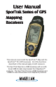
User Manual SporTrak Series of GPS Mapping Receivers . This manual covers both the SporTrak™ Map and the SporTrak™ Pro GPS receivers. All of the functions described in this manual apply to both receivers. The SporTrak Map has a 2MB basemap with an additional 4MB for data downloaded from MapSend™ products. The SporTrak Pro has a 9MB basemap and 23MB for data downloaded from MapSend products.
WARNINGS FOR SAFETY REASONS, THE DRIVER SHOULD NOT USE THIS DEVICE IN A VEHICLE WHILE IN MOTION TO ASSIST THE DRIVER TO NAVIGATE. Please do not try and change any settings on the SporTrak while driving. Come to a complete stop or have your passenger make any changes. Taking your eyes off the road is dangerous and can result in an accident in which you or others could be injured.
THALES NAVIGATION LIMITED WARRANTY All Magellan GPS receivers are navigation aids, and are not intended to replace other methods of navigation. Purchaser is advised to perform careful position charting and use good judgment. READ THE USER GUIDE CAREFULLY BEFORE USING THE PRODUCT. package to: original warranty, whichever is longer. 5. 2. The following are excluded from the warranty coverage.
• MODIFICATIONS TO THE RECEIVER WHICH MAY BE REQUIRED DUE TO ANY CHANGE IN THE GLOBAL POSITIONING SYSTEM (GPS). (Note: All Magellan GPS receivers use GPS to obtain position, velocity and time information. GPS is operated by the U.S. Government, which is solely responsible for its accuracy and maintenance. Certain conditions can cause inaccuracies which could require modifications to the receiver. Examples of such conditions include but are not limited to changes in the GPS transmission.
Introduction About This User Manual ......................................................................... 1 Setting Up the SporTrak Installing the Batteries ............................................................................. 3 Selecting Language .................................................................................. 4 Initialization for First Time Use .............................................................. 4 Turning the SporTrak On ...........................................
Reference Power/Backlight/Contrast ..................................................................... 18 Turn the SporTrak On ................................................................................. 18 Turn the SporTrak Off ................................................................................. 18 Using the Display Backlight ......................................................................... 18 Adjusting the Display Contrast .......................................................
Compass Screen .................................................................................... 30 Customizing the Data Fields ........................................................................ 31 Large Data Screen ................................................................................. 31 Customizing the Data Fields ........................................................................ 32 Position Screen ................................................................................
Inserting a Leg ......................................................................................... 46 Deleting a Leg ......................................................................................... 46 Replacing a Leg ........................................................................................ 47 Appending a Leg ...................................................................................... 47 Appending a Newly Created Waypoint to a Route ...................................
Accessing the Fish/Hunt Screen ................................................................... 57 Changing the Fish/Hunt Date ..................................................................... 57 Changing the Fish/Hunt Position ................................................................ 57 SporTrak Alarms ................................................................................... 58 Setting the Arrival Alarm .............................................................................
vi Magellan SporTrak GPS Receiver
Welcome and congratulations on your purchase of one of the Magellan SporTrak GPS mapping receivers. The SporTrak has all the features that a sailor, fisherman, hiker, hunter, or any person involved with outdoor recreational activities has come to expect from a Magellan GPS receiver. In addition to these features, the SporTrak offers the ability to display your location on detailed city maps providing you with a complete navigation tool that will last you for years to come.
Reference Guide: Here you will find step-by-step instructions for all of the features found in the SporTrak. This chapter is set up in a way that you can quickly and easily find the feature you are looking for. Frequently Asked Questions: This chapter is aimed at answering some of the more basic questions that you may have about your SporTrak, the global positioning system (GPS) and using the SporTrak to its fullest.
Setting up the SporTrak is a simple three-step process: installing the batteries, selecting the language to be used and initializing the SporTrak. The Magellan SporTrak uses two AA batteries that are installed from the back through the battery cover. You can expect to get up to 15 hours of usage on two AA batteries with the backlight turned off. To remove the battery compartment, loosen the retaining screw at the bottom of the battery compartment.
The first time you use your SporTrak (or if memory has been completely erased) you will be asked to select the language that you want to use. Use the UP/DOWN arrows on the keypad to highlight the language you desire. With the language highlighted, press the ENTER button. You can select English, French, German, Spanish, Italian, Portuguese, Finnish, Dutch or Swedish. You can change the language at any time by accessing the Languages option of the Setup Menu.
Press [ENTER]. (You have 10 seconds to press [ENTER] or the SporTrak will shut off.) The SporTrak displays a message box indicating that the receiver needs to be initialized. Press [ENTER]. Enter Your Approximate Position (Initialize) Use the Up/Down arrows on the keypad to highlight your general region. Press [ENTER]. Use the Up/Down arrows on the keypad to highlight your area. Press [ENTER]. The cursor appears in the time field, waiting for you to input your local time.
To use the arrow keys to edit a field, follow the simple diagram below. Editing moves the cursor block left or right. Pressing right arrow results in: increments the value up or down. Pressing up arrow results in: When the time is correct, press [ENTER]. The last piece of information needed is the date. Using the arrow keys, enter the present date. Press [ENTER].
For many of you this will be your first introduction into using a GPS receiver as a navigational tool. With all of the features and functions provided with the SporTrak, it may seem a bit intimidating at first. Don’t worry. There are only a few things you need to know to use the SporTrak. They will be discussed here in detail. Other features and functions can be found in the Reference Section of the User Manual. SporTrak GPS Receiver OUT Zooms out the display of the Map screen.
Turning the SporTrak On You have 10 seconds to press ENTER accepting the warning or the SporTrak will shut off. The last navigation screen you were viewing will be displayed. If the last navigation screen view was the Map screen, the last zoom scale setting will be used. Turning the SporTrak Off Pressing the POWER button again will turn off the SporTrack immediately. PWR Pressing ESC will cancel the power down sequence. The display backlight can be set to one of three levels (low, high or off ).
from any screen Use up/down arrows to highlight Contrast The menu display may differ slightly depending upon which screen it was accessed from. Use left/right arrows to adjust the contrast. Because the SporTrak attains information it needs from satellites orbiting the earth, the antenna needs to have a relatively unobstructed view of the sky. This allows the SporTrak to choose from all satellites currently available.
Map Screen The Map screen has two modes, position or cursor. In the position mode, your present position is indicated by the large arrow icon in the center of the display. If you are moving, the arrow will point in the direction that you are heading. At the bottom of the screen is the scale for the map displayed and two data fields that can be customized, or turned off, depending upon your needs. In the Cursor Mode, you are provided with a cursor that can be moved on the map.
Position Screens. The Position screens 1 and 2 display your present position using the coordinate systems that you have selected in Setup. This screen shows all of the basic position, time and satellite information. In addition, current navigation information is shown in the bottom half of the screen. Road Screen. The Road screen presents your route as if you were travelling on a road. When you need to make a turn, the road will graphically display the turn and the direction.
A waypoint is a point on a map that you can name and save in the SporTrak. They are primarily used for creating routes. Whether the route is a simple GOTO or a more complex multileg route, it needs stored waypoints to use as its starting and destination point. Saving a Waypoint with a Receiver-Generated Name From any screen, press “Mark” and press [MENU]. Use the arrows to highlight [ENTER]. The “Save” button is highlighted and you can press [ENTER] to save the waypoint using the default name and icon.
As a reference tool, all of the icons and their names are listed in the Reference Chapter of the User Manual. When you have highlighted the icon you want to use, press [ENTER]. The cursor is now highlighting the Waypoint Name field. With the Name field highlighted, press [ENTER]. The input keyboard is displayed. The very top of the keyboard window shows you what field you are changing, in this case the Name field. You can now use the arrow keypad to select the character you wish to enter.
SHORTCUT: There is a shortcut to accessing the Mark screen that you may find easier to use than accessing Mark from the Main Menu. If you press the [GOTO] key and hold it down for 2-3 seconds, the Mark Waypoint Screen is displayed. Entering a Message As many as 200 waypoints can have a message assigned to it. This comes in handy in further identifying the waypoint. If this was a waypoint for a friend’s house or business, you could add a phone number or any other information that you find useful.
The example shown here is a sample of a City Waypoint List. This is a sample of a Nearest City Waypoint list for Magellan. Your screen will look different. Use the UP/DOWN arrows to highlight your choice of waypoint to be your destination and press [ENTER]. The GOTO route is now active and you are returned to the last viewed navigation screen.
The list of all the waypoints for the category you selected, in this case cities, is displayed with the waypoint that was previously selected at the top of the list. Now just use the Up/Down arrows to highlight the waypoint you are looking for and press [ENTER]. For this example, you would highlight Los Angeles and press [ENTER]. The Map screen is displayed and the SporTrak will begin computing all of the necessary information needed to get you to your destination.
This concludes the basic operation of the Magellan SporTrak, but there is so much more. More detailed information can be found in the Reference Section of the User Manual. If this is your first time using a GPS receiver, you should take some time now to get comfortable with the NAV screens and begin saving some waypoints at different locations. An ideal way to get used to using the Magellan SporTrak is to go outside your house and obtain a position fix.
Reference Turn the SporTrak On — Applies power to the SporTrak and displays last NAV screen viewed. During power-up the first screen shows the software and map database versions currently loaded in the SporTrak. The second screen gives a warning that must be read. After reading the warning press ENTER to proceed. (If you do not press ENTER, the SporTrak will shut off after 10 seconds.) You have 10 seconds to press ENTER accepting the warning or the SporTrak will shut off.
Reference Adjusting the Display Contrast — Sets the contrast of the display for easy viewing in most lighting conditions. from any screen Use up/down arrows to highlight Contrast The menu display may differ slightly depending upon which screen it was accessed from. Use left/right arrows to adjust the contrast. Selecting NAV Screens — The NAV button provides a means of accessing the navigation screens. (Note: the sequence displayed is when all eight navigation screens are turned on.
Reference Present Position Icon Track History Map Scale Indicator Data Fields Present Position Icon The Present Position Icon graphically displays your position on the map. While you are moving it will point in the direction you are heading. If the SporTrak is not computing positions, this icon is replaced with an hourglass icon. Map Scale Indicator Provides the scale for the map. The number displayed represents approximately 1/4 of the screen’s width. Scale can be changed with the IN and OUT buttons.
Reference In the Cursor Mode, you are provided with a cursor that can be moved on the map. At the bottom of the display is the information for the position of the cursor relative to your present position. Also any points of interest that the cursor is over will be shown. To access the Cursor Mode, press any arrow on the keypad. A crosshair appears that can be moved with the arrow keys. To return to the Position Mode, press [ESC].
Reference Setting the Map Detail — The detail of the map can be set to highest, high, medium, low or lowest. This changes the zoom level that different map objects (cities, highways, labels, etc.) are displayed. If you have set a zoom level and the display is too cluttered, set the map detail to a lower level; conversely set it to a higher level to view more detail. The default is Medium.
Reference Customizing the Map Display — The Map screen can be customized for your individual needs and requirements. You can select what is being displayed on the map as well as what additional data will be presented at the bottom of the screen. Customization is broken into two parts; what items are displayed on the map and what data fields (if any) are displayed at the bottom of the screen. Selecting Map Items Turning On/Off Display Waypoints — Turns on or off the waypoints on the Map screen.
Reference Globally Turn Map Items On/Off — If you have uploaded map data from a MapSend product, you will notice that the list of POIs can be extremely lengthy. To aide you in the customization of the display you can turn everything on or off globally. To turn off all map items, follow these instructions.
Reference Selecting the Data Fields — This function allows you to select which data fields are to be displayed. You can choose from Customize Fields, Street Information or, if topographic information is loaded, you can select Horizontal Profile or Terrain Projection. If you select either Horizontal Profile or Terrain Projection and you do not have topographic information loaded a warning screen is displayed.
Reference function requires that map data has been uploaded from Magellan MapSend Topo for the United States and that your present position as well as the projected horizon falls within the area uploaded.) You should note that when you select Horizontal Profile, your Map Orientation will change to “Track Up” so you may need to change that when you are done viewing the horizontal profile.
Reference Terrain Projection, the default Two Data Fields is displayed. Changing the Orientation back to “Track Up” will revert back to the projected terrain. Changing the Map Orientation — You can change how the map is orientated on the screen to either North Up, Course Up or Track Up. Default is North Up.
Reference From the MAP Screen Highlight Map Setup Use arrows to highlight the “Track Mode” field Use arrows to select Mode Setting the Track Mode to “OFF” will cause severe limitations to the ability of your SporTrak to create a backtrack route. The same temporary waypoints used to create the displayed track are used to compute a backtrack route. Therefore, it is highly recommended that you use the “Auto” Track Mode whenever possible. Auto vs. Auto Detailed.
Reference Selecting Vertical Profile — Note, not all options for Vertical Profile are available at all times. For example, if you have a topographical map loaded but the cursor or present position is not on a road, the option “Highlighted road” will not be displayed. From Any Screen Highlight Vert. Profile ENTER Select option ENTER Track History Description — This option displays the vertical profile of the track that is stored in the SporTrak.
Reference When you are done viewing the Vertical Profile of the path you created, press ESC to return to the map screen. Now you can continue adding legs to the path. Tip: You can convert this path into a stored route by simply pressing the MENU key and selecting the Save To Route option. Destination Name Data Fields Destination Icon Heading Marker Destination Name When you are navigating on a GOTO or multileg route, the name of the destination is placed here.
Reference Customizing the Data Fields — Allows you to change the data that is being displayed to 1 of 13 data options (bearing, distance, speed, heading, VMG, CTS, ETA, ETE, XTE, turn, elevation, time, or date) for any of the two fields. From the Compass Screen Highlight Customize Use arrows to highlight the title for the data field to be changed Use arrows to select new data type Destination Name Data Fields Destination Name Data Fields When you are navigating on a Customizable data fields.
Reference Customizing the Data Fields — Allows you to change the data that is being displayed to 1 of 13 data options (bearing, distance, speed, heading, VMG, CTS, ETA, ETE, XTE, turn, elevation, time, or date) for any of the four fields.
Reference Present Position Coordinates and Elevation Current Time and Date GPS Status Data Fields Trip Odometer Use the Left/Right Arrows to toggle between Position 1 and Position 2 Present Position Coordinates Data Fields and Elevation Customizable data fields. The Displays your present position in the data displayed can be selected coordinate system chosen in Setup. from 13 different options. Also displays the elevation of the Customizing is accessed through present position.
Reference From the Position Screen Highlight Use arrows to highlight the title for the data field to be changed Customize Use arrows to select new data type GPS Status Messages — Messages indicating the status of the GPS receiver section of the SporTrak are displayed on the Position screen. Message Description Searching - 1st sat Searching for 1st satellite.
Reference Projecting a Waypoint — This function, found on the menu associated with the Position Screen, allows you to create a new waypoint that is a fixed distance and bearing from your present position or from any waypoint/POI stored in the SporTrak. An example of waypoint projection would be if you wanted to go to a location that is 2.0 miles and due north of your current position. You would access the waypoint projection function and enter 2.0 as the distance and a bearing of 0°.
Reference The Road Screen provides you with navigation information in a graphical format. At the top of the display are four customizable data fields. Immediately below them is a compass that will provide you with your heading. Following the compass is a graphical representation of your route as if it was a road. This familiar indication of where you are in regards to your planned route will provide you with the knowledge required for you to keep on track.
Reference Customizing the Data Fields — Allows you to change the data that is being displayed to 1 of 13 data options (bearing, distance, speed, heading, VMG, CTS, ETA, ETE, XTE, turn, elevation, time, or date) for any of the four fields.
Reference Accessing Waypoints in the Database — All stored waypoints, whether user-input or preloaded, can be found in the Waypoint Database. You will need to access waypoints in the database whenever you are editing waypoints, activating a GOTO route or creating a multileg route. Highlight From Any Screen Database Use up/down arrows to select category Use left/right arrows to select “Find By” Selecting Waypoints from the Nearest List.
Reference Selecting Waypoints Nearest to the Cursor. As discussed in the Map Screen section, the Map Screen has two modes of operation, position and cursor. If you are in the cursor mode you may want to know what waypoints are near your cursor rather than the ones nearest to your present position. You can do this by selecting the “Find By” option of Near Cursor. You are then presented with a list of waypoints that are close to the cursor for the category you selected.
Reference (Note: To modify the icon, name or message use the Up/Down arrows to highlight the field you wish to change and press ENTER. You are then placed into the Edit Mode.) Creating New Waypoint with Map Cursor — Provides a method of creating a new waypoint with coordinates other than your present position. The new coordinates are computed automatically based on the location of the map cursor.
Reference An alternative method to entering the edit mode is after highlighting the waypoint you wish to modify press MENU. Highlight Edit WPT and press ENTER. Viewing a Map Object on the Map — Displays on the Map the Map Object you have selected. Note: This function is for viewing map objects (cities, airports, etc.) only. See Viewing User Waypoints on the Map for instructions on how to perform this feature using User waypoints.
Reference Searching for a Street Address — This option allows you to search an uploaded map database for a specific street address. After finding the address, you can save it as a waypoint (“Mark”) or view it on the Map Screen. NOTE: The option is available ONLY if you have uploaded one or more detailed maps from the Magellan MapSend Streets CD-ROM.
Reference Creating a GOTO Route — Creates and sets as the active route a 1-leg route with your present position as the starting point and a destination waypoint that you choose from the waypoint database. From Any Screen If a GOTO route already exists, you will be asked to clear it. Select Waypoint Category Use left/right arrows to select “Find By” Select Waypoint from List GOTO routes are not saved in memory. When you turn your SporTrak off and then back on, the GOTO route is gone.
Reference then imagine a bunch of GOTO’s strung together where the destination of one GOTO is the starting point for the next GOTO. That means if you had three GOTO’s, one from “A” to “B”, another from “B” to “C” and a third from “C” to “D” you could then put them together to make one multileg route. In this example you would have a 3-leg route that went from “A” to “B” to “C” to “D”.
Reference Sample Route List Sample Route Create (Bold route indicates “Active” route) (Note: these routes have been termed “multileg” in an effort to make the understanding of them a little clearer, however you could create a 1-leg route and save it in the SporTrak’s memory.) Activating/Deactivating a Route — Enables the activating or deactivating of a stored route. When a route is being used to navigate, it is termed to be “active”.
Reference Editing a Route — Enables you to modify an existing route by inserting a leg, deleting a leg or replacing a leg. Follow the instructions above for Viewing a Route and then use the instructions for inserting, deleting, replacing or appending a leg as appropriate. When you are done with editing the route, use the Up/Down arrows to highlight the “Save Route” button and press ENTER.
Reference Replacing a Leg — Replaces the destination of an existing leg with a new destination. Select route to be edited. See Instructions for Viewing a Route Highlight destination waypoint for leg that will be replaced. Select Database Highlight Replace Select Waypoint Appending a Leg — Adds a leg to the end of a route. Select route to be edited. See Instructions for Viewing a Route Highlight next available leg.
Reference Deleting a Route — Enables the deletion of any route in memory. Useful when you want to add a new route but no “EMPTY” routes are available. Highlight From Any Screen Routes Select Route Highlight Delete Viewing a Route on the Map Screen — Provides you with a graphical representation of the route selected on the Map screen.
Reference Initializing the SporTrak — Enables you to initialize the SporTrak should it be needed to speed up satellite acquisition. Two such instances would be travelling over 500 miles with your SporTrak turned off or complete loss of memory. From Any Screen Highlight Highlight Setup Initialize Highlight Region Highlight Area Input Elevation (optional) Input Date Input Time Turning NAV Screens On/Off — Allows you to turn off or on any of the navigation screens you choose.
Reference Selecting the Coordinate System — Allows you to set the coordinate system that will be used to display the position for the primary or secondary position screen. Available coordinate systems are: Lat/Lon, UTM, OSGB, Irish, Swiss, Swedish, Finnish, German, French, USNG, MGRS, or User Grid. From Any Screen Highlight Highlight Setup Coord System Select Primary or Secondary Select Coordinate System The coordinate system you select may require additional information.
Reference Selecting the Elevation Mode — Allows you to select the elevation mode used by the SporTrak. You may choose between 3D (uses satellite information to compute elevation) or 2D (displays a fixed elevation based upon the elevation entered). From Any Screen Highlight Highlight Setup Elev Mode Select 3D or 2D Default: 3D Selecting the Time Format — Enables you to choose from three different time formats: Local 24 Hr (military time), Local AM/PM or UTC.
Reference Selecting the North Reference — Allows the selection of whether the SporTrak uses True North, Magnetic North, Military True or Military Magnetic as its North reference. From Any Screen Highlight Highlight Setup North Reference Select North Reference Default: Magnetic Setting the Backlight Timer — Allows you to set the time interval that will be used to turn off the display backlight when not in use. Times available are: 30 seconds, 1 Minute, 2 Minutes, 4 Minutes, 10 Minutes or Timer Off.
Reference Selecting NMEA Message — Allows the selection of the NMEA message that will be output from the SporTrak. Choices are Off, V1.5 APA, V1.5 XTE or V2.1 GSA. Your choice will be dependent upon what message the device you are connecting to needs to receive. From Any Screen Highlight Highlight Setup NMEA Select NMEA Message Default: Off Selecting the Baud Rate — Enables you to set the baud rate of the data being sent out from the SporTrak’s output port.
Reference Selecting Daylight Savings — Allows you to select what region you are in which will allow the SporTrak to automatically adjust the time displayed to compensate for daylight savings time.
Reference All of the Clear functions operate in the same way. The instructions shown apply to all of the Clear options except Clearing All. From Any Screen Highlight Highlight Setup Clear Memory Highlight Menu Choice Confirm? Yes/No Clearing Track History — This will clear the track history that is displayed on the Map screen from memory. Clearing Wpts/Routes — This will clear all waypoints and routes from the SporTrak’s memory.
Reference You can select from one of nine languages (English, French, German, Swedish, Spanish, Italian, Dutch, Portuguese or Finnish) to be used by the SporTrak. From Any Screen Highlight Highlight Setup Languages Select desired language TIP: If you change the language setting in the SporTrak just to see what it looks like and need to get back to the Language Select screen, follow these instructions. Press NAV until the MAP screen is displayed and press MENU.
Reference Changing the Sun/Moon Position — Allows you to change the position that you want to view the sun/moon information for. The default is “Position” which is your present position. Highlight From Any Screen Highlight At Field Sun/Moon Use left/right arrows to select “Find By” Highlight Waypoint Accessing the Fish/Hunt Screen — The Fish/Hunt screen displays the best times for fishing or hunting for the position you choose from your User waypoints.
Reference All of the Alarm options are set in the same way. The instructions below apply to all of the Alarm settings. When the beeper is turned on for alarms (see Setup - Turning the Beeper On/Off ) an audible beep will be sounded for the alarm. A visual alert is displayed for the alarm whether the beeper is turned on or off.
Reference Turning on the Simulator - Auto Mode — This turns the simulator on and uses a predefined heading and speed rate. From Any Screen Highlight Highlight Setup Simulate Highlight Auto Confirm Clearing of Track Turning on the Simulator - User Mode — This turns the simulator on and uses a heading and speed rate that you define.
Reference About... Screen The About... screen displays the current status of your SporTrak. Using the About... screen you can tell what the version of the software is, the version and memory size of the base map, the number of and total memory size of detailed maps you may have installed using MapSend Streets™, and how much free memory is available. From Any Screen Highlight About Help Screen You can view help tips for Nav Screens, Map, Routes, Setup, Database, User Waypoints and Misc Topics.
Frequently Asked Questions General What is the difference between degrees/minutes/seconds (DEG/MIN/SEC) and degrees/minutes/minutes (DEG/MIN/MMM or DEG/MIN/MM)? There are different ways in expressing the coordinates computed using Lat/Lon coordinate system. With DEG/MIN/SEC the final set of numbers (SEC) is expressed as 0-59 while DEG/ MIN/MM expresses the same value as 0-99 and DEG/MIN/ MMM is from 0-999.
Frequently Asked Questions How long can I expect my SporTrak to run on a fresh set of batteries? Under normal operating conditions you should get up to 15 hours of use while the display backlight is turned off. This duration will drop significantly if you use the display backlight. How often do I need to initialize the SporTrak? Initializing the SporTrak decreases the time it takes to get a position fix during cold start.
Frequently Asked Questions Navigation Screens Why does my compass not point in the right direction? The SporTrak computes direction by comparing your present position to the last position taken, it requires that you be moving to compute your compass heading. Furthermore, to eliminate error, you must be moving at a minimum of 0.5 mph. Routes What is a backtrack route? A backtrack route allows you to “retrace” your steps.
Frequently Asked Questions What are the NMEA message strings? The SporTrak supports version 1.5 and 2.1 of the NMEA 0183 standard. Additional information on NMEA can be found at on the internet at www.nmea.org, where you can purchase the NMEA Interface Standards. Another excellent source for NMEA standards is a FAQ sheet that is published on the internet by Peter Bennett at vancouver-webpages.com/peter/nmeafaq.txt. My GPS is not communicating with my computer.
Receiver will not turn on: 1. Check to see if batteries are installed correctly. 2. Replace with two new AA alkaline batteries. Takes more than 10 minutes to get a position fix: 1. If there are any obstacles nearby or overhead, move to a new location. 2. Make sure that the antenna is pointing up, has a clear view of the sky and is a reasonable distance away from your body. 3. Check Satellite Status screen to see where the satellites are and if the receiver is acquiring data. 4.
Appendix These is a list of the icons and their designator that can be assigned to a waypoint while marking a position or editing a waypoint.
Appendix If after using the troubleshooting section, you are still unable to solve your operation problems, please call Magellan’s Technical Service at (800) 707-9971. Representatives are available Monday through Friday from 7 AM to 5 PM, PST. Faxes can be sent to Customer Service at (909) 394-7070. If necessary, you can also return your receiver to Magellan for repair. Before returning the receiver you must get a Return Materials Authorization (RMA) from Magellan.
Appendix CHARACTERISTICS Performance Receiver 12 parallel-channel technology, tracks up to 12 satellites to compute and update information with quadrifilar antenna Acquisition Times (under optimal conditions): Warm Cold Update Rate approximately 15 seconds approximately 1 minute 1 second continuous Accuracy Position 7 meters, 95% 2D RMS w/WAAS <3 meters, 95% 2D RMS Velocity 0.1 knot RMS steady state Limits: Speed 951 mph Altitude 17,500 meters Physical: Size 5.6” x 2.2” x 1.
Appendix Accessories for your receiver are available from your Magellan dealer or you can order directly from Magellan at (800) 669-4477 (press 3 to place an order). Swivel Mounting Bracket: Mounts the receiver on a surface, allowing for handsfree operation. Vehicle Mounting Bracket: Full swivel and tilt for easy viewing in any vehicle. Bike Mounting Bracket: Mounts the receiver on the handlebars of a bicycle, motorcycle or off-road vehicle.
Appendix The MapSend Streets CD allows you to load detailed street maps into your SporTrak. The maps supplied on the MapSend Streets CD contain full street detail of North American or European cities. Features • Enables you to load street maps for any region in the United States, Canada or Europe into the SporTrak. • Allows you to cut any rectangular map region you choose to load into the receiver. Maps are not pre-cut to counties or other boundaries.
Appendix Available as accessories for your GPS receiver are the following cables: External Power Cable with Cigarette Lighter Adapter, Power/Data Cable, Data Cable and PC Cable with Cigarette Lighter Adapter. The instructions given below apply to all cables, unless otherwise stated. Connecting directly to the SporTrak. Using the captive screw that is attached to the plug, tighten into the back of the receiver.
Appendix Connecting to an External Power Source If using the cable that comes with the cigarette lighter adapter, simply connect it to the cigarette lighter outlet. If you wish to make a permanent mount to a power supply, cut the cable between the power supply box and the cigarette lighter adapter. Attach the red (+) and black (-) wires to your external power source. The input voltage range for external power is 9-18 VDC.
Appendix Your Magellan GPS receiver has been upgraded to include the latest WAAS (Wide Area Augmentation System) technology. With WAAS your GPS receiver can compute position locations with an accuracy never before possible in a commercial receiver. What is WAAS? WAAS is a means of improving the accuracy of GPS beyond the standard civilian signal. WAAS was developed by the FAA to provide the accuracy needed for aircraft to perform approaches for landings.
Appendix 74 Active Leg The segment of a route currently being traveled. Altitude The current elevation above sea level. BRG Bearing. The compass direction from your position to a destination, measured to the nearest degree. Buoy A navigation aid (usually found in marine charts) that is floating in water. The position can vary due to the magnitude and direction of the current. COG Course Over Ground. The direction the receiver is moving. COG can be reported in true or magnetic north values.
Appendix ETE Estimated Time Enroute. The estimated time remaining to reach the next waypoint in a route. HDG Heading. The direction you are facing, defined as an angle from North. Latitude The angular distance north or south of the equator measured by lines encircling the earth parallel to the equator from 0˚ to 90˚. LAT/LON Coordinate system using latitude and longitude coordinates to define a position on the earth.
Appendix True North The direction to North Pole from an observer’s position. The north direction on any geographical meridian. UTC Universal Time Coordinated. Formerly referred to as Greenwich Mean Time (GMT). UTM Universal Transverse Mercator metric grid system used on most large and intermediate scale land topographic charts and maps. VMG Velocity Made Good. The component of the velocity that is in the direction of the destination. WPT Waypoint.