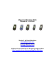
Magellan Meridian FAQ Version 2.0 – 10/31/2003 Version 1 by Kevin Harrelson kevin@harrelson.com Version 2 by Dan Surratt skramblr@hotmail.com Updated info provided by the Meridian group members http://groups.yahoo.
Table of Contents: 1) 2) 3) 4) 5) 6) 7) 8) 9) 10) 11) 12) 13) 14) 15) 16) 17) 18) 19) 20) 21) 22) 23) 24) 25) 26) 27) 28) 29) 30) 31) 32) 33) 34) 35) 36) 37) 38) 39) 40) 41) 42) 43) 44) 45) 46) 47) 48) 49) 50) 51) 52) 53) 54) Introduction Which model for me? Various Models -- What's the Difference? Difference between Magellan SporTrak and Meridian GPS receivers? What does the compass and barometer on the Platinum do? Memory and Maps – The Overview Base Maps -- What's the deal? Where do I find basemaps? Mem
55) 56) 57) 58) 59) 60) 61) 62) 63) 64) Troubleshooting – My Battery Compartment Door does not fit right. Troubleshooting – The contact area on my unit is missing its cover.
1) Introduction This document covers the most commonly asked questions about the Magellan Meridian line of mapping GPS receivers. At the time of the writing of this document, the most current firmware version was 5.12 for the Gold/Platinum/Marine, 4.05 for the Green/Yellow, and 5.12 for the Color. Some sections of this FAQ that discussed problems with firmware previous to 4.02 have been removed. If you have an earlier version, we strongly suggest that you upgrade.
however, is that the SporTrak has no SD card support, which means they are limited to internal memory for storing detailed maps. With a SporTrak, only one detailed map can be uploaded at a time, and it is not possible to save waypoint or track files to an SD card. With a Meridian, you can upload multiple map files to the SD card and change between the files on the unit (handy if you’re going on a long driving vacation and you don’t have a laptop along to reload your GPS.
typically come from the Magellan Support website, Firmware update CDs, or the occasional tech support email response. Standard Base Map – This memory size is 2MB in the yellow/green models and 16MB in all other models. It can hold a standard base map only (no detailed maps). This map comes in North American, European, and Australian version with both standard and marine flavors available. A majority of the road detail is deleted and it has a limited number of points-of-interest (POI).
16MB version has many large roads and river details. The Worldwide basemap shows only a few more roads than the 2MB map, but does have contour lines. 8) Where do I find basemaps? Basemaps were provided by users and stored over on Navicache.com and an FTP server. In the summer of 2003, Magellan made a request that the base maps be removed from those sites. So, there is currently no permanent site for storage of the base maps. Some basemaps appear on Firmware Update CDs or on a Mapsend Software CD.
10) Memory Usage – How much memory is left? When using your unit, eventually you will run into memory limits. You can check the percentage of free space remaining for Maps (SD card space), Routes, Waypoints and Track History. To do this, simply press Menu, then select About. 11) Detailed Maps -- How do I do it? Detailed maps can provide a lot more detail than the built-in base map. The base map is shown when zoomed out, but the data in the detailed map begins to display when the unit is zoomed it.
version is also reported to be coming out for Europe. Note that maps generated with this product are limited to a single GPS serial number. DiscoverAus Streets & Tracks –This recently released software package (summer 2003) replaces the older Australian Mapsend products. The older product had to be purchased for the separate states. This new package is more up to date and covers the entire country.
the file name is eight characters or less, and that the file name still ends with ".img". If you do not see the ".img" ending, then do not worry because your Windows Explorer settings won't let you change the ending. Once you have done this, use the MapSend software to send another map to the card. Then change the name of this new map also. When you are done, you will have two or more maps on the card, each with a different name. Activating Different Basemaps: If you have the version 3.
19) Combining Mapsend Products (Method 1 – Australia Mapsend Streets) The Australia MapSend Streets has separate versions for each state. Users may want to combine data from multiple states into a single directory, so they can create maps that span state lines. This procedure is from a mail posted by hedorr, Modifying MapSend to accept maps from other installations. When installing Mapsend from a CD the program is installed in its own folder. Subsequent installations are installed in separate folders.
21) What other software is available. There are many other programs available that can communicate with the Magellan Meridian. As stated before, none of them will allow detailed maps to be uploaded to the Meridian. However, other programs can provide a surprising amount of functionality. Most software will allow you to transfer tracks, waypoints, and routes between the PC and the Meridian.
little screen to see where it says I am, and then I look out the window of the car to see if we’re really driving in the Pacific Ocean,” which was what one user said when she took her new GPS to Hawaii. First, you have to understand the difference between routes and tracks. Routes A route is a trip you plan, shown by “waypoints” (specific points noted by longitude and latitude) connected by a solid line. There are three basic ways to lay out a route: • Lay out your route on the GPS itself.
When I arrive at the starting point, I clear all the tracks out of the internal memory of the Meridian (Map Screen: Menu>Clear Tracks, or from other screens, Menu>Setup>Clear Memory>Tracks), so that my route will start fresh. I also reset the trip odometer (Position screen>Menu>Reset Trip), so I’ll know how far I’ve traveled. Then I hike or paddle or drive keeping an eye out for the next waypoint. The MeriPlat beeps when I get close to a waypoint (tap Enter to make it stop) and then it’s on to the next.
27) What are all of these secret menus? Magellan built a bunch of secret menus into the GPS. These are supposedly for testing and to try out new functionality. There are two ways to access the hidden menus: § If your Meridian is turned off, hold down GOTO and NAV and tap the PWR button. In a couple of seconds you should see a box pop up with "00" inside of it. At this point, release GOTO and NAV. Use the direction pad to change the "00" to the number of the menu that you want, and then press ENTER.
28) Secret Key Combinations Below is a list of secret key combinations. NOTE: Do NOT use any of these key combinations unless told to do so elsewhere in this document. Some of these may erase the memory of your unit or do other nasty things which will cause your unit to not work. They are included simply to make this FAQ a complete reference. PLEASE PLEASE PLEASE do NOT use the following table unless you know exactly what you are doing.
Save the file and start up Topo or S&D, mark your regions, save to disk and move to the memory card and start up your Magellan Meridian and you should see the new screen just before the "Lawyer" screen. Unlike the “Lawyer” screen modification, this one is simple and does not involve manipulating the firmware. It is 100% safe. Note: You cannot have blank lines or lines filled with spaces. I've had as many as 8 lines. More than that just won't show up on the Magellan's Screen.
MagUp software was designed to prevent this type of upgrading. The MagUp software is available with the latest firmware update package available from the Magellan web site. Setup of the Meridian 1. Connect the Meridian to the PC. 2. Switch the Meridian on to make sure that the battery life indicator is over 50%, modify the baud rate if you want to, and then switch off the Meridian. 3. Press NAV and GOTO simultaneously while switching on the Meridian. 4.
Select no when asked for software upload. In Expert menu: - Select expert mode on - Select Meridian GPS In the file menu: - Select Database file option and then the base map file to upload Select Upload Select "basemap only" Select "upload basemap" Step 5: Reinitialize 34) Base Map Backup Here are the instructions on how to back up the base map in your Gold/Marine/Platinum/Color. This has been tested with v3.08 and v4.02 firmware. Note that it is not possible to backup the base map in a Green or Yellow.
Check 'Echo typed characters locally' Set both delays to 0 milliseconds Check 'Append line feeds to incoming line ends' Uncheck 'Force incoming data to 7-bit ASCII' Check 'Wrap lines that exceed terminal width' Click OK twice to close the two windows 7. Now connect to the Meridian (click on the Call icon) and type the following line into the window $PMGNCMD,FIL,FIRST,*6B 8. The unit will then respond with the name of the first file. This is usually the base map. On a Meridian with v4.
Step 2 - More data collection Go to the start of another trail you want to include on your map. Display the map screen and clear the track. Travel along the trail. Save the track giving it a different file name. Step 3 - Edit the data you collected to make the map The 2 track files you created on your memory card are DOS text files. In this step you will combine those two files into one file to begin making your map.
Repeat step 3 to add this new trail segment onto your map. Have fun with this and be sure to let the rest of us know if you figure out any improvements/enhancements to this technique. 36) Change the Meridian icons. Do you wish you had geocaching icons? Maybe you don’t have a use for wineries and would like to make a symbol for your favorite brew pub? There is a utility to change the icons stored in the Meridian. In the files section of the Meridian group is a utility called Meridicon.
down. Tip - do not name these waypoints SIM001, SIM002, etc Step 2 Use these newly created waypoints to build a route. This must be done as route #20. Menu>Routes>up-arrow will get you to route #20. First delete any route currently in route #20. Begin your route with the waypoint you took at the present cursor or hourglass location. Add your other waypoints to the route and then save the route. Step 3 Start the simulation. Menu-Setup-Simulate-Auto Your waypoints and route should appear on the screen.
3. Use the standard Magellan software (MagUp) for uploading firmware fixes. Select Expert Upload (press no to the default question to upload firmware), select Meridian as your GPS unit and the port the GPS is connected to. Press save. 4. Choose Expert Upload and select Upload firmware and basemap. For basemap select the chart you have previously prepared with the WWBaseMap CD. 5. First, the program uploads the firmware. When this is done the GPS shuts down.
43) Troubleshooting -- MyMeridian reports “Bad Data” The MyMeridian program is used to personalize the layer screen. When attempting to use it with v4.06 users are greeted with a “Bad Data” message. There is a work around for this. Open the MyMmeridian.ini file, find the line that reads ‘English=All data’ and replace it with ‘English=All data is’. The program should now work normally. Other fixes offered by reitgruppe: The following needs to be corrected in the MyMeridian.
Copying Files to an SD Card Reader Manually from MapSend 1. Without connecting your Meridian to a PC create your regions and begin the map download process. 2. When the map compilation part of the download process is done, MapSend will display a message that it cannot find your GPS receiver to perform the download. 3. Stop the process here by selecting "Cancel". 4. Using Windows Explorer, go to Program Files/Magellan/MapSend/Export and locate the file called "maps.img". 5.
52) Troubleshooting – Screen Spots Some users have reported that the backlight on their Meridian began to develop dark discolored spots. These spots are only visible when the backlight is turned on. Magellan has apparently fixed the problem that caused this to happen with new units, and has promised to fix the problem under warranty for existing units (even if the unit is no longer under warranty). Contact Magellan if this happens, and arrange for the problem to be fixed.
no. Unfortunately, the Mapsend software was written before the ability to save to the SD card was available. The Meridian stores files on the SD card in text format, while Mapsend stores its files in a binary format. There is a way to convert these files. The tool is called GPSbabel and is available from http://gpsbabel.sourceforge.net/ By using that tool, you can quickly copy files between the PC and SD card (using a reader) and convert them.
62) Troubleshooting -- 128MB and larger SD Cards Due to a bug in the 3.08 firmware, serial downloads cannot be done to a 128MB SD card. It is unknown is this problem still exists in the 3.12 firmware and above. If you have version 3.08 and a card this size, then you must use a SD card writer. The MapSend Streets & Destinations product has a bug when using a 128MB card in a SD card writer. The current workaround is to follow the same instructions as for using older MapSend products with a SD card writer.
64) Credits & Thanks Some parts of this document were based on data and assistance provided by the following people. If you feel that you should be included in this "Credits" section, please e-mail me. Members can be found at the Magellan Meridian Yahoo Group. bradleymsuter ClayJar Daniel de Wildt edmaurer2002 Fred Merchant geo_alexm georockers gmcaddon hedoor hedorr Jacek M.