
Operation Manual


X
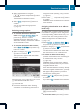
Select Standard Symbols, Personal
Symbols or No Symbols.
If you select Personal Symbols, the list of
points of interest appears.
X
To switchthe icon display on/off: select
the point of interest using the 9:
buttons and press the 9 button to confirm.
Depending on the previous setting, the
icons will be switched on O or off ª.You
can switch on the icon displays for more
than one point of interest.
i
The list shows all icons that are contained
on the digital map across all countries.
However, not all points of interest are
available in all countries. As a result, certain
point of interest icons may not be displayed
on the map, even if the icon display is
switched on.
X
To exit the menu: press the =
or ; button.
Map information in the display
Displaying map information
During route guidance, you can have map
information displayed at the bottom edge of
the display.
X
To show the menu: press the 9 button.
X
Select Navi in the main menu bar using the
9=; buttons and press the 9
button to confirm.
X
Select Information On Map and press the
9 button to confirm.
The ä icon indicates the current setting.
X
Select Arrival Time / Distance,
Current Street, Geo-coordinates or
None and press the 9 button to confirm.
X
To exit the menu: press the =
or ; button.
Arrival time/distance to the destination
Arrival time/distance display switched on
:
Icon for destination
;
Distance to the destination
=
Icon for estimated time of arrival
?
Estimated time of arrival
You can only see this display during route
guidance. When scrolling the map
(Y page 82), you will see data, e.g. road
names, depending on the crosshair position
if the digital map supports this data.
i
During route calculation, or if the vehicle
is traveling on a non-digitized road, the
linear distance to the destination is shown.
In this case, the display will be grayed out.
Road display
Road display active
:
Road name or designation
84
Map operation and settings
Navigation