
Operation Manual

58
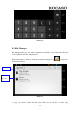
7 GPS Function
7.1 GPS Navigation
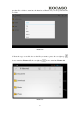
1. Map of the third parties is required for TABLET internal GPS satellite signal
receiver positioning, after installation the device can accurately implement traffic
real-time navigation, meet the needs of outdoor navigation.
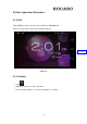
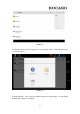
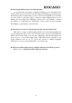
2. Enter into setting interface, click icon, enter into below picture 7.1
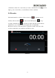
Picture 7.1
When positioning successfully, the blue parts will turn to green color, and it shows the
latitude, longitude, height, speed, and the time of your location.
The value indicates the signal strength, the positioning time is relavant to time zone in
your setting, if the time is not inconsistent with real time in your location, please
check the time zone in your setting is correct or not.