User’s manual MobileNavigator 6 Version August 2006
Imprint NAVIGON AG Schottmüllerstraße 20A D-20251 Hamburg The information contained herein may be changed at any time without prior notification. This manual nor any parts thereof may not be reproduced for any purpose whatsoever without the express written consent of NAVIGON AG, nor transmitted in any form either electronically or mechanically, including photocopying and recording. All technical specifications, drawings etc are subject to copyright law. © Copyright 2006, NAVIGON AG All rights reserved.
User’s manual MobileNavigator 6 Table of contents 1 Introduction 3 1.1 About this manual 3 1.1.1 Conventions 3 1.1.2 Symbols 3 1.2 Legal notice 2 3 Liability 3 1.2.2 Trademarks 4 1.3 Support 4 Before you begin 7 2.1 Software Installation 7 2.2 Navigation with GPS 7 2.3 Important safety information 8 2.3.1 Navigation safety information 8 2.3.2 Safety information on the installation in the vehicle 8 Operating the navigation software 9 3.1 Volume 9 3.2 Information 9 3.
User’s manual MobileNavigator 6 5 6 4.3.1 Last destinations 19 4.3.2 Favourites 20 4.4 Navigation homewards 20 4.5 Determine the destination on the map 21 4.6 Starting navigation 21 Destination management 22 5.1.1 Saving a destination 22 5.1.2 Define destination as home address 23 Routes with various stages 6.1 Itinerary 23 23 6.1.1 Enter the starting point 23 6.1.2 Enter route stages 24 6.1.3 Edit route stages 25 6.2 Managing routes 25 6.2.1 Save route 25 6.2.
User’s manual MobileNavigator 6 1 Introduction 1.1 About this manual 1.1.1 Conventions For better legibility and clarification, the following styles are used in this manual: Bold and italics: Registered names, company and product descriptions. SMALL CAPITALS: Window and dialogue box titles. Bold: Highlighting important parts in the text. Underlined: Descriptions of buttons, input fields and other elements in the user interface. 1.1.
User’s manual MobileNavigator 6 1.2.2 Trademarks All brands and trademarks mentioned in this document are possibly registered by third parties and are subject to the current legislation and to the rights of their respective owners without reservation. All mentioned names of products, societies, or brands may be registered trademarks of their respective owners. Every right that is not explicitly accorded is reserved.
User’s manual MobileNavigator 6 Denmark Telephone: 901-31033 Service times: Monday to Friday from 8 to 20 hrs MEZ Costs: 3.00 DKK/min. Finland Telephone: 0600-413414 Service times: Monday to Friday from 8 to 20 hrs MEZ Costs: 0.50 €/min. France Telephone: 0891-650065 Service times: Monday to Saturday from 8 to 20 hrs MEZ Costs: 0.225 €/min. Great Britain Telephone: 0905-8480701 Service times: Monday to Friday from 8 to 20 hrs MEZ Costs: 0.25 GBP/min.
User’s manual MobileNavigator 6 Sweden Telephone: 0900-1001110 Service times: Monday to Friday from 8 to 20 hrs MEZ Costs: 4.00 SEK/min. Switzerland Telephone: 0848-662544 Service times: Monday to Friday Costs: 08 - 17 hrs: 0.11 17 - 22 hrs: 0.09 22 - 08 hrs: 0.06 from 8 to 20 hrs MEZ CHF/min. CHF/min. CHF/min. Spain Telephone: 807-001205 Service times: Monday to Friday from 8 to 20 hrs MEZ Costs: 08 - 20 hrs: 0.356 €/min. + 0.104 €/ per call 20 - 08 hrs: 0.288 €/min. + 0.
User’s manual MobileNavigator 6 2 Before you begin 2.1 Software Installation 1. Insert the memory card into your device. Note: The memory card must remain in the device during operation of the navigation system. 2. Slide the main switch on the under side of the device to the ON position. The installation will now be carried out. 2.2 Navigation with GPS GPS is based on a total of 24 satellites that circle the earth and, in doing so, are constantly transmitting their position and the current time.
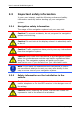
User’s manual MobileNavigator 6 2.3 Important safety information In your own interest, read the following notices and safety information carefully before starting up your navigation system. 2.3.1 Navigation safety information The usage of the navigation system is at your own risk. Caution! To prevent accidents, do not program the navigation system while driving.
User’s manual MobileNavigator 6 3 Operating the navigation software 3.1 Volume The volume of the spoken driving instructions from MobileNavigator 6 can be adjusted during the navigation. You have started a navigation. The map is in Navigation or Destination search mode. 1. Tap the button Volume. The volume bar opens. It contains three buttons for adjusting the volume. Louder, Quieter, 2. Tap the Volume Sound on/off. button again. The volume bar closes. 3.
User’s manual MobileNavigator 6 Energy The Energy symbol can display the following states of the built—in battery: The device is being supplied by an external power source. The battery is being charged. The device is being supplied by its internal battery. The battery charge is sufficient. The device is being supplied by its internal battery. The battery charge is low. Direction The Direction symbol shows you in which direction you are currently moving.
User’s manual MobileNavigator 6 searching for “Würzburg”, then simply enter "WURZBURG". You need not enter special characters when entering a destination's town or street name but they may be helpful for entering names for saved destinations and itineraries. Special keys Enters a space character. deletes the character to the left of the cursor. opens the numeric keypad. opens the character keyboard. opens the special character keyboard.
User’s manual MobileNavigator 6 For detailed information on the options, please refer to the Options chapter on page 28. 3.6 Menus Some buttons have menus which open when activated. Tap on a menu button to select its function. If you would like to quit the options list without selecting an option, tap on the button which you used to open the menu. 4 Navigation Use navigation system at your own risk.
User’s manual MobileNavigator 6 4.1 Start MobileNavigator 6 1. Switch the navigation device on. 2. Tap on the navigation software symbol. Each time you start the navigation software , the following message will appear: Please note that the road traffic regulations are prior to the instructions of the navigation system. Please do not operate the device while driving. 3. After you have read and fully understood the text, tap on the button OK. 4.
User’s manual MobileNavigator 6 Opening the Main window The MAIN WINDOW opens when the navigation software starts. If another window is open, tap the previous window will open. Tap repeatedly on the opens. (Back) button. The (Back) button until the MAIN WINDOW 4.2 Specifying a new destination New destinations for MobileNavigator 6 are all destinations that you have not yet navigated, or you have not yet stored.
User’s manual MobileNavigator 6 4.2.2 Address of destination 1. In the MAIN WINDOW, tap on New destination > Enter an address. The ADDRESS window opens. 2. Enter the name of the town or the postcode. 3. Enter the name of the street. You can also enter the name of a well-known building, e.g. "Olympic stadium" or "Eiffel tower". 4. Enter the number of the house. If you don't know the number of the house, or you specified an object in the preceding step, then leave the field empty.
User’s manual MobileNavigator 6 Special destinations nearby Special destinations nearby are special destinations that are located within a particular radius of your current location.. This means you can always find, for example, the nearest petrol station, no matter where you are. Note: The GPS-reception must be sufficient for position determination. You can see if GPS-reception is sufficient by (GPS ready) symbol. For further looking at the information, please refer to chapter "GPS status" on page 37.
User’s manual MobileNavigator 6 Nationwide Points of Interest Nationwide Points of Interest are airports, places of interest, national monuments, large ports etc. This enables you to find places of interest without having to know the name of the location.This enables you to find places of interest without having to know the name of the location. 1. In the MAIN WINDOW, tap on New destination > Search for POI > nationwide. The POI OF NATIONAL SIGNIFICANCE window opens. 2.
User’s manual MobileNavigator 6 5. Tap on the name of the destination. 6. Tap on the Start navigation button. The map screen opens in Preview mode. For detailed information on how to start the navigation system, please refer to chapter "Starting navigation" on page 21. 4.2.4 Information about the destination For many destinations that you specify, there will be further information available stored in the navigation system's database.
User’s manual MobileNavigator 6 Note: The GPS reception must be sufficient for position determination. You can see if GPS-reception is sufficient by (GPS ready) symbol. For detailed looking at the information, please refer to chapter "GPS status" on page 37. 1. In the MAIN WINDOW, tap the New destination button. The NEW DESTINATION menu opens. The symbols of the categories which have been selected for quick access can be seen in the menu at the bottom. 2.
User’s manual MobileNavigator 6 For detailed information on how to start the navigation system, please refer to chapter "Starting navigation" page 21. 4.3.2 Favourites Preferred destinations can be saved in the FAVOURITES list. In the FAVOURITES list, up to 300 destinations can be saved. Information on how to store a destination can be found in the "Saving a destination" chapter on page 22. 1. In the MAIN WINDOW, tap on My destinations > Favourites. 2.
User’s manual MobileNavigator 6 4.5 Determine the destination on the map You may indicate a destination directly on the map. In addition to towns and streets, you may also select special destinations quickly. 1. In the MAIN WINDOW, tap on Options > Show Map. The map screen opens in Destination search mode. 2. Tap the destination to which you would like to navigate.
User’s manual MobileNavigator 6 Note: If you change the route options, any changes made also remain valid for subsequent navigations. You can get information regarding the individual route profile (Help) button. settings by clicking on the corresponding 5. Tap the Start navigation button or just start driving. No GPS reception When the received GPS signal is not sufficient, the following message appears: "No GPS signal available at present.
User’s manual MobileNavigator 6 4. If you want to define the destination as your home address, tap on the button value is highlighted in black. (Toggle), so that the Yes 5. Tap Save. 5.1.2 Define destination as home address You can define precisely one destination from the FAVOURITES list as your home address. You can then begin navigation to this destination very quickly by tapping the Take me home button in the MAIN WINDOW. 1.
User’s manual MobileNavigator 6 The starting point is only important if you want to see a planned route on the map, but currently have no GPS reception or you are not currently at the planned starting point. The starting point that you enter therefore has the flow number "0". As soon as you begin a navigation, your current location will be used as the basis for the route calculation. The first stage is therefore the trip to the route stage with the flow number "1". 1.
User’s manual MobileNavigator 6 The selected route stage will now be shown next to its flow number. Repeat this step for each additional destination that you want to add to your route. 6.1.3 Edit route stages Route stages can be deleted from a route. The order of the route stages can be varied as you wish. Note: The start point (flow number "0") can neither be moved or deleted. ▶ Tap on the route stage that you want to edit.
User’s manual MobileNavigator 6 3. Tap Save. The destination is now entered into the SAVED ROUTES list. The dialog window closes. 6.2.2 Load route 1. Tap Options > Saved routes. 2. Tap the route that you want to load. 3. Tap the Load route button. The ROUTE PLANNING window opens. The starting point and the route stages of the loaded route are entered. 6.3 Navigation The system first has to calculate the route. Afterwards, you can begin the navigation or just simulate it. 6.3.
User’s manual MobileNavigator 6 End simulation You may stop a simulation at any moment. 1. Tap the (Back) button. A dialog box will prompt you to confirm the navigation cancel. Afterwards, the MAIN WINDOW opens. 6.3.3 Starting navigation You have calculated and displayed a route. The calculation of a route is based on so called route options. 1. If you want to view or change these options, click on the Route profile button.
User’s manual MobileNavigator 6 7 Options Some windows have options which lead to further functions. ▶ Tap on the Options button to open the options list. ▶ Tap on the options you would like to implement. ▶ If you would like to quit the options list without selecting an option, tap on the Options button again. Delete all Deletes all destinations from the LAST DESTINATIONS list. The list is then empty. A dialog box prompts you to confirm.
User’s manual MobileNavigator 6 Calibration Opens a window in which you can re-calibrate the touchscreen (re-align), should it become imprecise to the touch. Show Map The map screen opens in Destination search mode. Here you can determine your navigation destination directly on the map. For detailed information, please refer to Determine the destination on the map chapter page 21. Delete Deletes the selected destination from the FAVOURITES list. A dialog box prompts you to confirm.
User’s manual MobileNavigator 6 Simulation Simulates a navigation based on the displayed route. This simulation can be undertaken without GPS reception. However, simulation is restricted to routes of 60 mi max. Traffic Opens the TRAFFIC INFORMATION window, in which pending reports can be listed. For detailed information, please refer to chapter TMC (Traffic information) on page 38. Rename Opens a window in which you can change the name for the selected destination or route.
User’s manual MobileNavigator 6 8.2 Map in Preview mode You have entered a destination and tapped on the Start navigation button. - OR – You have planed or loaded a route and tapped the Show route button. The map screen opens in Preview mode. You can see the entire route. 1 The destination is marked with a little flag. When you have planned or loaded a route and displayed it, the starting points and each route stage will be marked with a little flag. 2 3 The route is marked in orange.
User’s manual MobileNavigator 6 If you display a route with various stages, you will see this information for each stage. ▶ Tap the Route profile button, in order to view or change the profile on which the route calculation is based. ▶ Tap on the Start navigation button in order to begin the trip. When you display a planned or loaded route, the route may be re-calculated. Your current location will be integrated into the calculation.
User’s manual MobileNavigator 6 3 4 If two manoeuvres need to be executed quickly one after the other, the small arrow field indicates the manoeuvre to be executed immediately after the next manoeuvre. The large arrow field shows a diagram of the next junction which you should turn on to. Underneath is the distance to the next junction. When you approach the junction, you will see a spot diagram instead of the distance. The nearer you are to the junction, the fewer yellow spots are displayed.
User’s manual MobileNavigator 6 11 12 The name of the route section that you need to drive onto next is shown in the upper street field. The name of the street you are currently driving on is shown in the lower street field. Note: The displays for many of the above mentioned areas can be configured via Options > Settings > Basic settings. A number of displays only work when the corresponding information is available on the map.
User’s manual MobileNavigator 6 Tap on this button once, in order to remove the block. POI on your route: Tap this button to display the special destinations on your route. This enables you to find out, for example, how long you need or how far it is to the nearest services. You can also add a destination shown here as a way point by tapping (Interim destination) to the right, next to its entry in the list. 8.
User’s manual MobileNavigator 6 Draw the map section from upper left to bottom right. and it will then zoom to fit the screen size. Draw the map section from bottom right to top left, and the map will zoom out. Pan mode: When this button is active, you can change the map section with the pen or with your finger. Simply push the map in the desired direction. Entire route: Zooms the map so that the entire route is visible.
User’s manual MobileNavigator 6 Save: Opens the SAVE DESTINATION AS... window. You can enter a name, under which the selected point will be stored in the FAVOURITES list. For detailed information, please refer to chapter "Saving a destination" on page 22. Neighbourhood search: Opens the POI NEARBY.window. Here you can search for destinations near the selected point. See "Special destinations nearby", on page 16). Tap (Destination search), in order to quit Destination search mode.
User’s manual MobileNavigator 6 9.2 TMC (Traffic information) If your device has an integrated TMC receiver, or if you have connected an external TMC receiver, the navigation system will have the latest traffic information available. If required, it can dynamically change your route, e.g. avoid a traffic jam. The current valid traffic reports are available via the options of many windows. 1. Tap Options > Traffic. The TRAFFIC INFORMATION window opens.
User’s manual MobileNavigator 6 ▶ Hold Station: Use the arrow keys of the Station section to receive another station. The system will search for the same sender on a different frequency if the signal becomes poor. ▶ Hold Frequency: Use the arrow keys of the Station section to receive another station. The system will not search for another sender if the reception becomes poor. Recalculate Route Tap on Recalculate Route to determine how new messages concerning your route should be dealt with.
User’s manual MobileNavigator 6 ▶ Some settings can accept many different values. These settings are recognisable by means of the button. The current valid value is visible. Tap the (List) (List) button. A list with all possible values opens up. The current valid value is marked. Tap on the desired value. It will now be marked. Tap on the OK button. The list closes again. The new value will be displayed. ▶ For each setting is a (Help) button.
User’s manual MobileNavigator 6 11 Index C Calibration............................ 28 Conventions followed in this manual ..................................3 Current position Save ................................ 37 Signals ............................... 7 GPS ....................................... 7 GPS status ........................... 37 H Home address....................... 20 Hotline ................................... 4 D K Data entry ............................
User’s manual MobileNavigator 6 P POI Direct Access..................... 18 in a city ............................ 17 nationwide ........................ 17 nearby.............................. 16 POI...................................... 15 Product info .......................... 29 R Recalculate Route .................. 39 Route planning...................... 23 Route points Delete .............................. 25 Indicate ............................ 24 Order ...............................