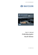
User's manual MobileNavigator User's manual MobileNavigator BLUE Edition as on October 2004
Impressum NAVIGON GmbH Berliner Platz 11 D-97080 Würzburg Hotline (dtms-Service, 0,12 €/min): +49 180-5-NAVIGON (+49 180-5-6284466) The information contained herein may be changed at any time without prior notification. This manual nor any parts thereof may not be reproduced for any purpose whatsoever without the express written consent of NAVIGON GmbH, nor transmitted in any form either electronically or mechanically, including photocopying and recording.
User's manual BLUE Edition Table of contents 1 2 3 4 User's manual Introduction................................................................ 3 1.1 Important safety information ............................................. 4 1.1.1 Safety information on navigation ............................. 4 1.1.2 Safety information on the GPS receiver .................... 5 1.1.3 Safety information on the installation in the vehicle................................................................. 5 1.
User's manual BLUE Edition 5 Appendix................................................................... 65 5.1 Configuration of MobileNavigator...................................... 66 5.1.1 Map information .................................................. 66 5.1.2 Route information................................................ 67 5.1.3 Volume .............................................................. 67 5.1.4 Representation.................................................... 68 5.1.
User's manual BLUE Edition 1 Introduction Topics covered in this chapter: 1.1 Important safety information page 4 Safety information on navigation Safety information on the GPS receiver Safety information on the installation in the vehicle 1.2 Search facilities and conventions page 6 1.3 Liability page 6 Support 1.
User's manual BLUE Edition 1.1 Important safety information Note 1.1.1 In your own interest, read the following notices and safety information carefully before starting up your navigation system. Safety information on navigation The use of MobileNavigator may only be effected at your own risk.
User's manual BLUE Edition 1.1.2 Safety information on the GPS receiver Attention: As it is not waterproof, don’t expose your GPS receiver to water! Attention: Do not install the cable next to security relevant equipment and supply lines. Attention: Please check the security relevant equipment when you have installed the navigation system. Attention: The GPS receiver should be disconnected from the power supply while your car is parking.
User's manual BLUE Edition 1.2 Search facilities and conventions Find information quickly This manual offers the following search facilities: In the footnote at the bottom of the page, you may check which chapter and which section you are actually reading. A glossary at the end of the manual contains explanations on the technical terms used in this manual. An index at the end of the manual allows precise search for the information contained in this manual.
User's manual BLUE Edition 1.3.1 Support You need help? Call our support staff for Telephone support: Mondays to Fridays 9am to 6pm +49 180-5-NAVIGON (0180-5-6284466) (dtms-Service, 0,12 €/min) Or call our Fax support: +49 180-5-6284444 (dtms-Service, 0,12 €/min) Further information may also be found on the web site of NAVIGON GmbH (www.navigon.com) in the Support section. 1.
User's manual BLUE Edition 2 Installation and quick-start guide Topics covered in this chapter: 2.1 Operating mode of your navigation system page 10 2.
User's manual BLUE Edition 2.1 Operating mode of your navigation system MobileNavigator The time of complicated and frustrating inquiries on the right way in folded maps is over. From now on MobileNavigator, your navigation system, will guide you, based on satellite information, quickly and safely to your destination. GPS-based navigation Based on satellites the Global Positioning System (GPS) determines your current geographical position.
User's manual BLUE Edition 2.2 2.2.1 Installation of the navigation system Inserting the memory card into the device Insert the memory card into the device… Before using MobileNavigator you must insert the memory card containing the cartographic data into the device. 1. Unpack the memory card carefully. Pay attention not to touch contacts and not to make them dirty. as shown below (label up, cut 2. Hold the memory card corner bottom right). Insert the memory card into the at the left of the device.
User's manual BLUE Edition code. Notice: Depending on the battery charging state, it may happen that you have to charge the device for a while before the installation may be executed. 2.2.3 Software registration and activation Activation code At the first start of MobileNavigator you will be prompted to enter an activation code. You cannot start the software without entering this code.
User's manual BLUE Edition 1. Tap the button. The ACTIVATION CODE screen opens: 2. Enter the activation code into the respective entry field. 3. Tap the OK button. Notice: Keep the activation code at a safe place. You might need it later, e.g. when you reinstall the software on your Pocket PC.
User's manual BLUE Edition 2.2.4 Installation in the vehicle Attention: The mounted holder must not impede the driver’s attention on the traffic. If this is not possible, mount the holder somewhere else so that safe driving is granted. Mounting the holder... 1. Attach the cradle of the device to the swan-neck mount. Notice: Take notice of the inscription on the swan-neck mount. The arrow with the inscription close must show in snap-on direction. The connection must snap on audibly. 2.
User's manual BLUE Edition 2.2.5 Fitting MobileNavigator on your bike Mount the fitting... 1. Connect the clamp and the mounting plate . Pull the clamp round the handle bar as represented above (opening up, plate towards the driver). Do not forget to put the rubber which is included in the delivery between the handle band bar and the clamp. The clamp is flexible, so you can open it carefully, place it round the handle bar and close it. onto the mounting plate . 2.
User's manual BLUE Edition 2.2.6 Starting navigation Use your navigation system… 1. Turn on your MobileNavigator. At the first start of MobileNavigator, the following message appears: 2. Tap the I accept button. If you do not accept and if you tap the I refuse button, the device turns off. 3. The MAIN SCREEN appears. 4. Tap the One destination button to enter your destination.
User's manual BLUE Edition 5. Tap the Address button. The ADDRESS screen opens: 6. Enter the name of the destination town into the Town field. 7. Enter the name of the destination street into the Street field. Enter the house number if possible. 8. Tap the Start navigation button. For details on the functions of your navigation system, please refer to “Operating the navigation software”, page 19, and to “Navigation and Itinerary planning”, page 53.
User's manual BLUE Edition 3 Operating the navigation software Topics covered in this chapter: 3.1 Starting MobileNavigator page 20 Basic settings 3.2 User interface and basic functionality page 25 Icons 3.3 Indicating destinations page 29 Entering a destination manually Selecting a special destination Indicating destinations on the map Saved destinations Recent destinations Save and use your home address 3.
User's manual BLUE Edition 3.1 Starting MobileNavigator Precondition You have carried out installation and activation of MobileNavigator as described in “Installation of the navigation system”, page 11. Starting the navigation software… 1. Turn MobileNavigator on. The MAIN SCREEN opens: Main screen All functions of the program are accessible via the MAIN SCREEN. Notice: When you turn MobileNavigator on, it shows the screen, which was displayed when MobileNavigator was turned off.
User's manual BLUE Edition For details, please refer to “Navigating to several destinations (Itinerary planning)”, page 57. Show map Tap this button to display the map currently in use. Select map Tap this button to select another map, which is stored on your device. For details, please refer to “Working with the map”, page 44. Settings Tap this button to modify the settings of MobileNavigator. For details, please refer to “Configuration of MobileNavigator”, page 66. Quit 3.1.
User's manual BLUE Edition 3. Tap into the Time zone entry filed. The SELECT THE TIME ZONE screen opens. 4. Select the time zone of the region you are currently staying in.(GMT without daylight saving time). The indication of capitals lying in the respective time zones makes the selection easier. 5. Tap Ok. 6. If there is currently daylight saving time, tap the Daylight saving time entry field. The entry switches to Yes.
User's manual BLUE Edition 2. Via the arrow buttons, select the HOME ADDRESS screen. 3. Tap Enter your home address. The DESTINATION screen opens. 4. Tap the Address button and enter your home address as described in “Entering a destination manually”, page 30. 5. Tap the Set as home address button. The address is indicated on the HOME ADDRESS screen.
User's manual BLUE Edition 6. Tap Save.
User's manual BLUE Edition 3.2 User interface and basic functionality Operation In order to offer a maximum of flexibility and convenience for the operation of MobileNavigator there is three ways to make entries: tapping with the stylus, tapping with your finger, or via the hardware keys of your Pocket PC. 3.2.1 Icons Icons The following buttons appear at the right of every MobileNavigator screen: Return Tap this icon to return to the previous screen. This icon is not available on the MAIN SCREEN.
User's manual BLUE Edition GPS The colour of this icon and the number displayed on it have the following significance: Colour/Number Significance red A GPS receiver is not connected or the power supply is interrupted. orange + number of received satellites A GPS receiver is connected, but the received signals are not convenient for navigation purposes (e.g. because you are in a closed building). green + number of received satellites The signals are convenient. Navigation may begin.
User's manual BLUE Edition Entry Significance Position Indicates the address of your current position. Save Tap this button to add the current address to the saved destinations list. Quit Tap this button to quit the GPS screen. Switching the GPS-receiver on / off The GPS-receiver consumes energy. This is of significance when the system is operated in battery mode, e.g. when you are on your way on foot or by bike. Switch therefore the GPS-receiver off when you don’t need it for a certain time. 1.
User's manual BLUE Edition Zoom out Works only in map view mode. Zoom in Works only in map view mode.
User's manual BLUE Edition 3.3 Indicating destinations Basic principle of navigation The indication of destinations is the basis of navigation respectively of itinerary planning. In this chapter, you will learn about the possibilities to indicate and manage destinations in MobileNavigator. For details on destination management, please refer to “Navigation and Itinerary planning”, page 53.
User's manual BLUE Edition 3.3.1 Entering a destination manually Database of places The data of all places covered by the currently loaded map is stored in the database of places. You need not enter the complete names of towns and streets as MobileNavigator lists automatically all names that match with your entry. If you enter for example "bab" into the Town entry field you will obtain a list of all towns beginning or having into their names "bab" or "bab".
User's manual BLUE Edition Special characters When you tap a key, a line above the software keyboard appears which lists all characters that may be entered by this key. The active character is highlighted. If you want to type "ö", tap the "mno" key repeatedly until "ö" is highlighted in the line above the software keyboard. Indicating a destination… 1. On the main screen tap One destination. The DESTINATION screen opens. 2. Tap the Country entry field and select the destination country. 3.
User's manual BLUE Edition 3.3.2 Selecting a special destination Special destinations Special destinations, also known as POIs (Points of Interest), are stored in the database of places and may be displayed on the map. Ports, airports, restaurants, hotels, petrol stations, public buildings, and others belong to the special destinations. Indicate a special destination by selecting one on the map, see “Indicating destinations on the map”, page 36, nearby, of supraregional interest, or in another town.
User's manual BLUE Edition Special destinations nearby Notice: You may only display special destinations nearby when the GPS receiver is turned on and when the GPS signal strength is sufficient. Selecting a special destination nearby... 2. On the SPECIAL DESTINATIONS screen, tap the Nearby button. The SPECIAL DESTINATIONS NEARBY screen opens: 3. Enter the radius around your current position within which you want to search for special destinations into the Radius entry field. 4.
User's manual BLUE Edition 7. Tap the Save button if you want to navigate more often to the entered destination. You may then quickly select it from the Saved destinations list. Special destinations of superregional significance Selecting a special destination of superregional significance... 2. On the SPECIAL DESTINATIONS screen, tap the Of superregional significance button. The SPECIAL DESTINATIONS OF SUPERREGIONAL SIGNIFICANCE screen opens: 3.
User's manual BLUE Edition Special destination in another town Selecting a special destination in another town... 2. On the SPECIAL DESTINATIONS screen, tap the In another town button. The SPECIAL DESTINATIONS IN ANOTHER TOWN screen opens: 3. Enter the name of the town in which you want to search for special destinations into the Town field. 4. Select the main category of special destinations to search for from the left one of the two Category list fields, e.g. “Nightlife”.
User's manual BLUE Edition 3.3.3 Indicating destinations on the map You may indicate a destination directly on the map. In addition to towns and streets, you may also select special destinations quickly.. Indicating a destination on the map... 1. On the main screen tap One destination. The DESTINATION screen opens. 2. Tap the Indicate on map button. The MAP screen opens: 3. Tap on the place you want to determine as destination and hold.
User's manual BLUE Edition Database information on the respective place will be loaded and displayed: 4. Tap the Task field. The TASK screen opens where you may indicate how to proceed: 5. Select Start navigation from the list to navigate to the respective place. Tap the Save button if you want to navigate more often to the entered destination. You may then quickly select it from the Saved destinations list. The TASK screen closes and the task is indicated on a new screen. 6. Tap the Execute button.
User's manual BLUE Edition 3.3.4 Saved destinations Saved destinations All destinations you have saved by tapping the Save button are listed on the SAVED DESTINATIONS screen. . On this screen you may: select destinations for navigation purposes, rename destinations, and delete destinations from the list. 1. On the DESTINATION screen tap Saved destinations. The SAVED DESTINATIONS screen opens. Take over 2. Tap the entry of the respective destination.
User's manual BLUE Edition Renaming a destination 1. Tap the Saved destinations button. 2. Tap the entry of the destination to be renamed. 3. Tap the Rename icon. The SAVE AS… dialog box opens. 4. Enter the new name. 5. Tap OK. The destination is now renamed. Deleting a destination 1. Tap the Saved destinations button. 2. Tap the entry of the destination to be deleted. 3. Tap the Delete icon. The destination is now deleted. 3.3.
User's manual BLUE Edition Taking over 1. On the DESTINATION screen tap the Recent destinations button. The RECENT DESTINATIONS screen opens. 2. Tap the entry of the desired destination. Notice: The list may be scrolled via the “up” and “down” icons. You may as well enter the first letter of the town of the desired destination. The list will then automatically scroll to the first destination matching your entry. 3. Tap OK. The destination will be taken over.
User's manual BLUE Edition Renaming a destination 1. Tap the Recent destinations button. 2. Tap the entry of the destination you want to save. 3. Tap the Save icon. The NAME OF THE DESTINATION dialog box opens. 4. Enter a name for the destination. 5. Tap OK. The destination is now saved and will appear on the SAVED DESTINATIONS list. Deleting a destination 1. Tap the Recent destinations button. 2. Tap the entry of the destination to be deleted. 3. Tap the Delete icon. The destination is now deleted.
User's manual BLUE Edition 3.3.6 Save and use your home address Survey You may store your home address in MobileNavigator in order to quickly start navigation home at any place. Saving your home address… 1. On the Main screen, tap the Settings button The SETTINGS screen opens. 2. Via the "Left" and "Right" icons, select Home address. 3. Tap the Enter your home address button. The DESTINATION screen opens.
User's manual BLUE Edition 4. Tap the Address button and enter your address as described in “Entering a destination manually”, page 30. 5. Tap the Set as home address button. The address is taken over to the HOME ADDRESS screen. 6. Tap the Save button. Using your home address for navigation... 1. On the main screen, tap . The route is now being calculated and navigation starts. The route options you have chosen for the last navigation are applied.
User's manual BLUE Edition 3.4 Working with the map Survey There are various pieces of information available on the MAP screen. Learn in this chapter about the possibilities for working with the map, which depend on whether you are in navigation mode, or not. Displaying the map On the main screen, tap the Show map button to open the MAP screen. Using the delivered maps There are two CDs (CD-ROM2 und CD-ROM3) with additional maps included in the delivery.
User's manual BLUE Edition 3.4.1 Operating the map Displaying the map You may display the map while planning an itinerary, in order to show destinations on the map, or in order to select destinations on the map. You may display the map via the Show map button on the main screen or via the Show on map and Select on map buttons which are available when you indicate a destination. On the DESTINATION screen you may tap the SELECT ON MAP button to display the map.
User's manual BLUE Edition Icons The following icons are displayed on the map: Zoom / Scroll Tap the Zoom/Scroll icon ( or ) to switch between Zoom and Scroll mode. Zoom In Zoom mode (the icon appears white) you may scale the map up or down. Zoom in by drawing a rectangle on the map, beginning with the upper left corner. Zoom out by beginning with the lower right corner. Scrolling In Scroll mode (the icon appears red) you may scroll the map. Tap on the screen and drag to the desired direction.
User's manual BLUE Edition Auto mode (GPS reception necessary) Tap the Auto icon to display the standard representation of the map after you have modified the view. The settings of 3D view, north orientation and autozoom mode will be applied. Your current position will be centred. The icons will not be displayed. For details please refer to "Auto mode", page 68. Additional functions Tap the Additional functions icon to display the ADDITIONAL screen.
User's manual BLUE Edition Change preferences Tap Change preferences to display the SETTINGS screen. For details, please refer to “Configuration of MobileNavigator”, page 66. Quit navigation This function is only available in navigation mode. Tap Quit navigation to exit navigation mode. Block, Unblock, New block These functions are only available in navigation mode. For details, please refer to “Blocking a route section”, page 63. Set interim destination This function is only available in navigation mode.
User's manual BLUE Edition 3.4.
User's manual BLUE Edition Information on the itinerary At the right of the map, the following information on the itinerary is being displayed: Field Information This symbol means "stage". All information displayed below refers to the next stage point. ETA (Estimated time of arrival). Remaining time to arrival (estimated). Remaining distance to arrival (estimated). Tap this icon to repeat the last spoken instruction. All available information will be displayed.
User's manual BLUE Edition 3.4.3 Displaying additional information on the map In MobileNavigator you may determine which information is to be displayed on the map. Modifying any configuration begins on the SETTINGS screen. Configuring the display of additional information… 1. On the main screen, tap Settings or tap the icon on the map and select Settings. The SETTINGS screen opens. 2. Select Map information using the arrow buttons: Info bar 3.
User's manual BLUE Edition 7. Tap the command buttons to display (Yes) or not (No) the respective information on the map. The desired information on the entire itinerary (upper section) and on the current stage (lower sector) will be displayed at the right hand side of the map. Section Information This symbol means "itinerary". All information displayed below refers to the complete route. This symbol means "stage". All information displayed below refers to the next stage point.
User's manual BLUE Edition 4 Navigation and Itinerary planning Topics covered in this chapter: 4.1 General notes on navigation page 54 4.2 Navigating to a destination page 55 4.3 Navigating to several destinations (Itinerary planning) page 57 Working on itineraries, storage and management 4.
User's manual BLUE Edition 4.1 General notes on navigation The use of MobileNavigator may only be effected at your own risk. Attention: To protect yourself and others from accidents please do not operate the navigation system while driving! Attention: You must not look at the display except when it is absolutely safe to do so! Attention: The road layout and the traffic signs are absolutely prior to the instructions of the navigation system.
User's manual BLUE Edition 4.2 Navigating to a destination Navigating to a destination… 1. Enter your destination as described in “Indicating destinations”, page 29. 2. Tap the Start navigation button. The ROUTE OPTIONS screen opens: 3. Tap the TYPE OF ROUTING field and select one of the following options: Option Signification Fast route The quickest route will be calculated. Short route The shortest route will be calculated. Pedestrian route A route for pedestrians will be calculated.
User's manual BLUE Edition 4. Tap the Motorways, Ferries, and Toll road fields successively and select one of the following options: Option Signification Permitted The respective kind of street will be regarded for route calculation. Avoid The respective kind of street will be avoided if reasonable. Forbidden The respective kind of street will be disregarded for route calculation. Notice: The Route options settings will be saved.
User's manual BLUE Edition 4.3 Navigating to several destinations (Itinerary planning) Itinerary planning You may plan itineraries without receiving GPS-signals, e.g. comfortably at home. Planned itineraries may be stored. Thus you may plan as many itineraries as you want, e.g. for holidays. Navigating to several destinations… 1. On the main screen, tap Several destinations. The ITINERARY screen opens: 2. Tap the Add destination icon to indicate the first stage point. The Destination screen opens. 3.
User's manual BLUE Edition 6. Tap the entry of the stage point you want to navigate to first. Notice: You have to select the stage point you want to navigate to first. You may then continue navigation when it was interrupted. You may as well navigate to only some of the stage points of a stored itinerary. 7. Tap Start navigation. The route is now being calculated. The map is being displayed in navigation mode.
User's manual BLUE Edition 4.3.1 Working on itineraries, storage and management Survey You may plan as much itineraries as you want, e.g. for holidays. You may save them and use them later for navigation purposes. At any moment, you may add stage points, modify the order of the stages, or display the itinerary on the map. The following commands are available: One place up Tap the One place up icon to navigate to the respective stage point earlier (example: stage 3 becomes stage 2).
User's manual BLUE Edition Tap Show on map to display the entire itinerary on the map. The route will be highlighted in blue: 4.3.2 Simulating the route Simulation You may execute a simulated navigation along the itinerary when the route has been calculated. Notice: The reception of GPS-signals is not necessary for the simulation. Simulating the route… 1. Tap the Show on map icon. The itinerary is displayed on the map. 2. Tap the Additional functions icon. 3. Tap Start simulation.
User's manual BLUE Edition 4.4 Functions which are useful for navigation Survey In MobileNavigator the following functions are available in navigation mode: Displaying the route list, see below. Adding a stage point during navigation, see page 61. Blocking route sections, see page 62. 4.4.
User's manual BLUE Edition 4.4.2 Adding a stage point during navigation Adding a stage point during navigation… At any moment during navigation you may add a new stage point to your itinerary. The route will be recalculated in order to make the new stage point the next destination to navigate to. The other remaining stage points will be navigated to after the new one. Adding a stage point… Precondition: The map is being displayed in navigation mode. 1. Tap the Additional functions icon. 2.
User's manual BLUE Edition 4.4.3 Blocking a route section Blocking a route section manually You may block a route section manually in order to evade it. Manual blocking forces a recalculation of the route. Presume that you are driving on a motorway and a radio message announces a traffic jam of 4 miles near your current position. With the “Block route sections” function you may instruct the navigation system to evade the announced traffic jam.
User's manual BLUE Edition Navigation and Itinerary planning - 64 -
User's manual BLUE Edition 5 Appendix Topics covered in this chapter: 5.
User's manual BLUE Edition 5.1 Configuration of MobileNavigator Configuration In MobileNavigator, you may modify the following settings: Map information, see below. Route information, see page 67. Volume, see page 67. Representation, see page 68, see page 69. Touch screen calibration, see page 68 Auto mode, see page 68. Speed profile, see page 69. Itinerary, see page 69. Time zone, see page 69. Itinerary, see page 69. Format, see page 69. Home address, see page 70.
User's manual BLUE Edition 5.1.2 Route information Route information On the ROUTE INFORMATION screen, you may effect the following modifications: Element Signification Dist. to final dest. Remaining distance to the final destination (estimated) Remaining time to the final destination (estimated). ETA (Estimated time of arrival) at the final destination. Tap the respective command buttons to display (Yes) or not (No) the respective information on the map.
User's manual BLUE Edition 5.1.4 Representation Representation 5.1.5 On the REPRESENTATION screen, you may effect the following modifications: Element Signification Skin Skins are made to personalise the user interface of MobileNavigator. Tap the Skin field. Select one of the available skins and tap OK. Brightness day Tap this entry field and select a brightness degree (1 to 8) to adapt the brightness of the screen to daylight conditions.
User's manual BLUE Edition 5.1.7 Speed profile Speed profile On the SPEED PROFILE screen, indicate your speed profile. This entry will have an effect on the calculation of the remaining time and of the estimated time of arrival (ETA). Tap the Speed profile button. Select one of the available profiles and tap OK. 5.1.
User's manual BLUE Edition 5.1.11 Home address Home address On the HOME ADDRESS screen, you may save your home address to quickly start navigation homewards from anywhere. 1. Tap Enter your home address. The DESTINATION screen opens. 2. Tap the Address button and enter your home address as described in “Entering a destination manually”, page 30. 3. Tap the Set as home address button. The address is indicated on the HOME ADDRESS screen. 5.1.
User's manual BLUE Edition 6 Glossary COM-port A COM port is a connector to a communications interface, usually the serial port. The ports are numbered by a number behind “COM”. A communications interface is designed to connect hardware like a mouse or a GPS receiver. GMT GMT (Greenwich Mean Time) is the mean solar time at the Royal Greenwich Observatory in Greenwich near London, England, which by convention is at 0 degrees geographic longitude.
User's manual BLUE Edition 7 Index A Activation code ............................... Additional functions ......................... Assistance for navigation.................. Autozoom ...................................... I 12 47 49 68 B Bike route ...................................... 55 Blocking......................................... 63 C Current position .............................. 49 M D Database of places .......................... Destination Delete....................................
User's manual BLUE Edition O Orientation ..................................... 68 P POI ............................................... 32 Proceed automatically ...................... 69 R Recent Destinations ......................... Remaining distance ......................... Remaining time............................... Route information ........................... Route options ............................ 48, Route point .................................... Route section ...........................