
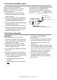
Operating Instructions and Installation Instructions


NAVMAN 8120/8084 Installation and Operation Manual110
Appendix C Glossary and navigation data
Air temp - Air temperature (requires
NAVMAN 7200 VHF radio).
Alarm status - Shows the symbol (see
section 19-10) for each alarm that is on. The
symbol is normally black and turns red if the
alarm triggers.
Attention Area - An important area on a
chart, such as a restricted anchorage or a
shallow area (see section 19-2).
AIS - Automatic Identification System. A
System where vessel information (location,
course, speed, etc.) is broadcast by VHF radio,
for use by other vessels in navigation and
collision avoidance.
Bathymetric line - A depth contour line on
the chart.
Chart card - A plug-in card that stores chart
data for a region (see section 1-3).
C-MAP™ chart card - See Chart card.
C-MAP™ user card - See User card.
CPA - Closest Point of Approach. The closest
distance two vessels will come to each other
based on their current course and speed.
Cursor - A
symbol on the display (see
section 3-2).
DGPS - Differential Global Positioning
System. A navigation tool based on GPS with
some errors corrected (see section 7).
DSC - Digital Selective Calling. A feature
of marine radios enabling communication
between specific vessels, as well as distress
alerts.
DTN - Distance to the next position the
8120/8084 is navigating to, either a waypoint
or the cursor.
Fish forecaster - An estimate of the
likelihood of catching fish based on
barometric pressure. The more fishes that
show the higher the likelihood (requires
NAVMAN 7200 VHF radio).
Gear - The gear the engine is in (requires
SmartCraft).
Goto - A simple way of navigating straight
to a waypoint or to the cursor position (see
section 3-1).
GPS - Global Positioning System. A satellite-
based navigation tool (see section 7).
Leg - The straight segments of a route
between waypoints. A route with four
waypoints has three legs.
MMSI - Maritime Mobile Service Identity.
Unique identification number for a vessel, for
use in Digital Selective Calling.
MOB - Man overboard.
MOB function - Starts navigating back to
the place where someone fell overboard (see
section 2-4).
NavBus - A way of connecting NAVMAN
instruments together to share data (see
section 20-11).
NMEA - National Marine Electronics
Association.
NMEA 0183 - A standard for interfacing
marine electronic devices (see section 20-12).
Radar guard zone - An area around the
boat, set up by the operator and defined
by distance and bearing. If an object (e.g.
another boat) enters the radar guard zone, an
alarm is activated.
Rain clutter - Heavy rain or snow can cause
interference with the radar image.
Range (radar) - The distance between the
centre of the radar image and the outer range
ring. The scale is shown in the top left corner
of the radar window.
Range rings - Concentric circles extending
from your boat (usually at the centre of
the radar window) and used to estimate
distances to objects. The scale is shown in
the top left corner of the radar window.
Route - Two or more waypoints linked in
sequence to form a course for the boat (see
section 7).