Table of Contents Getting Started...................................................................................................................2 GPS Information .......................................................................................................3 Entering Data on the Nextar Navigation System.....................................................3 Moving Through the Screens ...................................................................................4 Resetting the GPS............
Getting Started Congratulations on your purchase of the Nextar Navigation System. Your Nextar Navigation System can guide you to the destination of your choice using signals from Global Positioning Satellites (GPS) orbiting the earth. There are 24 GPS satellites orbiting the earth. A GPS device can calculate your position on the earth if it can receive signals from at least three of these satellites.
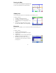
GPS Information To view the GPS information: 1. Tap Menu 2. Tap Information. 3. Tap GPS Information. The GPS Info screen appears. Entering Data on the Nextar Navigation System The GPS doesn't have a physical keyboard. Instead, you tap the screen to enter data.
Moving Through the Screens The GPS shows you one screen at a time. Each time you tap a button, a new screen appears. If you want to return to go to the previous screen, tap the in the upper right corner of the screen. If you want to go back to the map view directly, tap the button on the upper left corner of the screen. Resetting the GPS You should never have to reset the GPS under normal circumstances. However, in the event that a problem cannot be corrected, you may reset the GPS.
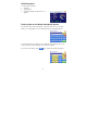
Working with the Map The GPS gives you many ways of looking at the map. You can see your current position, view any of the turns on a route, or pan the map to view other areas. You can zoom in and out, and find information about specific locations. Map View The map view on the GPS shows your current location. At the bottom of the map is a scale indicating your current zoom level. On the upper right is the compass. On the center right and left are zoom in and out buttons, respectively.
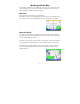
Panning the Map You can pan the map by tapping and dragging the map. To return to the regular map view, tap the X button. 3D Map View You can change the perspective of the map display to 3D or bird’s eye view. To change to 3D view: 1. Tap Menu. The Main Menu appears. 2. Tap Settings. The Settings screen appears. 3. Tap Display Options. The Display Option screen appears. 4. Select from 2D, High, Medium and Low, which represents the inclination of the 3D map display.
Current Location You can find location information about any point on the map by pressing firmly on the map for one second. A screen appears giving you the opportunity to set the location as the Start or the Destination, and save the location to your Favorites list, or view information.
Screen Tap Areas Tap in designated areas on the map display for shortcuts to handy functions. Show route list Repeat Voice Guidance Change map orientation to Heading Up or North Up Zoom Out Zoom in Mute Show details of current location (2D map only) Tap and hold to show details of the street, set as the start location, or set as the destination.
Planning Your Route You can set a destination with the GPS in many different ways. Once you have set a destination, you can add a detour or a stopover. The GPS also offers an Itinerary feature, where you can enter up to 100 destinations and use the Itinerary screen to re-order destinations as you like.
Using an Address as a Destination There are two ways to enter the address: by selecting the street first, or by selecting the city first. If you use Street First and too many records match, you will be asked to use City First. NOTE: You will be prompted for the street name first, then the house number. To Enter an Address as a Destination Using Street First: 1. Tap Menu. The main menu appears. 2. Tap Destination. The Set Destination screen appears. 3. Tap Address. The Input Method screen appears. 4.
Using an Intersection as a Destination There are two ways to enter the intersection: by selecting the street first, or by selecting the city first. If you use Street First and too many records match, you will be asked to use City First. To enter an intersection as a destination using Street First: 1. Tap Menu. The main menu appears. 2. Tap Destination. The Set Destination screen appears. 3. Tap Intersection. The Input Method screen appears. 4. If you need to change the region or State: a. Tap Change State.
Using a Point of Interest (POI) as a Destination There are over 6 million points of interest that you can select as a destination. Generally, you choose a category and then choose one of four methods of selecting the specific point of interest. Sometimes you must first select a subcategory before you can choose a selection method. The four methods of selecting a specific point of interest include two for nearby POIs and two for all POIs in a region. To select a nearby POI as a destination: 1. Tap Menu.
5. Tap a Subcategory. The POI Options screen appears. 6. Select the radius, if you are searching for a nearby POI. To select a nearby POI from an alphabetical list: a. Tap Alphabetical. The Enter POI Name screen appears. b. Tap the Letters to enter the name of the POI. a. Tap OK when you have selected the POI. The POI Select screen appears, displaying the address of the POI. b. c. d. Tap Nav. The map appears, and the guidance directions begin. Tap Fav to save the POI in the Favorites list.
To select a nearby POI by distance: a. Tap By Distance. The POI List screen appears, listing the closest POIs first. b. Tap the POI that you want to go to and tap Nav. You may need to scroll down the list by tapping the scroll bar. The map appears, and the guidance directions begin. c. Tap Fav to save the POI in the Favorites list. d. Tap Show to show the POI location on the map display. e. Tap Info to show additional detail including address and telephone number.
Using a Favorite Destination as a Destination Favorite destinations are locations you add to a list on the GPS. You can add locations to your Favorites list as you set a destination, from the POI(s) screen, and from the Location Information screen. You can then easily select one of these locations as a destination. To Select a Favorite as a Destination: 1. Tap Menu. The main menu appears. 2. Tap Destination. The Set Destination screen appears. 3. Tap Favorites. The Favorites screen appears. 4.
Using a City Center as a Destination Sometimes you may want to use the GPS to get to a city, but not to a specific location within the city. To do this you select a City Center as a destination. As with selecting a Point of Interest, there are several methods of selecting a city center: two for nearby city centers and one for all city centers in a region. To select a nearby City Center as a destination: 1. Tap Menu. The main menu appears. 2. Tap Destination. The Set Destination screen appears. 3.
Detours, Avoid Roads, and Stopovers The Detour feature will allow you to bypass a certain portion of the route starting at your present position, while avoid road allows you to bypass the entire road. Stopovers are stops you add to a trip to make prior to reaching your destination. Detour NOTE: you cannot create a detour if you do not have a current destination To set a detour: 1. Tap Menu. The main menu appears. 2. Tap Destination. The Destination Options screen appears 3. Tap Detour.
To avoid roads in the route list: 1. Tap Menu. The main menu appears. 2. Tap Destination. The Destination Options screen appears. 3. Tap Avoid Road. The Avoid Road screen appears. 4. Mark any segments that you do not want included: 5. a. Tap on a route instruction to highlight it. b. Tap Avoid. A do-not-enter symbol appears. When you have finished marking segments, tap Nav. Your route is recalculated, the map appears and the guidance directions begin.
Setting an Itinerary The Itinerary feature allows you to set multiple destinations. You can add, remove, or reorder destinations according to your needs. To set the Itinerary: 1. Tap Menu. The main menu appears. 2. Tap Itinerary. The Itinerary screen appears. 3. 4. 5. 6. Tap Add to add new destinations from Favorites, Recent or POI list, or enter a new address as destination. Tap Del to remove a destination from the Itinerary. Tap Go! to start navigating from the first item on the Itinerary.
Managing Your Favorites List You can edit the destinations you add to your Favorites list to give them descriptive names. You can also remove destinations from your favorites list. To manage your favorites list: 1. Tap Menu. The main menu appears. 2. Tap Favorites. The Favorites screen appears. To edit a favorite: a. Tap on the favorite you want to edit. b. Tap Edit. The Edit Favorites screen appears. c. Enter a descriptive name for this favorite. d. Tap OK when you are done.
Getting Information To access the Information screen: 1. Tap Menu. The main menu appears. 2. Tap Information. The Information screen appears. 3. Select from the following: Route List Provides detailed turn-by-turn maneuver information of your current route. If you have not set a destination, the route list will be empty. Current Location Provides detailed information about your current location. You can save the current location into your Favorites list by tapping on Save.
Trip Information Provides information such as average speed and distance traveled. This feature is convenient when you need to keep track of your mileage. Almanac Provides information related to the sun and the moon, based on your current geographic location. System Information Provides software revision number and copyright information. GPS Information Provides information related to GPS signal strength, coordinates, date and time.
Using Tools Parked-car Locator This feature is useful when you park your car in a large open area such as inside a theme park, or on a street nearby a tourist attraction or shopping center. To save your parking location: 1. Press the Standby button on the top of GPS, after you have parked your car. 2. Take the GPS with you. Note: If you park inside a parking structure, the saved location will be nearby the entrance to the structure. To find your car: 1. Tap Menu. 2. Tap Parked-car Locator. 3.
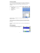
Setting Your Options You can set many different options to customize the GPS and make it work your way. These options include: Ÿ Route Options Ÿ Display Options Ÿ Language Options Ÿ Localization Options Ÿ System Options Ÿ Safety Options Display Options The display options give you control over the appearance of the map. You can change the following: Ÿ Orientation Ÿ Guidance Ÿ Day/Night Ÿ POI Icons Ÿ Color Ÿ 3D View There are two orientation settings.
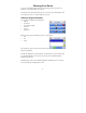
The color settings control the background color of the map. You can choose from four different colors. The 3D view settings control your view of the map. Off shows you the map in traditional 2D mode. High, Medium, and Low show you a 3D version of the map, with a different angle for each value. If you use any of the 3D settings you will not be able to tap on a location to view location information. To set your display settings: 1. Tap Menu. The Menu screen appears. 2. Tap Settings.
Local calculates a route that uses local roads whenever possible. Walking enables pedestrian walking mode. The ferries setting indicates whether ferries should be included when your route is calculated. If you include ferries, the route will take you to the ferry terminal, but the total time for the route does not take into account the ferry schedule or time spent on the ferry. The toll roads setting indicates whether you want to include or exclude toll roads when your route is calculated.
Auto speed alert is based on road class and may not necessarily reflect the actual speed limit. Please use this feature only as a reference To set the speed alert: 1. Tap Menu. The Menu screen appears. 2. Tap Settings. The Settings screen appears. 3. Tap Safety Options. The Safety Options screen appears. To set the speed alert: a. Tap Auto. A warning appears. b. Tap Confirm to close the warning. c. Tap OK. You return to the map. To set a fixed speed alert: a. Tap Fixed. b.
Language Options The language options allow you to configure the following: Ÿ Language Ÿ TTS (Text-to-Speech) There are six language settings. When you change the language, all of the screen names and controls will be in the selected language. To set your language settings: 1. Tap Menu. Menu screen appears. 2. Tap Settings. Settings screen appears. 3. Tap Language Options. The Language Options screen appears. 4. Tap your Language preference: English, French, Spanish, Chinese, Korean or Japanese.
There are six time zone settings, for all areas of the United States. There are two daylight-savings options, to determine whether or not daylight savings time is currently in effect at your location. There are two settings for systems, which determine how the distance to your location is expressed. You can choose between Mi (miles) or KM (kilometers). To set your localization settings: 1. Tap Menu. Menu screen appears. 2. Tap Settings. Settings screen appears. 3. Tap Localization Options.
No part of this manual may be copied, republished, reproduced, transmitted or distributed in any way without prior written consent of Nextar, Inc. Any unauthorized distribution of this manual is expressly forbidden. TM Nextar , a trademark of Nextar (Hong Kong) Limited. Nextar may find it necessary to modify, amend or otherwise change or update this manual. W e reserve the right to do this at any time, without any prior notice. All specifications and features are subject to change without notice.