
User Manual


5
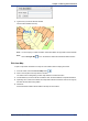
Working with Annotations
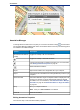
The functions available in MapInfo Stratus are controlled by the
administrator for each organization and some users may not have these
Note:
tools enabled, whilst others may only have measuring tools enabled
instead of the full annotation tools.
The following topics provide help on working with annotations:
In this section:
• Annotations . . . . . . . . . . . . . . . . . . . . . . . . . . . . . . . . . . . . .32
• Measuring Distance and Area . . . . . . . . . . . . . . . . . . . . . .39