
User manual


16
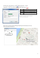
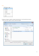
Altitude Display of Planning
Click the planning route of route list,
or click on the map route starting point of
Icon the front
. There will be a graph with altitude below map.
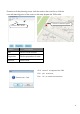
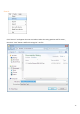
When point with the curve of altitude graph, it will display corresponding altitude and
distance. It will also display this point on map.
Corresponding point
with altitude graph