
User's Manual Part 2

VeriTracks™ User’s Manual
Satellite Tracking Of People 44
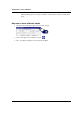
• If the offender’s tracks move off of the current map, click on the auto pan check box so the
map automatically pans and refreshes ..
Review a track
• The connect track points from start date/time icon allows you to connect track points
for a selected offender, beginning with the earliest point to fall within the date range of the
map.
• Map one or more offender tracks (a collection of points during a specified time period)
• Select one or more points for the offender of interest. You can only link points for a single
offender at a time.
• Select the connect track point button.
• The track points will be connected by colored lines. A green line indicates less than two
minutes between points, a yellow line indicates less than 10 minutes between points and a red
line indicates more than 10 minutes between points.
Identify Features
• Hold down your left mouse button and draw a box around one or many map features.
• Click the Identify Features icon on toolbar.
• This produces a detailed report on each feature (offender track point, zone, home/work
address) in the box drawn.
NOTE: These first three capabilities when used together can quickly focus the supervising officer on
location anomalies, such as on offender going to an unusual place and allows him/her to drill down
into the details of the offender’s behavior..
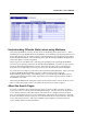
See the places an offender frequents
• Map a track for the offender of interest for any time period.
• Select an offender’s track on the map by drawing a box around one track point to identify the
offender.
• Select the Show Offender Range
icon to overlay a density layer that depicts hot spots
where the offender frequented or the offender’s “home range.”
• Zoom out to see the entire home range
• This feature visualizes an offender’s “home range,” which covers all of the places an offender
has visited and where he/she spends most of his/her time.
Find offenders at a location at a time.
• Go to the Map link on the main menu bar. This provides a drop-down box in which you can
enter the address information to be mapped.