
Software Instruction Manual
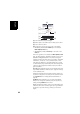
Table Of Contents
- Table of Contents
- Introduction to ProMark Field
- Installing ProMark Field
- Getting Started With ProMark Field
- Creating a New Job
- Importing/Exporting Jobs
- Running a Post-Processed Project
- Using Your Rover in a Real-Time RTK Project
- Changing the Storage Medium for Raw Data Collection
- Initialization
- Logging with Offsets
- Setting an RTK Base
- Installing Geoids
- Adding Background Maps
- E-Compass & External Device
- Index

English
40
A warning message will be displayed at this stage if the
position accuracy does not meet your acceptance criteria
(see Tolerances tab in Setting General Parameters on
page 8).
• When you reach the end of the line, select Menu > Stop.
You may use the Pause/Resume function in the Menu when
the line is discontinuous. While in pause, ProMark Field
stops logging points according to the chosen time or
distance rate.
• When you are finished with the job, select Menu, Exit to
close the job and quit ProMark Field.
Using the Stake
Out Function
The file containing the stakeout points is a survey file (csv) or
a shape file (shp). It may have been prepared with GNSS
Solutions and/or derived from a job run earlier with ProMark
Field. With a csv job, stakeout points can also be added
directly in the open job file using the Add button after
selecting Menu>Job>Points.
To export stakeout points from a GNSS Solutions project,
select these points in the project, then use the Project>Export
Geo Data to File command, choosing “CSV” as the output
format.
NOTE: The Stakeout function can also be used simply to take
you back to the selected point (navigation function).
Follow the instructions below to use the Stakeout function:
• Set up the rover as explained in Choosing the Survey Type
and Mode on page 32.
• Turn on the receiver, run ProMark Field and open the job
file containing the stakeout points.
• Go to Menu>Options, select “Stop & Go Kinematic” and
“Real-time” on the Survey tab, then tap OK.
• Think about which initialization method you will be using
at the beginning of the survey and take the corresponding
steps:
– On the Fly: Nothing special needs to be done.
– From Known Point: Go to the known point and place
the rover antenna exactly over this point.
– From Bar: Go to the base (fitted with the initializer bar)
and place the rover antenna at the free end of the
initializer bar.
– Statically: You will stay static for a while on a point of
your choice.
• Tap Menu and select Configuration...