
Reference Manual User Manual


GPS Reference Manual
10
Auto Accept
:
is where you select to use criteria for automatic point
acceptance. When checked, both the data and Offset Shots screens
will automatically accept points once the measurement is better than
the specified criteria.
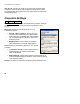
Projection Settings
The Projection Settings card is used to define the projection mode you
will use to calculate horizontal and vertical coordinates in your
survey.
Horizontal
: contains the following options for your
horizontal projection.
•
Ground - TDS Localization
: use this setting to
transform GPS coordinates into a ground level
local system using a default TDS map projection
set up to produce ground distances at the GPS
base point origin.
•
Mapping Plane
: use this setting to transform
GPS coordinates to a selected mapping plane
Vertical
: contains the following options for your vertical
projection.
•
Localization (+Geoid)
: use this setting to have a
geoid model with or without a localization
vertical adjustment.
•
Ellipsoid Height
: use this setting when no transformation of
measured ellipsoid heights is desired. Point elevations will be
local ellipsoid heights.
Database
: is where you select the coordinate system database to use.