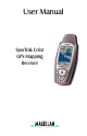
User Manual SporTrak Color GPS Mapping Receiver
WARNINGS FOR SAFETY REASONS, THE DRIVER SHOULD NOT USE THIS DEVICE IN A VEHICLE WHILE IN MOTION TO ASSIST THE DRIVER TO NAVIGATE. Please do not try and change any settings on the SporTrak while driving. Come to a complete stop or have your passenger make any changes. Taking your eyes off the road is dangerous and can result in an accident in which you or others could be injured.
THALES NAVIGATION MAGELLAN PRODUCTS LIMITED WARRANTY All Thales Navigation global positioning system (GPS) receivers are navigation aids, and are not intended to replace other methods of navigation. Purchase is advised to perform careful position charting and use good judgment. READ THE USER GUIDE CAREFULLY BEFORE USING THE PRODUCT. 1.
(6) service performed or attempted by anyone Some national, state, or local laws do not allow other than an authorized Thales Navigations the exclusion or limitation of incidental or consequential damages, so the above Service Center; limitation or exclusion may not apply to you. (7) any product, components or parts not manu7.
Table of Contents Introduction ....................................................................... 1 About This User Manual ......................................................................... 1 Setting Up the SporTrak ..................................................... 2 Installing the Batteries ............................................................................. 3 Selecting Language ..................................................................................
Reference .......................................................................... 17 Power/Backlight/Contrast ..................................................................... 17 Turn the SporTrak On ....................................................................... 17 Turn the SporTrak Off ....................................................................... 17 Using the Display Backlight .............................................................. 17 Adjusting the Display Contrast ........
Highlighted Road Vertical Profile Description ............................ 27 Route Vertical Profile Description .............................................. 28 Path Check Description ............................................................. 28 Compass Screen ................................................................................ 29 Customizing the Data Fields .......................................................... 29 Large Data Screen ......................................................
Searching for a Street Address ............................................................ 43 Routes ................................................................................................... 44 Creating a GOTO Route ................................................................... 44 Creating a Backtrack Route ............................................................... 44 Creating a Multileg Route .................................................................
Clearing Memory .................................................................................. 55 Clearing Track History ...................................................................... 55 Clearing Wpts/Routes ....................................................................... 55 Clearing All Routes ........................................................................... 55 Resetting SporTrak to Factory Defaults ..............................................
Heading vs. Bearing vs. Course Over Ground ................................... 68 Navigating with the Compass Screen ................................................. 70 Calibrating the Compass ................................................................... 70 Using the Barometer and Temperature Screens .................................. 74 Accessories ............................................................................................ 76 MapSend Streets .........................................
Introduction Welcome and congratulations on your purchase of the Magellan SporTrak Color GPS mapping receiver. The SporTrak Color has all the features that a sailor, fisherman, hiker, hunter, or any person involved with outdoor recreational activities has come to expect from a Magellan GPS receiver. In addition to these features, the SporTrak Color offers the ability to display your location on detailed city maps providing you with a complete navigation tool that will last you for years to come.
Appendix: Sections containing information about connecting your SporTrak Color to external devices, accessories, troubleshooting and specifications can be found in the Appendix. Glossary: A glossary is provided explaining some of the terms and abbreviations found in the SporTrak Color and this manual that may not be familiar to all users. It’s time to begin using your SporTrak Color.
Setting up the SporTrak Setting up the SporTrak Color is a simple three-step process: installing the batteries, selecting the language to be used and initializing the SporTrak. Installing the Batteries To change the batteries, remove the battery door on the back of the SporTrak Color. The door can be easily removed by pressing on the lever at the top of the battery door. This releases the door and allows it to swing away from the receiver.
Selecting Language The first time you use your SporTrak (or if memory has been completely erased) you will be asked to select the language that you want to use. Use the UP/DOWN arrows on the keypad to highlight the language you desire. With the language highlighted, press the ENTER button. You can select English, French, German, Spanish, Italian, Portuguese, Finnish, Dutch or Swedish. You can change the language at any time by accessing the Languages option of the Setup Menu.
Press [ENTER]. (You have 10 seconds to press [ENTER] or the SporTrak will shut off.) The SporTrak displays a message box indicating that the receiver needs to be initialized. Press [ENTER]. Enter Your Approximate Position (Initialize) Use the Up/Down arrows on the keypad to highlight your general region. Press [ENTER]. Use the Up/Down arrows on the keypad to highlight your area. Press [ENTER]. The cursor appears in the time field, waiting for you to input your local time.
To use the arrow keys to edit a field, follow the simple diagram below. Editing moves the cursor block left or right. Pressing right arrow results in: increments the value up or down. Pressing up arrow results in: When the time is correct, press [ENTER]. The last piece of information needed is the date. Using the arrow keys, enter the present date. Press [ENTER].
Basic Operation For many of you this will be your first introduction into using a GPS receiver as a navigational tool. With all of the features and functions provided with the SporTrak, it may seem a bit intimidating at first. Don’t worry. There are only a few things you need to know to use the SporTrak. They will be discussed here in detail. Other features and functions can be found in the Reference Section of the User Manual.
Turning Power on/Off Turning the SporTrak On You have 10 seconds to accept the warning by pressing ENTER or the SporTrak will shut off. The last navigation screen you were viewing will be displayed. If the last navigation screen view was the Map screen, the last zoom scale setting will be used. Turning the SporTrak Off Pressing the POWER button again will turn off the SporTrak immediately. Pressing ESC will cancel the power down sequence.
Adjusting the Contrast From any screen Use up/down arrows to highlight Contrast Use left/right arrows to adjust the contrast. (The menu display may differ slightly depending upon which screen it was accessed from.) Getting a Position Fix Because the SporTrak attains information it needs from satellites orbiting the earth, the antenna needs to have a relatively unobstructed view of the sky. This allows the SporTrak to choose from all satellites currently available.
Map Screen — The Map screen has two modes, position or cursor. In the position mode, your present position is indicated by the large arrow icon in the center of the display. If you are moving, the arrow will point in the direction that you are heading. At the bottom of the screen is the scale for the map displayed and two data fields that can be customized, or turned off, depending upon your needs. In the Cursor Mode, you are provided with a cursor that can be moved on the map.
Road Screen — The Road screen presents your route as if you were travelling on a road. When you need to make a turn, the road will graphically display the turn and the direction. Waypoint and destination icons will be displayed relative to your position as they come into view. Above the road is a compass that displays your heading and above that are four customizable data fields. Data Scr een — When you need to see a lot of information in one place then you’ll appreciate the Data screen.
Saving a Waypoint A waypoint is a point on a map that you can name and save in the SporTrak. They are primarily used for creating routes. Whether the route is a simple GOTO or a more complex multileg route, it needs stored waypoints to use as its starting and destination point. Saving a Waypoint with a Receiver-Generated Name From any screen, press [MARK]. The “Save” button is highlighted and you can press [ENTER] to save the waypoint using the default name and icon.
You can now use the arrow keypad to select the character you wish to enter. With the character highlighted, press [ENTER] and the character is appended to the name you are entering and displayed in the field above the keys. (Note: waypoint names can be up to 8 characters in length.) Highlighting “Back” and pressing you entered. [ENTER] erases the last character Highlighting “Clear” and pressing [ENTER] clears the entire name. Highlighting the space bar and pressing [ENTER] adds a space.
Using Goto Routes A GOTO route is simply a route with a start point and a single destination point: I am here and I want to go to there. All that is required to create a GOTO route is having the destination waypoint saved in memory. This waypoint can be one that you have saved earlier (which is stored in your User Waypoint List) or any of the landmarks that come with the SporTrak in its built-in database. Creating a GOTO Route Press GOTO.
letter “L” and that the cursor has moved to the next letter in the city name. (You can move the cursor back if you made a mistake by highlighting the “<-” button on the keyboard and press [ENTER].) Since we are looking for Los Angeles, we need to highlight the “O” next and press [ENTER]. Then the “S” and press [ENTER]. To add a space, highlight the “space bar” and press [ENTER]. (Also, you can use the “->” button to move the cursor to the right if you want to skip the letter the cursor is indicating.
GOTO routes are NOT saved in memory when the SporTrak is turned off. If you are navigating on a GOTO route and you need to turn the SporTrak off, you will need to restart the GOTO. Routes, however, are stored in memory. If you need to make a GOTO but expect to turn the SporTrak off before arriving, you might consider making a 1-leg route using the route menu. Summary This concludes the basic operation of the Magellan SporTrak, but there is so much more.
Reference Power / Backlight / Contrast Turn the SporTrak On — Applies power to the SporTrak and displays last NAV screen viewed. During power-up the first screen shows the software and map database versions currently loaded in the SporTrak. The second screen gives a warning that must be read. After reading the warning press [ENTER] to proceed. (If you do not press [ENTER], the SporTrak will shut off after 10 seconds.
Reference Adjusting the Display Contrast — Sets the contrast of the display for easy viewing in most lighting conditions. From any screen Use up/down arrows to highlight Contrast Use left/right arrows to adjust the contrast. (The menu display may differ slightly depending upon which screen it was accessed from.) Navigational Screens Selecting NAV Screens — The [NAV] button provides a means of accessing the navigation screens.
R eference Present Position Icon Track History Map Scale Indicator Data Fields Present Position Icon The Present Position Icon graphically displays your position on the map. While you are moving it will point in the direction you are heading. If the SporTrak is not computing positions, this icon is replaced with an hourglass icon. Map Scale Indicator Provides the scale for the map. The number displayed represents approximately 1/4 of the screen’s width. Scale can be changed with the IN and OUT buttons.
Reference In the Cursor Mode, you are provided with a cursor that can be moved on the map. At the bottom of the display is the information for the position of the cursor relative to your present position. Also any points of interest that the cursor is over will be shown. To access the Cursor Mode, press any arrow on the keypad. A crosshair appears that can be moved with the arrow keys. To return to the Position Mode, press [ESC].
R eference Setting the Map Detail — The detail of the map can be set to highest, high, medium, low or lowest. This changes the zoom level that different map objects (cities, highways, labels, etc.) are displayed. If you have set a zoom level and the display is too cluttered, set the map detail to a lower level; conversely set it to a higher level to view more detail. The default is Medium.
Reference Turning On/Off Displayed POI’s — [Available only if a map has been uploaded from a Magellan MapSend Streets and Destinations or MapSend Topo for the United States CD-ROM] Allows you to select which, if any, POIs that have been uploaded from a MapSend product to be displayed. Default is On.
R eference Turning Data Fields On/Off — This option allows you to turn on or off the two information fields that are displayed on the Map screen. Turning these off allows for more of the map to be displayed. Default is SHOW. From the MAP Screen Highlight Hide Map Info or Show Map Info When Map Info is hidden and the map is in the cursor mode, the bearing (BRG) and distance (DIS) to the cursor is shown in the bottom left corner of the map replacing the scale.
Reference Street Information Description — This mode just displays the name of the street close to your present position. Horizontal Profile Description — This mode displays at the bottom of the Map screen a graphical representation of the horizon at a fixed distance from your present position. This fixed distance is equal to the map scale you have selected for the Map screen, so as you zoom in or out, the horizon displayed will change.
R eference to the map scale indicator. (This function requires that map data has been uploaded from Magellan MapSend Topo for the United States and that your present position as well as the projected horizon falls within the area uploaded.) Like Horizontal Profile, you must be zoomed in to a scale of 0.80 miles or closer for the projected terrain to be displayed. Zoom scales higher then 0.
Reference Selecting Primary Usage — The SporTrak can be set to either Land or Marine Usage. When in Land (default), the map displays land areas in white and water areas as dark gray. For marine applications it may be desirable to reverse the display, showing water as white and land as dark gray. This will make reading some of the data information on the water easier.
R eference Using Vertical Profile — Vertical Profile displays the elevation as a graphical display for the option you select. Only Track History is available for this function if MapSend Topo for the United States map data is not uploaded. (Path Check is shown as an available function but will not display the vertical profile, however it can be used to graphically create a route. See the information on Path Check for more details.
Reference Route Vertical Profile Description — (Available only with map data uploaded from Magellan MapSend Topo for the United States.) If you have at least one route stored in memory, you can view the vertical profile for the route. After selecting Vertical Profile, you will be asked to select the route you want to plot. Path Check Description — Path check performs two functions.
R eference Compass Screen Destination Name Data Fields Heading Marker Destination Icon Sun/Moon Position Markers Compass Destination Name When you are navigating on a GOTO or multileg route, the name of the destination is placed here. For multileg routes, the name displayed is the name of the destination for the leg of the route you are presently navigating on. Data Fields Customizable data fields. The data displayed can be selected from 13 different options.
Reference Large Data Screen Destination Name Data Fields Destination Name Data Fields When you are navigating on a Customizable data fields. The GOTO or multileg route, the name data displayed can be selected of the destination is placed here. from 17 different options. For multileg routes, the name Customizing is accessed through displayed is the name of the the destination for the leg of the route the data displayed requires you to you are presently navigating on.
R eference Position Screen The Position screens 1 and 2 simply display your present position using the coordinate systems that you have selected in Setup. The Position 1 screen shows all of the basic position, time and satellite information, all on one screen. In addition, current navigation information is shown on the bottom half of the screen. Selecting the Position Screen — Allows you to toggle between the two Position screens.
Reference Present Position Coordinates and Elevation Current Time and Date GPS Status Data Fields Trip Odometer Use the Left/Right Arrows to toggle between Position 1 and Position 2 Present Position Coordinates Data Fields and Elevation Customizable data fields. The Displays your present position in the data displayed can be selected coordinate system chosen in Setup. from 17 different options. Also displays the elevation of the Customizing is accessed through present position.
R eference GPS Status Messages — Messages indicating the status of the GPS receiver section of the SporTrak are displayed on the Position screen. Message Description Searching - 1st sat Searching for 1st satellite. Searching - 2nd sat 1st satellite found; searching for 2nd satellite Searching - 3rd sat Two satellites are being tracked and searching for a third. Searching - 4th sat Three satellites are being tracked and searching for the fourth.
Reference Projecting a Waypoint — This function, found on the menu associated with the Position Screen, allows you to create a new waypoint that is a fixed distance and bearing from your present position or from any waypoint/POI stored in the SporTrak. An example of waypoint projection would be if you wanted to go to a location that is 2.0 miles and due north of your current position. You would access the waypoint projection function and enter 2.0 as the distance and a bearing of 0°.
R eference Road Screen The Road Screen provides you with navigation information in a graphical format. At the top of the display are four customizable data fields. Immediately below them is a compass that will provide you with your heading. Following the compass is a graphical representation of your route as if it was a road. This familiar indication of where you are in regards to your planned route will provide you with the knowledge required for you to keep on track.
Reference Data Screen Destination Name Customizable Data Fields Compass Destination Name Data Fields When you are navigating on a Customizable data fields. The data GOTO or multileg route, the displayed can be selected from 17 name of the destination is different options. Customizing is placed here. For multileg accessed through the MENU button.
R eference Speed Screen Destination Name Customizable Data Fields Speedometer accessed through the MENU button. Some of the data displayed requires you to be moving to be computed, invalid data is indicated by dashes. Destination Name When you are navigating on a GOTO or multileg route, the name of the destination is placed here. For multileg routes, the name displayed is the name of the destination for the leg of the route you are presently navigating on.
Reference Satellite Status Screen The Satellite Status screen visually displays the satellites being used and the strength of the received signal. Additionally, this screen displays the power source you are connected to and, if internal batteries, how much battery life is remaining. This is a very handy screen when you wish to view how well your SporTrak is tracking satellites.