TomTom GO BASIC User Manual 17.
Contents Welcome to navigation with TomTom 7 Features 8 Your TomTom GO BASIC .......................................................................................... 8 Get going 9 Installing in your car .............................................................................................. 9 Positioning the device ............................................................................................ 9 Switching on and off ................................................................
Reordering the Main Menu buttons ........................................................................... 33 Traffic 34 About TomTom Traffic .......................................................................................... About RDS-TMC ................................................................................................... Looking at traffic on the map ................................................................................. Looking at traffic on your route ...............
Step by step search 81 Choosing which search to use ................................................................................. 81 Using step by step search ...................................................................................... 81 About search .................................................................................................. 81 Entering search terms ....................................................................................... 82 Working with search results..
Speed Cameras 126 About speed cameras .......................................................................................... 126 Crossing into another area or country ...................................................................... 126 Speed camera warnings ........................................................................................ 126 Changing the way you are warned ........................................................................... 128 Reporting a new speed camera ........
Getting Help 153 Help ............................................................................................................... 153 Product certification 154 Finding product certification information on your device ............................................... 154 Using MyDrive Connect 155 About MyDrive Connect ........................................................................................ 155 Setting up MyDrive Connect................................................................
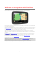
Welcome to navigation with TomTom This User Manual explains all you need to know about your new TomTom GO BASIC. To learn about getting started with your device and installing it in your vehicle, we recommend that you read the Get going chapter. After that, you will probably want to connect to TomTom services and you can read all about that in the TomTom services chapter.
Features Your TomTom GO BASIC Here are the main features of your TomTom GO BASIC and shortcuts to more information. Updates using Wi-Fi® Get the latest TomTom maps and software for your TomTom GO BASIC with built-in Wi-Fi. No computer needed. Learn more: About updates and new items TomTom Services via smartphone Activate live services like traffic by connecting to your smartphone using the TomTom MyDrive app.
Get going Installing in your car Use the supplied mount to install your TomTom GO BASIC in your vehicle. Read the instructions about positioning your device before you install your TomTom GO. To install your TomTom GO, do the following: 1. Connect the supplied USB cable to the mount. If the mount is integrated into your TomTom GO, connect the USB cable to the device. Note: Use ONLY the USB cable supplied with your TomTom GO. Other USB cables may not work. 2.
Sending your device to sleep To send your navigation device to sleep, press the On/Off button and then release it. You can also press the On/Off button for more than 2 seconds until you see the Sleep and Turn Off buttons. Select Sleep to make the device sleep. Tip: To send your navigation device to sleep when the USB cable is unplugged or whenever it is removed from the mount, go to Battery settings in the Settings menu.
3. Select Your information & privacy. 4. Select the button to turn sending of information on or off. Note: If you choose not to send location information to us, you will no longer receive our services. This is because services need to send the location of your device to TomTom in order to receive the traffic information related to where you are. The end date of your subscription remains the same, even if you do not send this information to us. You can find current and more detailed information at tomtom.
Do not open the casing of your device under any circumstances. Doing so may be dangerous and will invalidate the warranty. Wipe or dry the screen of your device using a soft cloth. Do not use any liquid cleaners.
TomTom services About TomTom services A TomTom GO connects to TomTom services in one of two ways, depending on the model: With a permanent connection directly from your TomTom GO. These navigation devices are called 'Always Connected' devices. With a connection using your smartphone. These devices are called 'Smartphone Connected' devices. To get TomTom services on your TomTom GO you need the following items: Any TomTom GO. A smartphone with a data plan from a mobile services provider.
To switch on automatic syncing using MyDrive, select Settings and then MyDrive. Connect to the internet using one of the three methods available and then log in to your TomTom account. Note: Some TomTom services might not be available in your current location.
Connecting a smartphone Why do I want to connect a smartphone to my device? Connect your smartphone to your TomTom GO BASIC to use these features: TomTom services Receive real-time traffic information, speed camera updates and MyDrive using your phone’s data connection. This feature uses approximately 7 MB of data per month. Note: Smartphone-connected devices only. Always-connected devices receive services over GPRS. Hands-free calls Receive and make calls on your TomTom GO.
5. Select Bluetooth. 6. Select Add Phone. 7. Follow the steps in the app and on your TomTom GO to pair your phone with your TomTom GO. Your phone's call history and frequent contacts are imported into your navigation device. When your phone is connected and hands-free calling is enabled, you see this icon on the map or guidance view: You can easily change the phone features you want to use in Bluetooth in the Settings menu.
Reconnecting a smartphone Your TomTom GO will remember your phone and find it automatically when your phone's Bluetooth is switched on and the phone is in range of your navigation device. Tip: Open the MyDrive app to use the smartphone messages feature. When your phone is connected and hands-free calling is enabled, you see this button on the map or guidance view: Your TomTom GO syncs your call history and phone contacts again.
Wi-Fi connection About Wi-Fi® The easiest way to manage your maps, software and all your device content is over a Wi-Fi connection. Your device can be updated using Wi-Fi without the need to connect to a computer. It remembers previously connected Wi-Fi networks so you can keep your device up to date when you are in range of that network. Before you begin, make sure that you have access to an unrestricted Wi-Fi network, such as a personal home network.
1. Select Settings in the Main Menu, then select Wi-Fi. You see a list of available Wi-Fi networks and saved Wi-Fi networks that are currently out of range. Tip: Scroll down to go to the list of out-of-range saved networks. 2. Select the Wi-Fi network that you want to forget. 3. Select Modify then select Forget. Your device is disconnected from the Wi-Fi network. Note: The Wi-Fi network still appears in the list, but your device will not automatically connect to it.
Map Share updates These updates are created from changes made and shared by other TomTom users and contain the following changes or updates: Speed limits Street names Recently blocked and unblocked roads Traffic directions Turn restrictions For more information, see Map Share. Speed Camera updates When a Speed Camera update is offered, you can choose which countries on your map you want to update. Voices You may also be offered new voices as an update.
Tip: Logging in to use Updates and New Items also logs you in ready for using TomTom MyDrive.
What's on the screen The map view The map view is shown when you have no planned route. Your actual location is shown as soon as your TomTom GO has found your GPS location. You can use map view in the same way as you might look at a traditional paper map. You can move around the map using gestures, and zoom using the zoom buttons.
1. Back button. This button returns the map to an overview of your whole route or, if no route is planned, moves the map to put your current location at the centre. 2. Switch view button. Select the switch view button to change between the map view and the guidance view. When in map view while driving, the small arrow rotates to indicate your direction of travel relative to north, with north being up. 3. Zoom buttons. Select the zoom buttons to zoom in and out. 4. Current location.
11. Select the phone button in the map or guidance view to activate your phone and make hands-free calls. 12. Route bar. The route bar is shown when you have planned a route. The guidance view The guidance view is used to guide you along the route to your destination. The guidance view is shown when you start driving. You see your current location and details along your route, including 3D buildings in some cities. Note: 3D buildings in guidance view are not available on all devices.
The direction of your next turn. The distance to your next turn. The name of the next road on your route. Lane guidance at some junctions. Note: Select the instruction panel to see a list of turn-by-turn text instructions for your planned route. 4. Route symbols. Symbols are used on your route to show your starting location, your stops, and your destination. 5. Main Menu button. Select the button to show the Main Menu. 6. Speed panel.
The arrival information panel shows the following information: Tip: If your destination is in a different time zone, you see a plus (+) or a minus (-) sign and the time difference in hours and half hours in the arrival information panel. The estimated time of arrival is the local time at your destination. The estimated time that you will arrive at your destination. The length of time to drive to the destination from your current location.
For remaining distances longer than 50 km (31 miles), only the next 50 km (31 miles) is shown. The destination icon is not shown. Tip: You can scroll the route bar to see your whole route (not available on iOS). For remaining distances between 10 km (6 miles) and 50 km (31 miles), the complete distance is shown. The destination icon is shown fixed at the top of the route bar. For remaining distances of less than 10 km (6 miles) the complete distance is shown.
Point of Interest In the Drive To menu, select this button to search for a point of interest, then plan a route to that location. Latitude Longitude In the Drive To menu, select this button to search for a latitude-longitude coordinate, then plan a route to that location. Select this button to drive to your home location. If this button is not included in your Main Menu, go to My Places to set up your home location.
My Places Select this button to show your saved places. My Routes Select this button to show your saved routes. Record Route Parking Select this button to start or stop recording a track. Select this button to find car parks. Petrol Station Select this button to find petrol stations. Report Speed Camera Select this button to report a speed camera. Contacts Select this button to synchronise your phone book from your phone to your device.
Select this button to open the Settings Menu. Smaller buttons and symbols On the map view or guidance view, select the Main Menu button to open the Main Menu. The following buttons and symbols are available in the Main Menu screen, in addition to the navigation buttons: Select this button to open the Help Menu. The Help Menu contains help about using your TomTom GO, together with other information about your device, for example, map version, device serial number and legal information.
This symbol shows that your device is connected to the internet using Wi-Fi. This symbol shows that your device is not connected to the internet using Wi-Fi. This button shows that you will hear voice instructions. Select the button to switch off voice instructions. You will no longer hear spoken route instructions but you will still hear information such as traffic information and warning sounds. Tip: You can select the types of instructions you want to hear.
In this User Manual, you learn how to use gestures to control your TomTom GO. Below is an explanation of each gesture. Double tap Touch one finger on the screen twice in rapid succession. Example of when to use this: Zooming in on the map. Drag Put one finger on the screen and move it across the screen. Example of when to use this: Scrolling around in the map. Flick Flick the tip of a single finger across the screen. Example of when to use this: Scrolling a big distance on the map.
Reordering the Main Menu buttons To reorder the buttons in the Main Menu to suit your preference, do the following: 1. Select the Main Menu button to open the Main Menu. 2. Press and hold the button you want to move for two seconds. Tip: Alternatively, select the Edit button in the Main Menu. The menu button is shown with left and right arrows. 3. Press the left or right arrow on the menu button to move the button to a new position in the menu. 4. Select and move other buttons to the order you want. 5.
Traffic About TomTom Traffic TomTom Traffic is a TomTom service providing real-time traffic information. In combination with historical road usage data, Traffic helps you plan the optimum route to your destination taking into account the current local traffic conditions and the weather. Your TomTom GO BASIC regularly receives information about the changing traffic conditions.
Tip: Select an incident on the map to see more detailed information. 1. Traffic incident that affects your route in your direction of travel. A symbol or number at the start of the incident shows the type of incident or the delay in minutes, for example 5 minutes. The colour of the incident indicates the speed of traffic relative to the maximum allowed speed at that location, with red being the slowest. The stripes on the traffic jam are also animated to show the speed of the traffic, where appropriate.
To get more information about an incident, select an incident in the route bar. The map opens zoomed in on the incident and an information panel opens showing detailed information about the traffic incident. The information shown includes: The cause of the traffic incident - for example accident, road works, lane closure, or weather. The severity of the incident - slow traffic, queuing traffic or stationary traffic. The delay time. The length of the incident.
The colour of the incident indicates the speed of traffic relative to the maximum allowed speed at that location, with red being the slowest. The stripes on the traffic jam are also animated to show the speed of the traffic, where appropriate. Traffic speed is 0% to 20% of the allowed speed. Traffic speed is 20% to 40% of the allowed speed. Traffic speed is 40% to 100% of the allowed speed. Traffic speed is normal. Road closed, no traffic.
3. Select Avoid in the pop-up menu. A new route is found that avoids the traffic jam. Avoiding a traffic jam using the map 1. On the map view, zoom in and select the traffic jam that is on your route. The traffic jam with an information panel is shown on the map. 2. Select the pop-up menu button. 3. Select Avoid. A new route is found that avoids the traffic jam. Selecting a faster route When a faster route is found, you are asked if you want to take the faster route.
As you approach an exit or junction, the lane you need is shown on the screen. Tip: To close the lane image, select anywhere on the screen. You can choose to see a split screen with the Guidance view on the left and lane guidance on the right, or a full screen with only lane guidance. You can also switch off lane guidance. Go to Appearance in Settings to change the Motorway exit previews setting. Time-dependent speed limits Some speed limits change depending on the time of day.
Syncing using TomTom MyDrive About TomTom MyDrive TomTom MyDrive is the easy way to set a destination, share locations and favourites, and save your personal navigation information. MyDrive synchronises your TomTom GO BASIC using your TomTom account. You can use MyDrive in a web browser on a computer or as a mobile app on a smartphone or tablet. Important: To use TomTom MyDrive you need a compatible navigation device.
Road Trips collection - sending a route to your device The TomTom Road Trips collection allows you to discover the world’s most amazing routes, from legendary coastal routes like the Amalfi Coast to classic road trips like Route 66. Sending a route from the Road Trips collection to your TomTom GO BASIC To use the Road Trips collection, do the following: 1. Log in to MyDrive at mydrive.tomtom.com. 2.
The route is shown on the map together with stops (flags) and start and end points. Using the buttons at the bottom of the box, you can edit the route, save the route as a .GPX file or Save to My Routes. Tip: Click the grey arrow near the road trip name to go back to the previous screen. 4. Click Save to My Routes. 5. To send the route to your device, click on the My Routes icon and click on the name of the road trip. 6. Make sure that Sync this route as a track with my devices is enabled.
The road trip is synced to your TomTom GO as soon as you are either connected to your computer, within range of your wireless network or connected to your phone. You must be logged in to MyDrive. Road Trips collection - planning a route to a stop The TomTom Road Trips collection allows you to discover the world’s most amazing routes, from legendary coastal routes like the Amalfi Coast to classic road trips like Route 66.
4. Click on a flag to see what is of interest at that point on the road trip. For example, you can see the Bay of Islands flag is selected below and, if available, you are shown information and reviews about that stop. 5. Click Start Here to start your route from this point, or Add to My Places or Send to Device. 6. Click Plan route to plan a route to that stop. You can then choose from settings including your vehicle type, fast or thrilling route etc.
You may then get offered a choice of routes as shown below. 8. Click on your chosen route option and then use the buttons at the bottom of the box to share your route, save it or Send to Device. Setting a destination using MyDrive When you are logged in to MyDrive using a web browser or the MyDrive app, you can select your destination on the map and send it to your navigation device.
Creating a route with stops 1. In a web browser, log in to your TomTom account. 2. On the map, select a destination. Tip: You can search for a destination or you can move the map and select a destination on the map. You can also select a destination from Recent Destinations in the Main Menu or your My Places list. 3. On the map, select a stop in the same way as you selected your destination, then select Add Stop. The stop is added to your route.
Tip: Alternatively, select My Places, followed by Recent Destinations. 2. Select Edit List. 3. Select the locations you want to delete. 4. Select Delete. Set a phone contact as your destination using the MyDrive app When you are logged in to the MyDrive app, you can select a contact in your phone's contacts list to set as your destination. Your contact must have a full address which is in the correct order. The destination is shown on the map and you can send it to your navigation device.
Importing a community POI list You can find collections of community POIs on the Internet and upload them to My Places using MyDrive in a web browser. A POI collection might contain, for example, campsites or restaurants for the area you are travelling in, and provides an easy way to select a location without the need to search for the location each time. Tip: Some TomTom Navigation devices have POI lists pre-installed. Your TomTom GO uses .OV2 files for POI collections.
Tracks have a beginning and an end but no stops, and there's a fixed map-dependent route between these points. Your device follows this fixed route as closely as possible. You can edit tracks using MyDrive. Using GPX files You use MyDrive on your computer to import .GPX track files to your TomTom device. The tracks are saved in the My Routes menu. Your device will navigate along the GPX track exactly and will not offer to replan your route, even if a faster route is available.
Tip: MyDrive also syncs your locations in My Places with your TomTom account. You can see your My Places locations and the POI place lists you have imported in MyDrive on a web browser or on the MyDrive app. Make sure that there is at least 400 MB of free space on your device before syncing your device with MyDrive. If there is not enough space, your MyDrive information will not be synced. You can check the amount of available space by going to About in the Help menu on your device.
Quick search Choosing which search to use The following two types of search are available: Quick search Start typing your destination, place or POI to immediately see a list of street names, places and POIs that match. Step by step search Find your destination in easy steps. For an address, enter the city, then the street, then the house number. For a POI, enter where you want to search, then the type of POI you want to search for.
Using quick search About search QUICK SEARCH ONLY You can use the search feature to find a wide range of places and then navigate to them. You can search for the following: A specific address, for example, type in 123 Oxford Street, London. A partial address, for example, type in Oxford st Lon. A type of place, for example, type in petrol station or restaurant. A place by name, for example, type in Starbucks. A postcode, for example, type in W1D 1LL for Oxford Street, London.
Tip: If you press and hold a letter key on the keyboard, you get access to extra characters if they are available. For example, press and hold the letter "e" to access characters 3 e è é ê ë and more. Tip: To edit, select a word you have already typed to place the cursor. You can then insert or delete characters. 3. Type of search button. You can search the whole of the current map, or a specific area such as a town or city, or near your destination.
Tip: To cancel a search, select the map/guidance view button in the top right-hand corner of the screen. Working with search results QUICK SEARCH ONLY Your search results are shown in two columns. Address and city matches are shown in the left-hand column, and POIs, types of POIs and Places are shown in the right-hand column. Recent destinations and saved places are also shown in your search results. Tip: To see more results, hide the keyboard or scroll down the results list.
If you show the result on the map, you can use the pop-up menu to add the location to My Places. If a route is already planned, you can add the location to your current route. Note: The best search results are shown on the map. When you zoom in, the lower ranked search results are gradually shown. About postcodes When searching using a postcode, your results depend on the type of postcode used in the country that you are searching in.
About mapcodes QUICK SEARCH ONLY In countries where roads and houses have no names or addresses, you can use a mapcode instead. A mapcode represents a location. Every location on Earth, including those in the sea like islands and oil rigs, can be represented by a mapcode. Mapcodes are short, and easy to recognise, remember and communicate. They are precise to a few metres, which is good enough for every-day use. Go to mapcode.com for instructions on how to find the mapcode for a location.
Police station Veterinarian Doctor Fire station Car-related services Outside parking Petrol station Parking garage Car wash Car dealer Vehicle inspection centre Rental car facility Electrical car charging point(s) Rental car parking Car repair facility Other services Embassy Pet services Government office Telecommunication Company Community service Post office Pharmacy Shopping centre Beauty services Tourist information office Shop Education 57
College or university School Library Convention centre Casino Winery Theatre Tourist attraction Cinema Zoo Concert hall Amusement park Museum Exhibition centre Opera Cultural centre Nightlife Leisure centre Leisure Children's Farm Sport Playing field Swimming pool Mountain peak Water sports Beach Tennis court 58
Park or recreation area Ice skating rink Yacht basin or marina Sports centre Stadium Golf course Church Place of worship Railway station Mountain pass Airport Scenic or panoramic view Ferry terminal Postcode Religion Travel Note: Not used in all countries.
Planning a route using quick search Using destination prediction What is destination prediction? Your TomTom GO can learn your daily driving habits to saved favourite Places and it can also suggest destinations when you start the device from sleep mode, for example, when driving to Work in the morning. Getting ready for destination prediction Before you get your first suggested destination, your device needs some time to learn about your habits.
The search screen opens with the keyboard showing. 3. Use the keyboard to enter the name of the place you want to plan a route to. Tip: If you press and hold a letter key on the keyboard, you get access to extra characters if they are available. For example, press and hold the letter "e" to access characters 3 e è é ê ë and more. You can search for an address, town, city, postcode or mapcode.
5. Select an address suggestion. 6. Enter the house number if you have one and haven't entered it already. If you don't have a house number, select Add Cross Road or Show on Map. Tip: If you enter a house number that is not found, then the number appears red. The nearest house number that is found is shown in the Drive button. You can enter a new house number, or you can select Drive/Ride to drive to the nearest house number. 7. Select Drive/Ride depending on which device you are using.
Planning a route to a city centre QUICK SEARCH ONLY Important: In the interest of safety and to avoid distractions while you are driving, you should always plan a route before you start driving. To plan a route to a city centre using search, do the following: 1. Select the Main Menu button to open the Main Menu. 2. Select Search. The search screen opens with the keyboard showing. 3. Use the keyboard to enter the name of the city or town you want to plan a route to.
Tip: You can switch between seeing the results on the map or in a list by selecting the list/map button: 5. Select the city in the left-hand column. The city name is shown in the right side of the search input box, and the city centre POI is shown below in the right-hand column. 6. Select the city centre POI. The city centre location is shown on the map. 7. Select Drive/Ride depending on which device you are using. A route is planned and then guidance to your destination begins.
Tip: If your destination is in a different time zone, you see a plus (+) or a minus (-) sign and the time difference in hours and half hours in the arrival information panel. The estimated time of arrival is the local time at your destination. Tip: You can add a stop to a route that you have already planned. Tip: You can save a route using My Routes.
Note: When searching, the whole map is searched. If you want to change how the search is done, select the search type button and then select a search option. 4. As you type, suggestions based on what you have entered are shown in columns. You can continue typing or select a suggestion. Tip: To see more results, hide the keyboard or scroll down the results list. Tip: You can switch between seeing the results on the map or in a list by selecting the list/map button: 5.
Tip: If your destination is in a different time zone, you see a plus (+) or a minus (-) sign and the time difference in hours and half hours in the arrival information panel. The estimated time of arrival is the local time at your destination. Tip: You can add a stop to a route that you have already planned. Tip: You can save a route using My Routes.
The search results are shown in a column. Tip: To see more results, hide the keyboard or scroll down the results list. Tip: You can switch between seeing the results on the map or in a list by selecting the list/map button: 4. Select an individual POI from the list. The location is shown on the map. 5. To see more information about the POI, select the POI on the map and then select the pop-up menu button. Select More Information on the pop-up menu.
Tip: You can save a route using My Routes. Planning a route using the map Important: In the interest of safety and to avoid distractions while you are driving, you should always plan a route before you start driving. To plan a route using the map, do the following: 1. Move the map and zoom in until you can see the destination that you want to navigate to. Tip: You can also select a map symbol to open the pop-up menu, then select the Drive/Ride button to plan a route to that location. 2.
A route is planned and then guidance to your destination begins. As soon as you start driving, the guidance view is shown automatically. Tip: You can use the location you selected in other ways, such as adding it to My Places, by selecting the pop-up menu button. Tip: If your destination is in a different time zone, you see a plus (+) or a minus (-) sign and the time difference in hours and half hours in the arrival information panel. The estimated time of arrival is the local time at your destination.
A list of all your Places opens. 3. Select the Place you want to navigate to, for example Home. Your chosen Place is shown on the map with a pop-up menu. 4. To plan a route to this destination, select Drive/Ride depending on which device you are using. A route is planned and then guidance to your destination begins. As soon as you start driving, the guidance view is shown automatically.
Planning a route using coordinates QUICK SEARCH ONLY Important: In the interest of safety and to avoid distractions while you are driving, you should always plan a route before you start driving. To plan a route using a pair of coordinates, do the following: 1. Select the Main Menu button to open the Main Menu. 2. Select Search. The search screen opens with the keyboard showing. 3. Select the type of search button to the right of the search box. 4. Select Latitude Longitude.
7. Select a suggestion for your destination. The location is shown on the map. 8. To plan a route to this destination, select Drive/Ride depending on which device you are using. A route is planned and then guidance to your destination begins. As soon as you start driving, the guidance view is shown automatically. Tip: If your destination is in a different time zone, you see a plus (+) or a minus (-) sign and the time difference in hours and half hours in the arrival information panel.
Tip: If your destination is in a different time zone, you see a plus (+) or a minus (-) sign and the time difference in hours and half hours in the arrival information panel. The estimated time of arrival is the local time at your destination. Tip: You can add a stop to a route that you have already planned. Tip: You can save a route using My Routes. Planning a route in advance You can plan a route in advance before you drive it. You can save the route as part of your My Routes list.
A pop-up menu shows a list of options. 3. Select Remove Starting Point. Your route is replanned with your current location as the starting point. The original starting point is removed from your route. Changing the starting point into a stop 1. Select the starting point on the route in the map view. 2. Select the pop-up menu button. A pop-up menu shows a list of options. 3. Select Change to a Stop. Your route is replanned with the starting point changed into a stop.
2. Select Parking. The map opens showing the locations of car parks. If a route is planned, the map shows car parks near your destination. If a route isn't planned, the map shows car parks near your current location. You can change the screen to show a list of car parks by pressing this button: You can select a car park from the list to locate it on the map. Tip: You can scroll down the list of results using the scroll bar on the right side of the screen.
If you want to change how the search is done, select the button to the right of the search box. You can then change where the search is carried out, for example, to search near you or the whole map. 3. Select a car park from the map or the list. A pop-up menu opens on the map showing the name of the car park. 4. Select Drive/Ride depending on which device you are using. A route is planned and then guidance to your destination begins. As soon as you start driving, the guidance view is shown automatically.
1. Select the Main Menu button to open the Main Menu. 2. Select Petrol Station. The map opens showing the locations of petrol stations. If a route is planned, the map shows petrol stations along your route. If a route isn't planned, the map shows petrol stations near your current location. You can change the screen to show a list of petrol stations by pressing this button: You can select a petrol station from the list to locate it on the map.
Tip: You can scroll down the list of results using the scroll bar on the right side of the screen. If you want to change how the search is done, select the button to the right of the search box. You can then change where the search is carried out, for example, to search near you or the whole map. 3. Select a petrol station from the map or the list.
A pop-up menu opens on the map showing the name of the petrol station. 4. Select Drive/Ride depending on which device you are using. A route is planned and then guidance to your destination begins. As soon as you start driving, the guidance view is shown automatically. Tip: You can add a petrol station as a stop on your route by using the pop-up menu. A petrol station that is a stop on your route has a blue icon.
Step by step search Choosing which search to use The following two types of search are available: Quick search Start typing your destination, place or POI to immediately see a list of street names, places and POIs that match. Step by step search Find your destination in easy steps. For an address, enter the city, then the street, then the house number. For a POI, enter where you want to search, then the type of POI you want to search for.
Entering search terms STEP BY STEP SEARCH ONLY Select Drive To in the Main Menu, then select Address or Point of Interest. The search screen shows the keyboard and the following buttons: 1. Back button Select this button to go back to the previous screen. 2. Search input box Enter your search term here. As you type, matching addresses or POIs are shown. Tip: If you press and hold a letter key on the keyboard, you get access to extra characters if they are available.
Tip: Select the Shift key once to make the next letter you type upper case. Double tap the Shift key to use Caps-Lock where all the letters you type are upper case. Select the Shift key once to quit Caps-Lock. Tip: To cancel a search, select the map/guidance view button in the top right-hand corner of the screen. Working with search results STEP BY STEP SEARCH ONLY Your Address or Point of Interest search results are shown in a list.
When you show the address or POI on the map, you can use the pop-up menu to add the location to My Places. If a route is already planned, you can add the location to your current route. Note: The best search results are shown on the map. When you zoom in, the lower ranked search results are gradually shown. About postcodes When searching using a postcode, your results depend on the type of postcode used in the country that you are searching in.
Legal and financial services Court house Cash dispenser Legal - Solicitors Financial institution Legal - other services Food services Convenience store Fast food restaurant Restaurant Chinese restaurant Accommodation Hotel or motel Luxury hotel Camping ground Economy chain hotel Emergency services Hospital or polyclinic Dentist Police station Veterinarian Doctor Fire station Car-related services Outside parking Petrol station Parking garage Car wash 85
Car dealer Vehicle inspection centre Rental car facility Electrical car charging point(s) Rental car parking Car repair facility Other services Embassy Pet services Government office Telecommunication Company Community service Post office Pharmacy Shopping centre Beauty services Tourist information office Shop College or university School Library Convention centre Casino Winery Theatre Tourist attraction Education Leisure 86
Cinema Zoo Concert hall Amusement park Museum Exhibition centre Opera Cultural centre Nightlife Leisure centre Children's Farm Sport Playing field Swimming pool Mountain peak Water sports Beach Tennis court Park or recreation area Ice skating rink Yacht basin or marina Sports centre Stadium Golf course Church Place of worship Religion Travel 87
Railway station Mountain pass Airport Scenic or panoramic view Ferry terminal Postcode Note: Not used in all countries.
Using destination prediction If your device prompts "Going to X?", where X is a destination, you have 12 seconds to respond yes or no. Tip: If you don't respond yes or no, your TomTom GO assumes a yes. To respond yes, select Yes. Your device plans a route to your destination. To respond no, select No or tap the screen to return to the map. Switching destination prediction on or off You can turn destination prediction on or off at any time.
When the correct street name appears in the list, select the name. 6. Enter the house number. Tip: If the house number does not exist then it appears red. The nearest house number is then shown in the Drive to button. 7. Select Drive/Ride depending on which device you are using. A route is planned and then guidance to your destination begins. As soon as you start driving, the guidance view is shown automatically.
2. Select Drive To. 3. Select Point of Interest. You can change the country or state setting by selecting the flag before you select a city. 4. Choose where to search. You can select from one of the following options: - Near me. - In town or city. - Along route if you have planned a route. - Near destination if you have planned a route. - Near point on map if you have selected a point on the map. - Near departure point if you have planned a route or a track. 5.
7. To see more information about the POI, select the POI on the map and then select the pop-up menu button. Select More Information on the pop-up menu. You see more information about the POI such as the phone number, full address and email. 8. To plan a route to this destination, select Drive/Ride depending on which device you are using. A route is planned and then guidance to your destination begins. As soon as you start driving, the guidance view is shown automatically.
When the correct city or town appears in the list, select the name. 5. Select the city centre POI. 6. Select Drive/Ride depending on which device you are using. A route is planned and then guidance to your destination begins. As soon as you start driving, the guidance view is shown automatically. Tip: If your destination is in a different time zone, you see a plus (+) or a minus (-) sign and the time difference in hours and half hours in the arrival information panel.
Tip: You can add a stop to a route that you have already planned. Tip: You can save a route using My Routes. Planning a route to a POI using online search STEP BY STEP SEARCH ONLY Important: In the interest of safety and to avoid distractions while you are driving, you should always plan a route before you start driving. Note: Searching online is only available on connected devices. To search online on your TomTom GO, you must be connected to TomTom services.
The search results are shown in a column. Tip: To see more results, hide the keyboard or scroll down the results list. Tip: You can switch between seeing the results on the map or in a list by selecting the list/map button: 4. Select an individual POI from the list. The location is shown on the map. 5. To see more information about the POI, select the POI on the map and then select the pop-up menu button. Select More Information on the pop-up menu.
Tip: You can save a route using My Routes. Planning a route using the map Important: In the interest of safety and to avoid distractions while you are driving, you should always plan a route before you start driving. To plan a route using the map, do the following: 1. Move the map and zoom in until you can see the destination that you want to navigate to. Tip: You can also select a map symbol to open the pop-up menu, then select the Drive/Ride button to plan a route to that location. 2.
A route is planned and then guidance to your destination begins. As soon as you start driving, the guidance view is shown automatically. Tip: You can use the location you selected in other ways, such as adding it to My Places, by selecting the pop-up menu button. Tip: If your destination is in a different time zone, you see a plus (+) or a minus (-) sign and the time difference in hours and half hours in the arrival information panel. The estimated time of arrival is the local time at your destination.
A list of all your Places opens. 3. Select the Place you want to navigate to, for example Home. Your chosen Place is shown on the map with a pop-up menu. 4. To plan a route to this destination, select Drive/Ride depending on which device you are using. A route is planned and then guidance to your destination begins. As soon as you start driving, the guidance view is shown automatically.
Planning a route using coordinates using step by step search STEP BY STEP SEARCH ONLY Important: In the interest of safety and to avoid distractions while you are driving, you should always plan a route before you start driving. To plan a route using a pair of coordinates, do the following: 1. Select the Main Menu button to open the Main Menu. 2. Select Drive To. 3. Select Latitude Longitude. Tip: The example coordinates shown on the screen are your current latitude and longitude. 4.
Tip: If your destination is in a different time zone, you see a plus (+) or a minus (-) sign and the time difference in hours and half hours in the arrival information panel. The estimated time of arrival is the local time at your destination. Tip: You can add a stop to a route that you have already planned. Tip: You can save a route using My Routes. Planning a route in advance You can plan a route in advance before you drive it. You can save the route as part of your My Routes list.
A pop-up menu shows a list of options. 3. Select Remove Starting Point. Your route is replanned with your current location as the starting point. The original starting point is removed from your route. Changing the starting point into a stop 1. Select the starting point on the route in the map view. 2. Select the pop-up menu button. A pop-up menu shows a list of options. 3. Select Change to a Stop. Your route is replanned with the starting point changed into a stop.
2. Select Parking. The map opens showing the locations of car parks. If a route is planned, the map shows car parks near your destination. If a route isn't planned, the map shows car parks near your current location. You can change the screen to show a list of car parks by pressing this button: You can select a car park from the list to locate it on the map. Tip: You can scroll down the list of results using the scroll bar on the right side of the screen.
If you want to change how the search is done, select the button to the right of the search box. You can then change where the search is carried out, for example, to search near you or the whole map. 3. Select a car park from the map or the list. A pop-up menu opens on the map showing the name of the car park. 4. Select Drive/Ride depending on which device you are using. A route is planned and then guidance to your destination begins. As soon as you start driving, the guidance view is shown automatically.
1. Select the Main Menu button to open the Main Menu. 2. Select Petrol Station. The map opens showing the locations of petrol stations. If a route is planned, the map shows petrol stations along your route. If a route isn't planned, the map shows petrol stations near your current location. You can change the screen to show a list of petrol stations by pressing this button: You can select a petrol station from the list to locate it on the map.
Tip: You can scroll down the list of results using the scroll bar on the right side of the screen. If you want to change how the search is done, select the button to the right of the search box. You can then change where the search is carried out, for example, to search near you or the whole map. 3. Select a petrol station from the map or the list.
A pop-up menu opens on the map showing the name of the petrol station. 4. Select Drive/Ride depending on which device you are using. A route is planned and then guidance to your destination begins. As soon as you start driving, the guidance view is shown automatically. Tip: You can add a petrol station as a stop on your route by using the pop-up menu. A petrol station that is a stop on your route has a blue icon.
Changing your route The Current Route menu When you have planned a route or track, select the Current Route or Current Track button in the Main Menu to open the Current Route or Current Track Menu. The following buttons are available in the menu: Clear Route / Clear Track Skip Next Stop Find Alternative Select this button to clear the currently planned route or track. The Current Route Menu closes and you return to the map view. Select this button to skip the next stop on your route.
Show Instructions Select this button to see a list of turn-by-turn text instructions for your planned route. The instructions include the following: Your current location. Street names. Up to two road numbers shown in road shields whenever available. An instruction arrow. An instruction description. The distance between two consecutive instructions. Exit number. The full addresses of stops on your route.
Drive to Route or Track Select Drive to Route to plan a route from your current location to the starting point of a My Route. The starting point is converted to a stop. Drive to Track plans a route to the nearest point of the track from your current position. Drive to Starting Point Share Track On the Current Track menu, select this button to plan a route to the starting point of the track. The starting point is converted to a stop. For more information, see Navigating using a track.
1. Select the Main Menu button to open the Main Menu. 2. Select Current Route. 3. Select Avoid Part of Route. A screen opens showing a list of the sections that comprise your current route. 4. Select the section of the route that you want to avoid. A preview shows you the section you have chosen on the map. 5. Select Avoid. A new route is found that avoids your chosen route section. The new route is shown on the map view.
Tip: Information from the TomTom Traffic is used when calculating alternative routes. Any route that is 50% longer in time than the original route is not shown. 5. Select your chosen route by tapping on the time balloon. Guidance to your destination begins. As soon as you start driving, the guidance view is shown automatically. Note: There are two other ways of finding alternative routes: 1. Select Current Route in the Main Menu, followed by Find Alternative. 2.
If you choose to avoid a route feature, a new route is planned. In Route Planning in the Settings Menu, you can set how each route feature is handled when a new route is planned. To avoid a feature on your route, do the following. 1. Select the Main Menu button to open the Main Menu. 2. Select Current Route. 3. Select Avoid toll roads and More. A screen opens showing a list of the features you can avoid. The features found on your route are highlighted. 4. Select the feature that you want to avoid. 5.
Zoom in on the map, then press and hold to select a location. In the pop-up menu, select Add. Select Search and search for a location. When you have found a location, select Add. Your route is recalculated to include your stop. Adding a stop to your route using the map 1. Press the switch view button to show the map. Your complete route is shown on the map. 2. Zoom in on the map, then press and hold to select a location. 3. Select the pop-up menu button. 4. Select Use in Route. 5.
My Routes About My Routes My Routes provides an easy way to save and retrieve routes and tracks. You may want to use My Routes in one or more of the following situations: While working - Your job involves driving several routes with multiple stops on a daily basis. Your routes can change and you need to be flexible and be able to change the order of your stops or change the planned route. While on holiday - You are going on holiday and want to plan and save a route.
Using GPX files There are several things you can do with your GPX file: Use TomTom MyDrive to view your track file. Export to a memory card or directly to your computer, then use your computer to view the file using software such as the Google Earth™ mapping service. Note: While viewing your recording, you may notice that the recorded GPS locations do not always correspond with the roads. This can happen for several reasons.
Tip: You can also save a route using the Add to My Routes button in the Current Route menu. Navigating using a saved route To navigate using a previously saved route, do the following: 1. In the Main Menu, select My Routes. 2. Select a route from your list. The route is shown on the map view. 3. To navigate to the start of the saved route, select Drive/Ride depending on which device you are using. The starting point of the saved route is converted to your first stop and then the route is planned.
Note: Your original route in My Routes is not changed. If you want to see the whole route, select the route again in My Routes. 1. In the Main Menu, select My Routes. 2. Select a route from your list. The route is shown on the map view. 3. Select the stop that you want to use as your starting point, then select the pop-up menu button to open the menu. 4. Select Start Route From Here. Your route is calculated from the new starting point. 5. Select Drive/Ride.
The starting point of your route is converted to your first stop and then the route is planned from your current location. Guidance to your destination begins. As soon as you start driving, the guidance view is shown automatically. Tip: There are two other ways to navigate using a saved route: Select the starting point of the route. When the pop-up menu opens, select Change to a Stop. Alternatively, select Drive to Route or Ride to Route in the Current Route menu.
Tip: To update the saved route in your My Routes list with the changes, select the route om the map then select Save Changes to Route in the pop-up menu. Recording a track You can record a track while you drive, with or without a route planned. After recording, you can then export your track so that you can share it with others. Alternatively, you view it using TomTom MyDrive if you’re logged in to MyDrive on your device. To record a track, do the following: 1. In the Main Menu, select Start Recording.
3. Select the track, then select the pop-up menu. 4. Select Drive to Starting Point. The starting point of the track is converted to your first stop and then the route is planned. Guidance to your destination begins from your current location. As soon as you start driving, the guidance view is shown automatically. Note: You see two different colours on the map for your route and track.
Tip: To select or deselect all routes for export, select the pop-up menu button. 4. Select Share then select Export to Memory Card. You see the message Saving. Tip: If there is not enough space on your memory card or your card is not formatted correctly, you get on-screen help to fix the problem. 5. When you see a message that your tracks have been exported successfully, remove your memory card to share your tracks with other users.
Map Share About Map Share You can report map changes using Map Share. These map changes are then shared with other TomTom device users when they receive a map update. There are two ways to report a map change: Select a location on the map and create the change report immediately. Mark a location and create the change report later. Your map change reports are sent to TomTom in real time when your TomTom GO has an internet connection. All map changes are verified by TomTom.
Note: If you want to report a map change of a type not shown in the menu, use the Map Share Reporter at tomtom.com. 5. Follow the instructions for your chosen type of map change. 6. Select Report. Your map change report is sent to TomTom in real time. Note: All map changes are verified by TomTom. These verified changes are then available as part of the next map update.
6. Select the type of map change you want to apply. Note: If you want to report a map change of a type not shown in the menu, use the Map Share Reporter at tomtom.com. 7. Follow the instructions for your chosen type of map change. 8. Select Report. The marker for the marked location is removed from the map. Your map change report is sent to TomTom. Types of map change Road Restriction Select this option to block or unblock a road.
3. 4. 5. 6. Select Report Map Error from the pop-up menu. Select Street Name. Enter the correct street name. Select Report. Turn Restriction Select this option to report incorrect road turn restrictions. 1. 2. 3. 4. 5. 6. Press and hold to select the location of the map change on the map view. Select the pop-up menu button to open the menu. Select Report Map Error from the pop-up menu. Select Turn Restriction. If the incorrect junction is shown, select Select another junction.
Speed Cameras About speed cameras The Speed Cameras service warns you about the following camera locations: Fixed speed camera locations. Mobile speed camera locations. Mobile speed camera hotspots. Average speed camera locations. Speed enforcement zones. Red light camera locations. Traffic restriction cameras. The Speed Cameras service also warns you about the following hazards: Accident blackspot locations.
Symbol shown on map Symbol shown in route bar Description Fixed speed camera - this type of camera checks the speed of passing vehicles and is fixed in one place. Mobile speed camera - this type of camera checks the speed of passing vehicles and can be moved to different locations. Mobile speed camera hotspots - this type of warning shows places where mobile cameras are often used. Average speed cameras - these types of cameras measure your average speed between two points.
Changing the way you are warned To change the way you are warned about speed cameras, select Sounds & Warnings in the Settings menu. You can then set how you want to be warned for the different types of cameras and hazards. You can choose to be warned, warned only if you are speeding, or never warned. To switch off all warnings, switch off Speed cameras & hazards. Reporting a new speed camera If you pass a new speed camera that you were not warned about, you can report it instantly.
Confirm or remove a mobile speed camera You can confirm the presence of a mobile speed camera or remove a mobile speed camera if it is no longer present. Just after you pass a mobile speed camera, in the route bar you are asked if the camera was still there. Select Yes if the mobile speed camera is still there. Select No if the mobile speed camera has been removed. Your selection is sent to TomTom. We collect reports from many users to determine if the camera warning should be kept or removed.
Danger Zones About danger zones and risk zones The Danger Zones service warns you about danger zones and risk zones on your route when you are in France. Since 3rd January 2012, it has been illegal to receive warnings about the position of fixed or mobile speed cameras when you are driving in France. To be compliant with this change in French law, speed camera locations are no longer reported but instead areas of danger are indicated as danger zones and risk zones.
Your distance to the start of the zone is shown in the route bar. The speed limit in the zone is shown in the route bar. You hear a warning sound as you get near the start of the zone. While you are approaching a zone or driving in a zone, your speed is monitored. If you drive more than 5 km/h or 3 mph over the speed limit the route bar turns red. If you drive less than 5 km/h or 3 mph over the speed limit the route bar turns orange.
Tip: If you make a mistake when reporting a camera, select Cancel in the message. Using the quick menu to report a risk zone 1. Select the current location symbol or the speed panel in the guidance view. 2. Select Report Risk Zone from the pop-up menu. You see a message thanking you for adding the risk zone. Tip: If you make a mistake when reporting a risk zone, select Cancel in the message. Using the Main Menu to report a risk zone 1. Select the Main Menu button to open the Main Menu. 2.
My Places About My Places My Places provides an easy way to select a location without the need to search for the location each time. You can use My Places to create a collection of useful or favourite addresses. Tip: The terms "favourite" and "place" mean the same thing - favourites are places that you go to often. The following items are always in My Places: Home - Your home location can be your home address or somewhere you often visit. This feature provides an easy way to navigate there.
2. Select Add Home or Add Work. Tip: To set your home location, you can also select Add Home from the main menu. 3. To select a location for home or work, do one of the following: Zoom in on the map at the location you want to select. Press and hold to select the location, then select Set. Select the Search button and search for a location. Select a location to set as home or work, then select Set. Setting your home or work location using the map 1.
Changing your home location using the map 1. In the Map View, move the map and zoom in until you can see your new home location. 2. Select the location by pressing and holding the screen for about one second. A pop-up menu shows the nearest address. 1. Open the pop-up menu and select Add to My Places. 2. In the name bar, enter the name "Home". Note: "Home" must have a capital letter H. 3. Select Add. Your home location is changed to the new location. Adding a location from My Places 1.
3. Select the pop-up menu button. 4. Select Add to My Places. The name of the location is shown in the edit screen. 5. Edit the name of the location so you can easily recognise it. 6. Select Done to save your location in the My Places list. The location you added is shown with a marker on the map. Adding a location to My Places using search 1. Search for a location. 2. Select the location then select Show on map. 3. When the map view shows the location, select the pop-up menu button. 4.
2. Select Edit List. 3. Select the locations you want to delete. 4. Select Delete. Using community POI lists You can find collections of community POIs on the Internet and use them by saving them to a supported SD-card that you insert in the device. A POI collection might contain, for example, campsites or restaurants for the area you are travelling in, and provides an easy way to select a location without the need to search for the location each time.
Tip: The POI list is marked with the symbol you selected. 4. Select Do not show. 5. Return to the map view. 6. Switch off your TomTom GO completely, then switch it on again. Your POI list locations have been removed from the map.
Smartphone notifications Receiving an SMS or IM 1. When someone sends you an SMS or IM, you see their name if they are in your contacts list, and the name of the app that was used to send it, for example WhatsApp. 2. Select Read Aloud to have it read to you by your device. 3. If you selected the message itself, you see the following options: Reply - select this button to reply using a predefined message such as Sorry, can't talk now. (Android phones only.
2. Select Settings in the Main Menu, then select Bluetooth Connections. If you have a phone connected you see the Bluetooth Setting screen. 3. Select your phone name. 4. Slide the toggle for Smartphone messages to turn messages on or off.
Settings Appearance Select Settings in the Main Menu, then select Appearance. On this screen, you can change these settings: Display Select Display to change the appearance of the display. Route bar Select Route bar to change the information you see in the route bar. Show POI lists on map Select Show POI lists on map to choose which POI lists you want to show on the map. Note: Show POI lists on map is not available on all TomTom navigation devices or apps.
Brightness Select Brightness to change the following settings: Day brightness Move the slider to adjust the brightness level of the screen during the day. Night brightness Move the slider to adjust the brightness level of the screen during the night. Select Switch to night colours when dark to automatically switch to night colours when it gets dark. Size of text and buttons Select Size of text and buttons to change the size of the text and the buttons you see on the screen.
When the wide route bar is shown, you see more information about your route. For example, you see time and distance to traffic queues and more. Guidance view In Guidance view you can change these settings: Show current street name This setting displays name of the street you are driving along. Guidance view style Select this setting to choose from 3D or 2D versions of the guidance view. Both the 2D and 3D guidance views move in your direction of travel.
A split screen is shown with the Guidance view on the left and lane guidance on the right. Show preview only Only lane guidance is shown. Off Only the Guidance view is shown. Route Planning Select Settings in the Main Menu, then select Route Planning. Suggest destinations When no route is planned, your device can learn your daily driving habits to saved favourite Places and also predict destinations when you start the device from sleep mode, for example driving to Work in the morning.
Carpool lanes are sometimes known as High Occupancy Vehicle Lanes (HOV) and are not present in every country. To travel on these lanes, you may need to have more than one person in the car, for example, or the car may need to use environmentally-friendly fuel. Bluetooth Select Settings in the Main Menu, then select Bluetooth. If you have not already paired your device with a phone, you are given instructions about how to connect a phone.
Network security Depending on the type of Wi-Fi network, you may see just password, proxy and IP settings. A more secure network however has extra security settings such as: Network name or SSID. EAP method, for example, PEAP, TLS, TTLs etc. Phase 2 authentication, for example, PAP, MSCHAP etc. CA certificate Identity Important: These are advanced Wi-Fi network security options so unless you fully understand what you are doing, please don't use these options.
Choose another map Select Choose another map to change the map that you are using. You can choose from maps stored either in internal memory, or on a memory card if your TomTom GO has a memory card slot. Important: Routes and tracks cannot be stored on the same memory card as maps because different memory card formatting is used. Note: Although you can store more than one map on your TomTom GO, you can only use one map at a time for planning and navigation.
Warnings You can set how you want to be warned for different types of cameras, danger zones and hazards. You can choose to be always warned, warned only if you are speeding, or never warned. Speed Cameras & hazards You can choose to switch off all speed camera, danger zone and hazard warnings. When Speed Cameras & hazards is switched on, you can switch off the warnings for each type of speed camera, danger zone and hazard.
Use this setting to control whether road sign information is read aloud as part of navigation instructions. For example, "Turn left onto A302 Bridge Street towards Islington." Read aloud street names Use this setting to control whether street names are read aloud as part of navigation instructions. For example, when street names are read aloud, you hear "Turn left Graham Road towards Hackney.
Country You can see your currently selected country on this screen. Select this setting to change the country. When you change the country, the time/date format, distance units and voice are changed automatically. The list includes the countries from the maps currently installed on your device. Keyboards Select this setting to choose from a list of available keyboards.
Select this setting to delete all your saved places and settings and restore the standard factory settings to your TomTom GO BASIC. This includes the language, voice settings, warning settings and theme. The contact book from your phone is also deleted. This is not a software update and will not affect the version of the software application installed on your TomTom GO. Battery settings Select this setting to control power saving options on your TomTom GO.
Reviews If you like using your TomTom GO, why not write a review on your favourite online store? You'll help other drivers to make the best choice, and we'll learn from the feedback you give us.
Getting Help Help Select Help from the Main Menu or the Settings menu. On this screen, you can see the following information: Device name and model About This screen shows you all sorts of useful information about your model of TomTom device. This information is useful during calls to Customer Support and when renewing subscriptions using the TomTom web shop.
Product certification Finding product certification information on your device To find product certification information, such as the ICASA-approved certification number, do the following on your TomTom GO: 1. Select Settings in the Main Menu. 2. Select System. 3. 4. 5. 6. Select About. Select Legal information. Select Certificates. You then see the relevant product certification information for your TomTom GO, for example, ICASA.
Using MyDrive Connect About MyDrive Connect The quickest and easiest way to keep your TomTom GO up to date is to use a Wi-Fi connection. If you are unable to connect to the internet using Wi-Fi or you prefer to use a different method, you can connect to the internet using a USB connection to a computer. To connect your TomTom GO to the internet, MyDrive Connect must be installed on the computer. Note: You cannot use MyDrive Connect to manage your device.
TomTom account To download content and to use TomTom services, you need a TomTom account. You can create an account using your computer in one of the following ways: On the device itself during the first time you use it or by selecting the MyDrive button. By selecting the Create account button at tomtom.com. By selecting the green MyTomTom button at tomtom.com. By going to tomtom.com/getstarted. Important: Take care when choosing a country during account creation.
Addendum Important Safety Notices and Warnings Global Positioning System (GPS) and Global Navigation Satellite System (GLONASS) The Global Positioning System (GPS) and Global Navigation Satellite System (GLONASS) systems are satellite-based systems that provide location and timing information around the globe. GPS is operated and controlled by the Government of the United States of America, which is solely responsible for its availability and accuracy.
Pacemakers Pacemaker manufacturers recommend that a minimum of 15cm / 6 inches be maintained between a handheld wireless device and a pacemaker to avoid potential interference with the pacemaker. These recommendations are consistent with independent research and recommendations by Wireless Technology Research. Guidelines for people with pacemakers: You should ALWAYS keep the device more than 15cm / 6 inches from your pacemaker. You should not carry the device in a breast pocket.
Do not attempt to replace or remove the battery yourself unless the user manual clearly indicates that the battery is user replaceable. For TomTom GO BASIC, a qualified professional should remove the battery. User replaceable batteries must only be used in systems for which they are specified. Caution: Risk of explosion if the battery is replaced by an incorrect type. If you have a problem with the battery, please contact TomTom Customer Support.
Certification for Australia This product displays the Regulatory Compliance Mark (RCM) to show that it complies with relevant Australian regulations. Warning for Australia The user needs to switch off the device when exposed to areas with potentially explosive atmospheres such as petrol stations, chemical storage depots and blasting operations. Certification for New Zealand This product displays R-NZ to show it complies with relevant New Zealand regulations.
This device can be used in all EU Member States. The frequency bands and the maximum radio frequency emission power in which this device operates are as follows: Model Frequency band (Bluetooth) (MHz) Maximum radio frequency emission power (dBm) Frequency band (Wi-Fi) (MHz) Maximum radio frequency emission power (dBm) 4BA53 2402 - 2480 5.5 2412 – 2472 19 4BA63 2402 - 2480 5.
Copyright notices © 1992 - 2018 TomTom. All rights reserved. TomTom and the "two hands" logo are registered trademarks of TomTom N.V. or one of its subsidiaries. The software included in this product contains copyrighted software that is licensed under the GPL. A copy of that licence can be viewed in the Licence section. You can obtain the complete corresponding source code from us for a period of three years after our last shipment of this product. For more information, visit tomtom.