
Manual


ET-316A
The Specifications are subject to be changed without notice. Copyright © 2007, GlobalSat Technology.
Page 17 of 17
Version 1.2
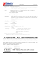
GPS receivers perform initial position and velocity calculations using an earth-centered earth-fixed
(ECEF) coordinate system. Results may be converted to an earth model (geoid) defined by the
selected datum. The default datum is WGS 84 (World Geodetic System 1984) which provides a
worldwide common grid system that may be translated into local coordinate systems or map datums.
(Local map datums are a best fit to the local shape of the earth and not valid worldwide.)
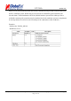
Examples:
Datum select TOKYO_MEAN
$PSRF106,178*32